Ofbyld:Autumn in Caucasus.JPG

Grutte fan dit proefbyld: 800 × 533 piksels. Oare resolúsjes: 320 × 213 piksels | 640 × 427 piksels | 1.024 × 683 piksels | 1.280 × 853 piksels | 2.560 × 1.707 piksels | 4.272 × 2.848 piksels.
Oarspronklik bestân (4.272 × 2.848 pixels, bestânsgrutte: 9,4 MB, MIME-type: image/jpeg)
Gearfetting
| Beskriuwing |
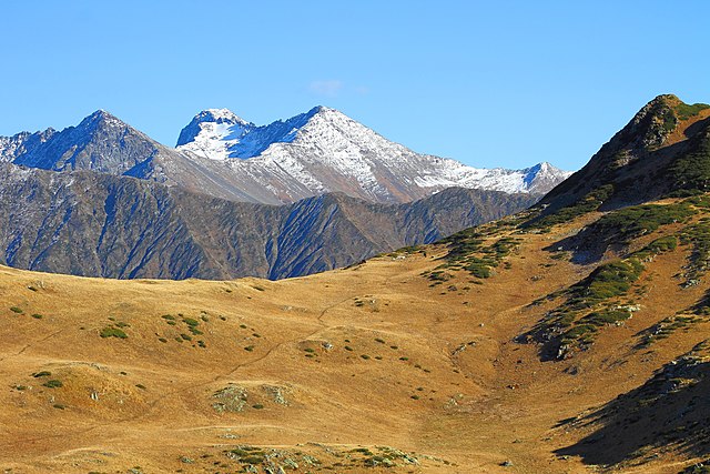
Русский: Вид с пика Табунный в сторону Главного Кавказского хребта. Октябрь 2015, Окрестности города Сочи, Краснодарский край. English: View of Greater Caucasus Range from top of peak of Tabunnaya near Krasnaya Polyana, Sochi. Fall 2015. |
| Datum | |
| Boarne | Eigen wurk |
| Auteur | SKas |
| Camera location | | View this and other nearby images on: OpenStreetMap |
|---|
Lisinsje
I, the copyright holder of this work, hereby publish it under the following license:
This file is licensed under the Creative Commons Attribution-Share Alike 4.0 International license.
- Fiel jo frij:
- te dielen – it wurk te kopiearjen, fersprieden en út te stjoeren
- te fermingen – it wurk oan te passen
- Under de neikommende betingsten:
- Nammefermelding – You must give appropriate credit, provide a link to the license, and indicate if changes were made. You may do so in any reasonable manner, but not in any way that suggests the licensor endorses you or your use.
- Lyk diele – If you remix, transform, or build upon the material, you must distribute your contributions under the same or compatible license as the original.
This image has been assessed using the Quality image guidelines and is considered a Quality image.
|
Triemskiednis
Klik op in datum/tiid om it bestân te besjen sa't it op dat stuit wie.
| Datum/Tiid | Miniatuer | ôfmjittings | Meidogger | Opmerking | |
|---|---|---|---|---|---|
| lêste | 25 jan 2016, 14.07 | | 4.272 × 2.848 (9,4 MB) | Yann | Reverted to version as of 15:47, 31 October 2015 (UTC) |
| 25 jan 2016, 12.32 |  | 4.272 × 2.848 (4,48 MB) | SKas | dust removed | |
| 25 jan 2016, 11.37 |  | 4.272 × 2.848 (4,24 MB) | SKas | New version | |
| 2 nov 2015, 22.38 |  | 4.272 × 2.848 (4,21 MB) | SKas | New version | |
| 31 okt 2015, 17.47 |  | 4.272 × 2.848 (9,4 MB) | SKas | User created page with UploadWizard |
Bestânsgebrûk
De neikommende side brûkt dit bestân:
Globaal bestânsgebrûk
De neikommende oare wiki's brûke dit bestân:
- Gebrûk op el.wikipedia.org
- Gebrûk op en.wikipedia.org
- Gebrûk op fa.wikipedia.org
- Gebrûk op hy.wikipedia.org
- Gebrûk op id.wikipedia.org
- Gebrûk op ja.wikipedia.org
- Gebrûk op lv.wikipedia.org
- Gebrûk op mk.wikipedia.org
- Gebrûk op ml.wikipedia.org
- Gebrûk op mt.wikipedia.org
- Gebrûk op ru.wikipedia.org
- Gebrûk op tr.wikipedia.org
- Gebrûk op uk.wikipedia.org
- Gebrûk op zh.wikipedia.org