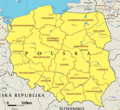
Ofbyld:EC map of poland.png
EC_map_of_poland.png (600 × 548 pixels, bestânsgrutte: 59 KB, MIME-type: image/png)
Triemskiednis
Klik op in datum/tiid om it bestân te besjen sa't it op dat stuit wie.
| Datum/Tiid | Miniatuer | ôfmjittings | Meidogger | Opmerking | |
|---|---|---|---|---|---|
| lêste | 26 feb 2005, 20.08 |  | 600 × 548 (59 KB) | Micga~commonswiki |
Bestânsgebrûk
De neikommende side brûkt dit bestân:
Globaal bestânsgebrûk
De neikommende oare wiki's brûke dit bestân:
- Gebrûk op ace.wikipedia.org
- Gebrûk op br.wikipedia.org
- Gebrûk op bs.wikipedia.org
- Gebrûk op de.wikipedia.org
- Gebrûk op fi.wikipedia.org
- Gebrûk op id.wikipedia.org
- Gebrûk op incubator.wikimedia.org
- Gebrûk op it.wikipedia.org
- Gebrûk op ja.wikipedia.org
- Gebrûk op jv.wikipedia.org
- Gebrûk op nl.wikipedia.org
- Gebrûk op ru.wikipedia.org
- Gebrûk op su.wikipedia.org
- Gebrûk op zea.wikipedia.org
- Gebrûk op zh-classical.wikipedia.org
- Gebrûk op zh.wikipedia.org
Mear globaal gebrûk fan dit bestân besjen.

