Ofbyld:Map of Helena, Montana (1899).jpg

Oarspronklik bestân (1.404 × 1.095 pixels, bestânsgrutte: 453 KB, MIME-type: image/jpeg)
.jpg)
Gearfetting
| Beskriuwing | |
| Datum | |
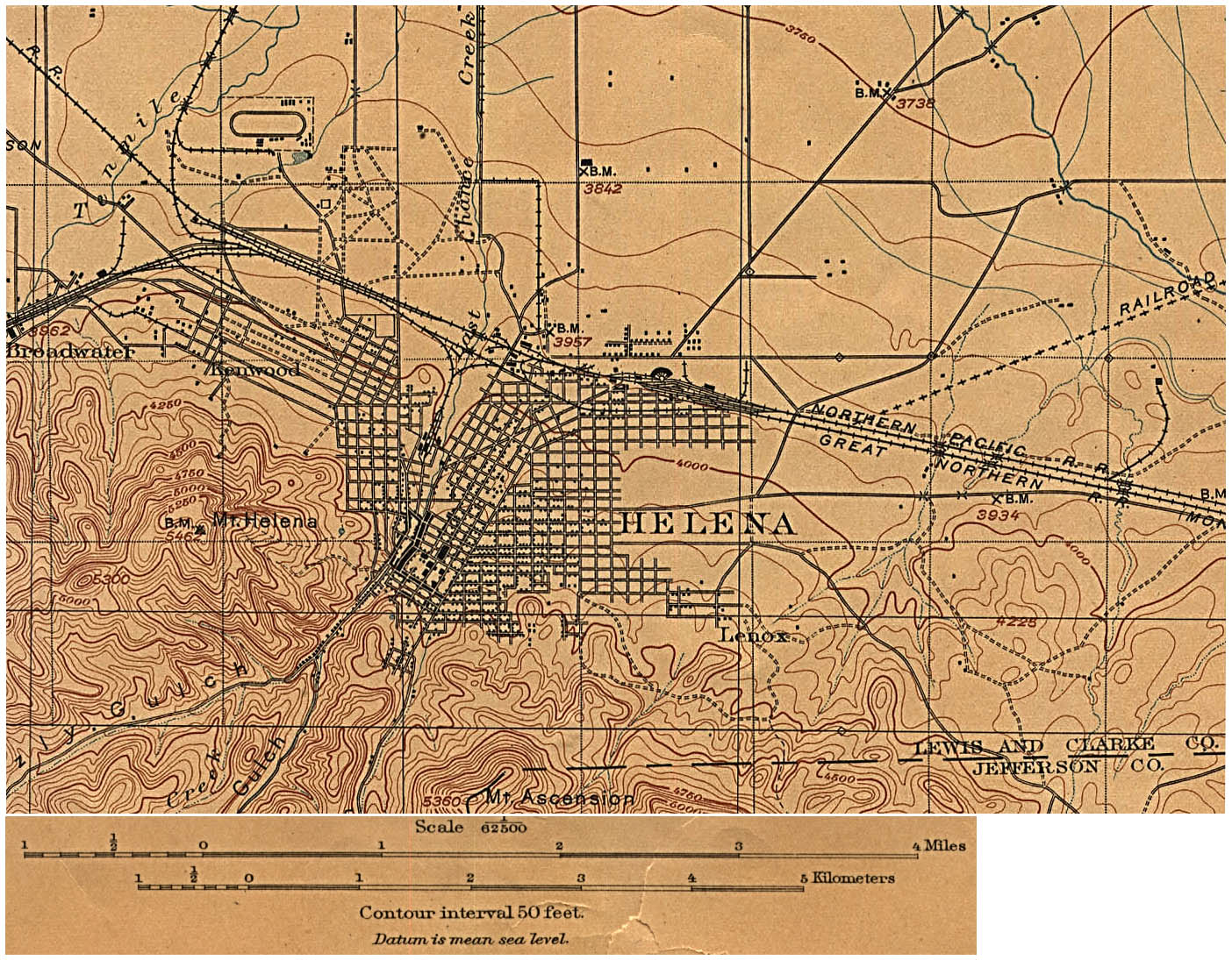
| Boarne | U.S. Geological Survey edition of 1899, reprinted 1906. |
| Auteur | US Geological Survey |
Lisinsje
|
This work is in the public domain in its country of origin and other countries and areas where the copyright term is the author's life plus 70 years or fewer.
| |
| This file has been identified as being free of known restrictions under copyright law, including all related and neighboring rights. | |
Triemskiednis
Klik op in datum/tiid om it bestân te besjen sa't it op dat stuit wie.
| Datum/Tiid | Miniatuer | ôfmjittings | Meidogger | Opmerking | |
|---|---|---|---|---|---|
| lêste | 6 mai 2008, 21.56 | | 1.404 × 1.095 (453 KB) | Kameraad Pjotr | {{Information |Description={{en|Map of the citiy of Helena, Montana, Montana in 1899.}} |Source=[http://www.lib.utexas.edu/maps/historical/helena_mt_1899.jpg U.S. Geological Survey edition of 1899, reprinted 1906.] |Date=1899 |Author=US Geologica |
Bestânsgebrûk
De neikommende side brûkt dit bestân:
Globaal bestânsgebrûk
De neikommende oare wiki's brûke dit bestân:
- Gebrûk op nl.wikipedia.org
.jpg)