Ofbyld:"Boston Stump" - geograph.org.uk - 3978.jpg
Gjin hegere resolúsje beskikber.
"Boston_Stump"_-_geograph.org.uk_-_3978.jpg (512 × 438 pixels, bestânsgrutte: 35 KB, MIME-type: image/jpeg)
Gearfetting
| Beskriuwing |
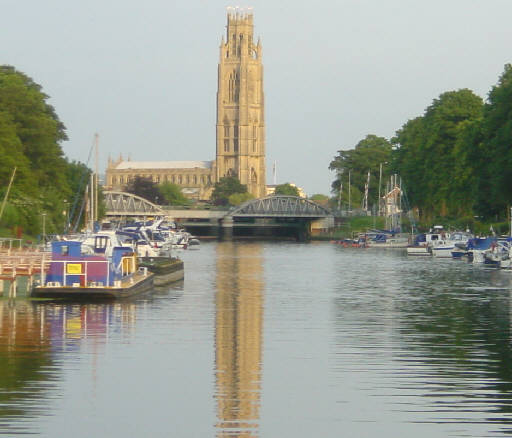
English: "Boston Stump" The tower of St Botolph's Church, Boston, is visible for many miles over the flat scenery of Lincolnshire and is known as "Boston Stump". Looking south east from the visitor moorings on the River Witham. |
| Datum | Taken in augustus 2004 |
| Boarne | From geograph.org.uk |
| Auteur | Martin Clark |
| Nammefermelding (required by the license) | Martin Clark / "Boston Stump" / |
| Object location | | View this and other nearby images on: OpenStreetMap |
|---|
_&language=fy)
Lisinsje

|
This image was taken from the Geograph project collection. See this photograph's page on the Geograph website for the photographer's contact details. The copyright on this image is owned by Martin Clark and is licensed for reuse under the Creative Commons Attribution-ShareAlike 2.0 license.
|
This file is licensed under the Creative Commons Attribution-Share Alike 2.0 Generic license.
Nammefermelding: Martin Clark
- Fiel jo frij:
- te dielen – it wurk te kopiearjen, fersprieden en út te stjoeren
- te fermingen – it wurk oan te passen
- Under de neikommende betingsten:
- Nammefermelding – You must give appropriate credit, provide a link to the license, and indicate if changes were made. You may do so in any reasonable manner, but not in any way that suggests the licensor endorses you or your use.
- Lyk diele – If you remix, transform, or build upon the material, you must distribute your contributions under the same or compatible license as the original.
Triemskiednis
Klik op in datum/tiid om it bestân te besjen sa't it op dat stuit wie.
| Datum/Tiid | Miniatuer | ôfmjittings | Meidogger | Opmerking | |
|---|---|---|---|---|---|
| lêste | 29 jan 2010, 12.20 | | 512 × 438 (35 KB) | GeographBot | == {{int:filedesc}} == {{Information |description={{en|1="Boston Stump" The tower of St Botolph's Church, Boston, is visible for many miles over the flat scenery of Lincolnshire and is known as "Boston Stump". Looking south east from the visitor moorings |
Bestânsgebrûk
De neikommende side brûkt dit bestân:
Globaal bestânsgebrûk
De neikommende oare wiki's brûke dit bestân:
- Gebrûk op azb.wikipedia.org
- Gebrûk op az.wikipedia.org
- Gebrûk op cs.wikipedia.org
- Gebrûk op cy.wikipedia.org
- Gebrûk op en.wikipedia.org
- Gebrûk op et.wikipedia.org
- Gebrûk op fa.wikipedia.org
- Gebrûk op fr.wikipedia.org
- Gebrûk op is.wikipedia.org
- Gebrûk op ko.wikipedia.org
- Gebrûk op nds-nl.wikipedia.org
- Gebrûk op nl.wikipedia.org
- Gebrûk op nn.wikipedia.org
- Gebrûk op no.wikipedia.org
- Gebrûk op ru.wikipedia.org
- Gebrûk op zh.wikipedia.org