Ofbyld:20140428 De Zijl 1-3-5 Dokkum Fr NL.jpg
Grutte fan dit proefbyld: 800 × 600 piksels. Oare resolúsjes: 320 × 240 piksels | 640 × 480 piksels | 1.024 × 768 piksels | 1.280 × 960 piksels | 2.560 × 1.920 piksels | 4.000 × 3.000 piksels.
Oarspronklik bestân (4.000 × 3.000 pixels, bestânsgrutte: 3,17 MB, MIME-type: image/jpeg)
| Beskriuwing |
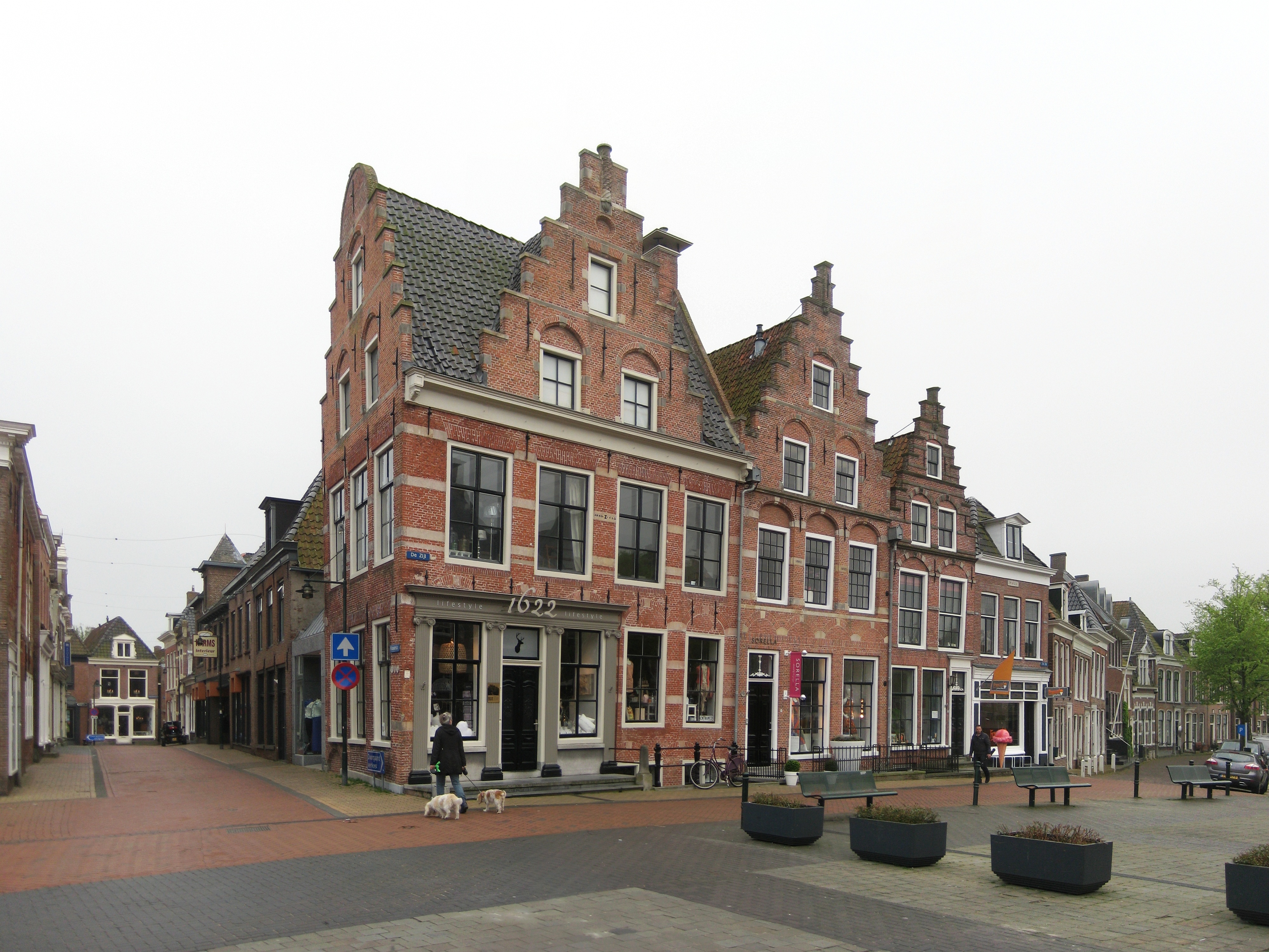
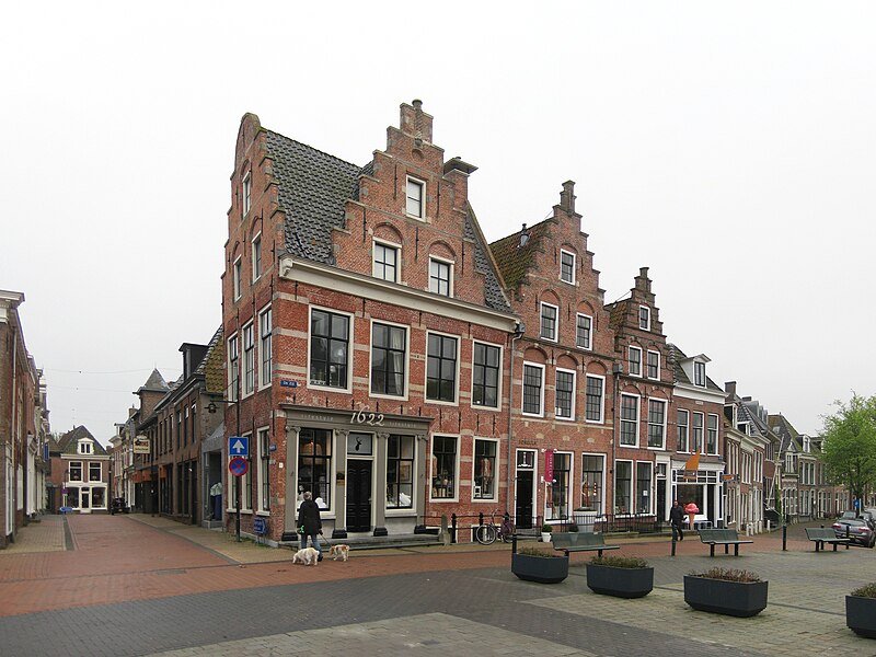
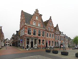
Frysk: De huzen De Zijl 1, 3 en 5 yn Dokkum. Se binne setten yn 1622 en oanwezen as ryksmonumint (resp. rm 13190, 13189 en 13188). De pei fan nû. 1 (it Blokhuis) is om 1860 hinne oanbrocht. Links de Vlasstraat. Nederlands: De panden De Zijl 1, 3 en 5 in Dokkum. Ze zijn gebouwd in 1622 en aangewezen als rijksmonument (resp. rm 13190, 13189 en 13188). De pui van nr. 1 (het Blokhuis) is rond 1860 geplaatst. Links de Vlasstraat.
|
||||||
| Datum | |||||||
| Boarne | Eigen wurk | ||||||
| Auteur | |||||||
| Nammefermelding (required by the license) | Wutsje / Wikimedia Commons / | ||||||
| Tastimming (Reusing this file) |
This file is licensed under the Creative Commons Attribution-Share Alike 3.0 Unported license.
|
| Camera location | | View this and other nearby images on: OpenStreetMap |
|---|
Triemskiednis
Klik op in datum/tiid om it bestân te besjen sa't it op dat stuit wie.
| Datum/Tiid | Miniatuer | ôfmjittings | Meidogger | Opmerking | |
|---|---|---|---|---|---|
| lêste | 21 mai 2014, 16.27 | | 4.000 × 3.000 (3,17 MB) | Wutsje | {{Information |Description = {{Multilingual description |en=Three seventeenth century houses in Dokkum, a city in the Dutch province of Fryslân. |fy=De huzen ''De Zijl 1, 3'' en ''5'' yn [[:Category:Dokk... |
Bestânsgebrûk
Der binne gjin siden dy't dit bestân brûke.