Oarspronklik bestân(1.188 × 1.085 pixels, bestânsgrutte: 252 KB, MIME-type: image/png)

Dit bestân komt fan Wikimedia Commons, en kin ek troch oare projekten brûkt wurde. De beskriuwing op syn bestânsside dêre wurdt hjirûnder werjûn.

Beskriuwing
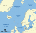
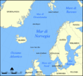
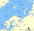
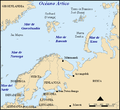
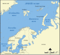
Deutsch: Diese Karte zeigt die Lage der Barentssee nördlich von Norwegen und Russland mit den umliegenden Meeren und Inseln in deutscher Beschriftung.
English: This map shows the location of the Barents Sea north of Russia and Norway, and the surrounding seas and islands, with German labels.
Datum (UTC)
Boarne
Auteur
Oare ferzjes

[bewurkje]

Norwegian Sea
Barents Sea


This is a retouched picture, which means that it has been digitally altered from its original version. Modifications: added German labels. The original can be viewed here: Barents sea map blank.png. Modifications made by Hämbörger.

I, the copyright holder of this work, hereby publish it under the following license:
GNU head Der wurdt tastimming jûn ta kopiearjen, fersprieden en/of wizigjen fan dit dokumint ûnder de betinksten fan de GNU-lisinsje foar iepen dokumintaasje, ferzje 1.2, as eltse lettere ferzje útjûn troch de Free Software Foundation; sûnder Ynfariante Seksjes, sûnder Omkaftteksten foar de Foarkante en sûnder Omkaftteksten foar de Efterkante. In kopy fan de lisinsje is opnaam yn de seksje "Text of the GNU Free Documentation License".
w:fy:Creative Commons
Nammefermelding Lyk diele
This file is licensed under the Creative Commons Attribution-Share Alike 3.0 Unported license.
Fiel jo frij:
  • te dielen – it wurk te kopiearjen, fersprieden en út te stjoeren
  • te fermingen – it wurk oan te passen
Under de neikommende betingsten:
  • Nammefermelding – You must give appropriate credit, provide a link to the license, and indicate if changes were made. You may do so in any reasonable manner, but not in any way that suggests the licensor endorses you or your use.
  • Lyk diele – If you remix, transform, or build upon the material, you must distribute your contributions under the same or compatible license as the original.
This licensing tag was added to this file as part of the GFDL licensing update.

Original upload log

This image is a derivative work of the following images:

  • File:Barents_sea_map_blank.png licensed with GFDL
    • 2006-02-28T22:27:52Z Historicair 1200x1098 (257777 Bytes) This map shows the location of the Barents Sea north of Russia and Norway, and the surrounding seas and islands. Created by NormanEinstein, November 25, 2005. Modified and blanked by ~~~~ {{GFDL-self}} [[Category:Maps of

Uploaded with derivativeFX

Captions

Add a one-line explanation of what this file represents

Items portrayed in this file

depicts Ingelsk

copyrighted Ingelsk

inception Ingelsk

23 feb 2009

media type Ingelsk

image/png

checksum Ingelsk

536b28bfcd325df3a7e71ac76d2dec5d4e80be60

determination method Ingelsk: SHA-1 Ingelsk

data size Ingelsk

258.065 byte

height Ingelsk

1.085 pixel

width Ingelsk

1.188 pixel

Triemskiednis

Klik op in datum/tiid om it bestân te besjen sa't it op dat stuit wie.

Datum/TiidMiniatuerôfmjittingsMeidoggerOpmerking
lêste10 des 2012, 04.52Miniatuer foar de ferzje fan 10 des 2012 om 04.521.188 × 1.085 (252 KB)Ras67cropped
23 feb 2009, 15.50Miniatuer foar de ferzje fan 23 feb 2009 om 15.501.200 × 1.098 (357 KB)Olaf Studtcorrected an error (the "Laptewsee" is somewhere else)
23 feb 2009, 15.24Miniatuer foar de ferzje fan 23 feb 2009 om 15.241.200 × 1.098 (361 KB)Olaf Studt{{Information |Description={{de|Diese Karte zeigt die Lage der Barentssee nördlich von Norwegen und Russland mit den umliegenden Meeren und Inseln in deutscher Beschriftung.}} {{en|This map shows the location of the Barents Sea north of Russia and Norway

De neikommende side brûkt dit bestân:

Globaal bestânsgebrûk

De neikommende oare wiki's brûke dit bestân: