Ofbyld:Capt John Smith's map of Virginia 1624.jpg

Oarspronklik bestân (2.520 × 1.944 pixels, bestânsgrutte: 1,02 MB, MIME-type: image/jpeg)
Gearfetting
| Titel |
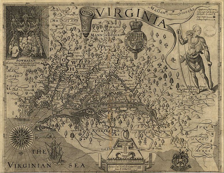
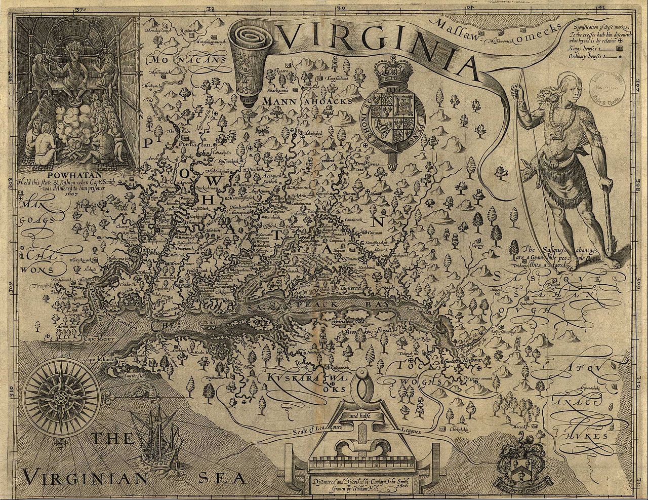
A Map of Virginia: With a Description of the Countrey, the Commodities, People, Government and Religion |
|||||||||
| Map legend |
Discovered and discribed by Captaijn John Smith 1606. Graven by William Hole. |
|||||||||
| Datum |
|
|||||||||
| Boarne | ||||||||||
| Makker |
William Hole (engraver, d. 1624) |
|||||||||
| Tastimming (Reusing this file) |
|
|||||||||
| Geotemporal data | ||||||||||
| Date depicted |
|
|||||||||
| Map location |
Virginia, United States |
|||||||||
| Map type |
Historical map |
|||||||||
| Bounding box |
|
|||||||||
| Georeferencing | ||||||||||
| Bibliographic data | ||||||||||
| Utjefte |
A Map of Virginia: With a Description of the Countrey, the Commodities, People, Government and Religion |
|||||||||
| Auteur |
Captain John Smith |
|||||||||
| Taal |
English |
|||||||||
| Place of publication |
Oxford |
|||||||||
| Publisher |
Joseph Barnes |
|||||||||
| Archival data | ||||||||||
| Dimensions | height: 32 cm; width: 41 cm | |||||||||
| Medium | gravure op papier | |||||||||
Lisinsje
|
This work is in the public domain in its country of origin and other countries and areas where the copyright term is the author's life plus 100 years or fewer. | |
| This file has been identified as being free of known restrictions under copyright law, including all related and neighboring rights. | |
Triemskiednis
Klik op in datum/tiid om it bestân te besjen sa't it op dat stuit wie.
| Datum/Tiid | Miniatuer | ôfmjittings | Meidogger | Opmerking | |
|---|---|---|---|---|---|
| lêste | 20 jun 2011, 02.24 | | 2.520 × 1.944 (1,02 MB) | Frank Schulenburg | Source: http://www.virtualjamestown.org/maps1.html |
| 16 jun 2010, 22.03 |  | 1.000 × 849 (242 KB) | MarmadukePercy | {{Information |Description={{en|1=John Smith's map of Virginia from "The Generall Historie of Virginia, New-England, and the Summer Isles," published in London, 1624. Courtesy of University of North Carolina Libraries.}} |Source=http://www.learnnc.org/lp/ |
Bestânsgebrûk
De neikommende side brûkt dit bestân:
Globaal bestânsgebrûk
De neikommende oare wiki's brûke dit bestân:
- Gebrûk op en.wikipedia.org
- Gebrûk op fr.wikipedia.org
- Gebrûk op he.wikipedia.org
- Gebrûk op hy.wikipedia.org
- Gebrûk op incubator.wikimedia.org
- Gebrûk op it.wikipedia.org
- Gebrûk op la.wikipedia.org