Ofbyld:Dnieper 32.03650E 46.60888N.jpg

Grutte fan dit proefbyld: 800 × 599 piksels. Oare resolúsjes: 320 × 240 piksels | 640 × 479 piksels | 1.024 × 766 piksels | 1.280 × 958 piksels.
Oarspronklik bestân (1.280 × 958 pixels, bestânsgrutte: 245 KB, MIME-type: image/jpeg)
Gearfetting
| Beskriuwing |
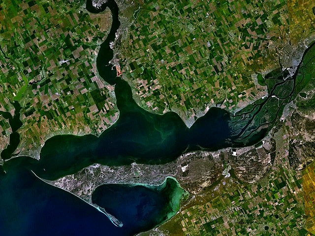
English: The satellite view of the Dnieper-Bug Estuary and the Dnieper delta. |
| Datum | Datum ûnbekend |
| Boarne | Satellite imagery taken from NASA World Wind software (by screenshot) |
| Auteur | World Wind |
| Object location | | View this and other nearby images on: OpenStreetMap |
|---|
Lisinsje
| This image is in the public domain because it is a screenshot from NASA’s globe software World Wind using a public domain layer, such as Blue Marble, MODIS, Landsat, SRTM, USGS or GLOBE.
|
 |
Triemskiednis
Klik op in datum/tiid om it bestân te besjen sa't it op dat stuit wie.
| Datum/Tiid | Miniatuer | ôfmjittings | Meidogger | Opmerking | |
|---|---|---|---|---|---|
| lêste | 22 jun 2005, 20.48 | | 1.280 × 958 (245 KB) | Rex | Dnieper river {{World Wind}} Category:Rivers |
Bestânsgebrûk
De neikommende side brûkt dit bestân:
Globaal bestânsgebrûk
De neikommende oare wiki's brûke dit bestân:
- Gebrûk op ar.wikipedia.org
- Gebrûk op ast.wikipedia.org
- Gebrûk op be.wikipedia.org
- Gebrûk op bs.wikipedia.org
- Gebrûk op ca.wikipedia.org
- Gebrûk op cy.wikipedia.org
- Gebrûk op da.wikipedia.org
- Gebrûk op de.wikipedia.org
- Gebrûk op en.wikipedia.org
- Gebrûk op es.wikipedia.org
- Gebrûk op fi.wikipedia.org
- Gebrûk op fr.wikipedia.org
- Gebrûk op hr.wikipedia.org
- Gebrûk op hu.wikipedia.org
- Gebrûk op it.wikipedia.org
- Gebrûk op ja.wikipedia.org
- Gebrûk op ka.wikipedia.org
- Gebrûk op kbd.wikipedia.org
- Gebrûk op lt.wikipedia.org
- Gebrûk op mk.wikipedia.org
- Gebrûk op nl.wikipedia.org
- Gebrûk op nn.wikipedia.org
- Gebrûk op no.wikipedia.org
- Gebrûk op pl.wikipedia.org
- Gebrûk op pt.wikipedia.org
- Gebrûk op ru.wikipedia.org
- Gebrûk op sh.wikipedia.org
- Gebrûk op sl.wikipedia.org
- Gebrûk op sr.wikipedia.org
Mear globaal gebrûk fan dit bestân besjen.