Ofbyld:Faroe Islands location map.svg

Size of this PNG preview of this SVG file: 465 × 600 piksels. Oare resolúsjes: 186 × 240 piksels | 372 × 480 piksels | 595 × 768 piksels | 793 × 1.024 piksels | 1.587 × 2.048 piksels | 775 × 1.000 piksels.
Oarspronklik bestân (SVG-bestân, nominaal 775 × 1.000 pixels, bestânsgrutte: 63 KB)
Gearfetting
| Beskriuwing |
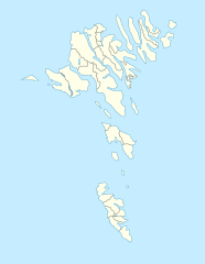
English: Location map of the Faroe Islands
Equirectangular projection, N/S stretching 213 %. Geographic limits of the map:
Deutsch: Positionskarte der Färöer
Quadratische Plattkarte, N-S-Streckung 213 %. Geographische Begrenzung der Karte:
|
| Datum | |
| Boarne | Eigen wurk |
| Auteur | Erik Frohne |
| Oare ferzjes |
Derivative works of this file: Strandfaraskip route map.svg Municipalities of the faroe islands 2005.png |
| SVG genesis |
Lisinsje
I, the copyright holder of this work, hereby publish it under the following licenses:

|
Der wurdt tastimming jûn ta kopiearjen, fersprieden en/of wizigjen fan dit dokumint ûnder de betinksten fan de GNU-lisinsje foar iepen dokumintaasje, ferzje 1.2, as eltse lettere ferzje útjûn troch de Free Software Foundation; sûnder Ynfariante Seksjes, sûnder Omkaftteksten foar de Foarkante en sûnder Omkaftteksten foar de Efterkante. In kopy fan de lisinsje is opnaam yn de seksje "Text of the GNU Free Documentation License". |
This file is licensed under the Creative Commons Attribution-Share Alike 3.0 Unported license.
- Fiel jo frij:
- te dielen – it wurk te kopiearjen, fersprieden en út te stjoeren
- te fermingen – it wurk oan te passen
- Under de neikommende betingsten:
- Nammefermelding – You must give appropriate credit, provide a link to the license, and indicate if changes were made. You may do so in any reasonable manner, but not in any way that suggests the licensor endorses you or your use.
- Lyk diele – If you remix, transform, or build upon the material, you must distribute your contributions under the same or compatible license as the original.
You may select the license of your choice.
Triemskiednis
Klik op in datum/tiid om it bestân te besjen sa't it op dat stuit wie.
| Datum/Tiid | Miniatuer | ôfmjittings | Meidogger | Opmerking | |
|---|---|---|---|---|---|
| lêste | 20 des 2020, 15.27 | | 775 × 1.000 (63 KB) | Hanzlan | Húsar merged with Klaksvík |
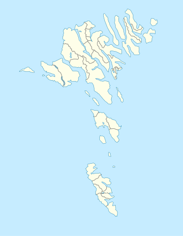
| 29 apr 2010, 14.58 |  | 775 × 1.000 (77 KB) | Erik Frohne | Removal of some borders according to http://www.us.fo/Default.aspx?ID=5497&M=News&PID=6574&NewsID=1842&CATID=29 | |
| 7 mrt 2009, 16.46 |  | 775 × 1.000 (79 KB) | Erik Frohne | {{Information |Description={{en|1=Location map of the Faroe Islands Equirectangular projection, N/S stretching 213 %. Geographic limits of the map: * N: 62.44° N * S: 61.30° N * W: 7.88° W * E: 6.00° W}} {{de|1=Positionskarte der Färöer Quadra |
Bestânsgebrûk
De neikommende 7 siden brûke dit bestân:
Globaal bestânsgebrûk
De neikommende oare wiki's brûke dit bestân:
- Gebrûk op af.wikipedia.org
- Gebrûk op an.wikipedia.org
- Gebrûk op ar.wikipedia.org
- Gebrûk op ast.wikipedia.org
- Gebrûk op az.wikipedia.org
- Gebrûk op ba.wikipedia.org
- Gebrûk op be-tarask.wikipedia.org
- Gebrûk op be.wikipedia.org
Mear globaal gebrûk fan dit bestân besjen.