Ofbyld:Gulf of Suez map.jpg

Grutte fan dit proefbyld: 600 × 600 piksels. Oare resolúsjes: 240 × 240 piksels | 480 × 480 piksels | 768 × 768 piksels | 1.024 × 1.024 piksels | 1.280 × 1.280 piksels.
Oarspronklik bestân (1.280 × 1.280 pixels, bestânsgrutte: 348 KB, MIME-type: image/jpeg)
| Beskriuwing | |
| Datum |
10 febrewaris 2009 |
| Boarne |
Transferred from en.wikipedia |
| Auteur | Original uploader was Odie5533 at en.wikipedia |
| Tastimming (Reusing this file) |
Released under the GNU Free Documentation License. |
| Oare ferzjes | Derivative works of this file: Gulf of Suez map DE.png |
Lisinsje
Odie5533 at en.wikipedia, the copyright holder of this work, hereby publishes it under the following license:

|
Der wurdt tastimming jûn ta kopiearjen, fersprieden en/of wizigjen fan dit dokumint ûnder de betinksten fan de GNU-lisinsje foar iepen dokumintaasje, ferzje 1.2, as eltse lettere ferzje útjûn troch de Free Software Foundation; sûnder Ynfariante Seksjes, sûnder Omkaftteksten foar de Foarkante en sûnder Omkaftteksten foar de Efterkante. In kopy fan de lisinsje is opnaam yn de seksje "Text of the GNU Free Documentation License". |
| This file is licensed under the Creative Commons Attribution-Share Alike 3.0 Unported license. | ||
| Nammefermelding: Odie5533 at en.wikipedia | ||
| ||
| This licensing tag was added to this file as part of the GFDL licensing update. |
Original upload log
The original description page was here. All following user names refer to en.wikipedia.
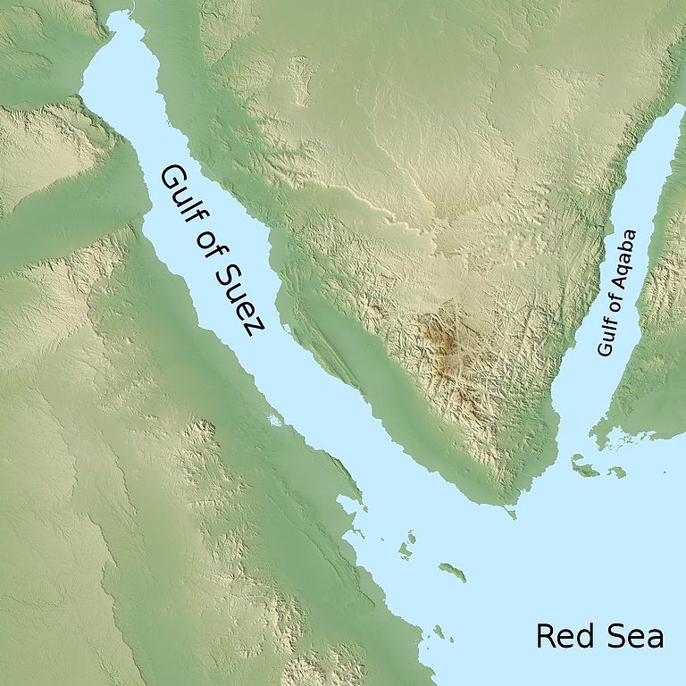
- 2009-02-10 09:31 Odie5533 1280×1280× (355904 bytes) {{Information |Description=A map depicting the location of the [[Gulf of Suez]] relative to the [[Red Sea]] |Source=I created this work entirely by myself. Using data from NASA which is not copyrighted unless noted. |Date=2009-02-10 |Author=~~~ |other_ver
Triemskiednis
Klik op in datum/tiid om it bestân te besjen sa't it op dat stuit wie.
| Datum/Tiid | Miniatuer | ôfmjittings | Meidogger | Opmerking | |
|---|---|---|---|---|---|
| lêste | 30 mai 2009, 22.44 | | 1.280 × 1.280 (348 KB) | Urdangaray | {{Information |Description={{en|A map depicting the location of the en:Gulf of Suez relative to the en:Red Sea}} |Source=Transferred from [http://en.wikipedia.org en.wikipedia]<br/> (Original text : ''I created this work entirely by myself. Us |
Bestânsgebrûk
De neikommende side brûkt dit bestân:
Globaal bestânsgebrûk
De neikommende oare wiki's brûke dit bestân:
- Gebrûk op af.wikipedia.org
- Gebrûk op ar.wikipedia.org
- Gebrûk op ast.wikipedia.org
- Gebrûk op azb.wikipedia.org
- Gebrûk op az.wiktionary.org
- Gebrûk op bg.wikipedia.org
- Gebrûk op bn.wikipedia.org
- Gebrûk op bs.wikipedia.org
- Gebrûk op ca.wikipedia.org
- Gebrûk op ckb.wikipedia.org
- Gebrûk op da.wikipedia.org
- Gebrûk op el.wikipedia.org
- Gebrûk op en.wikipedia.org
- Gebrûk op es.wikipedia.org
- Gebrûk op eu.wikipedia.org
- Gebrûk op fa.wikipedia.org
- Gebrûk op fi.wikipedia.org
- Gebrûk op fr.wikipedia.org
- Gebrûk op gl.wikipedia.org
- Gebrûk op gv.wikipedia.org
- Gebrûk op hi.wikipedia.org
- Gebrûk op hu.wikipedia.org
- Gebrûk op hy.wikipedia.org
- Gebrûk op id.wikipedia.org
- Gebrûk op ilo.wikipedia.org
- Gebrûk op it.wikipedia.org
- Gebrûk op ka.wikipedia.org
- Gebrûk op kcg.wikipedia.org
- Gebrûk op ku.wikipedia.org
- Gebrûk op lt.wikipedia.org
- Gebrûk op lv.wikipedia.org
Mear globaal gebrûk fan dit bestân besjen.