Ofbyld:IJsselmeer satellite.jpg
Grutte fan dit proefbyld: 565 × 599 piksels. Oare resolúsjes: 226 × 240 piksels | 453 × 480 piksels | 893 × 947 piksels.
Oarspronklik bestân (893 × 947 pixels, bestânsgrutte: 268 KB, MIME-type: image/jpeg)
Gearfetting
| Beskriuwing |
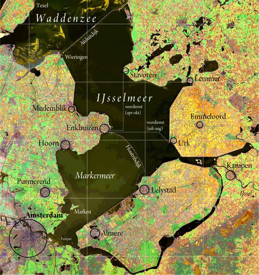
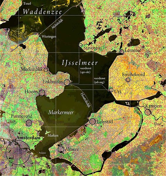
Nederlands: IJsselmeer. Satellietopname: Nasa Visible Earth Samenstelling foto, kleur- en schaalcorrectie, kaartopmaak: Ed Stevenhagen
English: IJsselmeer (also known as Lake IJssel or Lake Yssel) Satellite photo from Nasa Visible Earthvcomposition photograph, colours and scale correction, card layout done by Ed Stevenhagen |
| Datum | Commons upload by Siebrand 12:09, 23 May 2006 (UTC) |
| Boarne |
NASA Visible Earth. Originally on Wikipedia from nl.wikipedia; description page is (was) here
|
| Auteur | User Ed Stevenhagen on nl.wikipedia |
| Tastimming (Reusing this file) |
PD-NASA |
Lisinsje
| This file is in the public domain in the United States because it was solely created by NASA. NASA copyright policy states that "NASA material is not protected by copyright unless noted". (See Template:PD-USGov, NASA copyright policy page or JPL Image Use Policy.) | ||
 |
Warnings:
|
Triemskiednis
Klik op in datum/tiid om it bestân te besjen sa't it op dat stuit wie.
| Datum/Tiid | Miniatuer | ôfmjittings | Meidogger | Opmerking | |
|---|---|---|---|---|---|
| lêste | 6 des 2012, 14.00 | | 893 × 947 (268 KB) | Classical geographer | +labels |
| 21 aug 2008, 03.15 |  | 893 × 947 (498 KB) | Cropbot | upload cropped version, operated by User:Rfsjim. Summary: Rfsjim cropped caption using Cropbot | |
| 20 mai 2008, 18.58 |  | 988 × 1.214 (652 KB) | Chech Explorer | Without borders | |
| 23 mai 2006, 14.09 |  | 1.000 × 1.225 (261 KB) | Siebrand | {{Information| |Description= {{nl|IJsselmeer. Satellietopname: nl:Nasa Visible Earth Samenstelling foto, kleur- en schaalcorrectie, kaartopmaak: Ed Stevenhagen}} Free to use as long as credits are given to Nasa Vis |
Bestânsgebrûk
De neikommende side brûkt dit bestân:
Globaal bestânsgebrûk
De neikommende oare wiki's brûke dit bestân:
- Gebrûk op ar.wikipedia.org
- Gebrûk op be.wikipedia.org
- Gebrûk op cs.wikipedia.org
- Gebrûk op cv.wikipedia.org
- Gebrûk op de.wikivoyage.org
- Gebrûk op en.wikipedia.org
- Gebrûk op eo.wikipedia.org
- Gebrûk op ko.wikipedia.org
- Gebrûk op nds-nl.wikipedia.org
- Gebrûk op nl.wikipedia.org
- Gebrûk op ro.wikipedia.org
- Gebrûk op ru.wikipedia.org
- Gebrûk op tr.wikipedia.org
- Gebrûk op zh.wikipedia.org