Ofbyld:IndonesiaBali.png
Gjin hegere resolúsje beskikber.
IndonesiaBali.png (800 × 375 pixels, bestânsgrutte: 79 KB, MIME-type: image/png)
Gearfetting
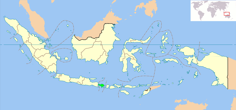
Locator map of Indonesian province of Bali showing provincial boundaries. Based on Image:Indonesia_provinces_blank_map.svg. Created for use in en:Wikiproject Indonesia Cartography.
NB: Please note, this map will probably need further editing in order to make the position of Bali clearer. For now, we are simply standardising all Indonesia Provincial locator maps, and will make additional changes once all standard maps have been uploaded
Lisinsje
| This file is licensed under the Creative Commons Attribution-Share Alike 3.0 Unported license. Subject to disclaimers. | ||
| ||
| This licensing tag was added to this file as part of the GFDL licensing update. |

|
Der wurdt tastimming jûn ta kopiearjen, fersprieden en/of wizigjen fan dit dokumint ûnder de betinksten fan de GNU-lisinsje foar iepen dokumintaasje, ferzje 1.2, as eltse lettere ferzje útjûn troch de Free Software Foundation; sûnder Ynfariante Seksjes, sûnder Omkaftteksten foar de Foarkante en sûnder Omkaftteksten foar de Efterkante. In kopy fan de lisinsje is opnaam yn de seksje "Text of the GNU Free Documentation License". Subject to disclaimers. |
Triemskiednis
Klik op in datum/tiid om it bestân te besjen sa't it op dat stuit wie.
| Datum/Tiid | Miniatuer | ôfmjittings | Meidogger | Opmerking | |
|---|---|---|---|---|---|
| lêste | 14 sep 2008, 12.28 | | 800 × 375 (79 KB) | AnonyLog | Added world locator from last version. |
| 6 mrt 2007, 15.08 |  | 800 × 375 (97 KB) | Bwmodular | New version of Locator Map, higher resolution map, standard across all Indonesian Province maps, showing West Irian Jaya province. | |
| 3 okt 2005, 01.32 |  | 300 × 220 (14 KB) | Romanm | uploaded current version from English Wikipedia | |
| 2 okt 2005, 02.59 |  | 300 × 220 (14 KB) | Fangz~commonswiki | Reduced file size. Jeez, I'm making alot of mistakes, eh? | |
| 2 okt 2005, 02.55 |  | 300 × 220 (28 KB) | Fangz~commonswiki | Reverted to earlier revision | |
| 2 okt 2005, 02.54 | 300 × 122 (7 KB) | Fangz~commonswiki | Reverted to earlier revision | ||
| 2 okt 2005, 02.53 |  | 300 × 220 (28 KB) | Fangz~commonswiki | Edited to give global context. (Using BlankMap-World.png) Done using the Gimp | |
| 14 aug 2005, 07.36 | 300 × 122 (7 KB) | *drew~commonswiki | Map of Indonesia showing the location of Bali. Taken from English Wikipedia. {{GFDL}} Category:Bali |
Bestânsgebrûk
De neikommende side brûkt dit bestân:
Globaal bestânsgebrûk
De neikommende oare wiki's brûke dit bestân:
- Gebrûk op ar.wikipedia.org
- Gebrûk op arz.wikipedia.org
- Gebrûk op ast.wikipedia.org
- Gebrûk op bcl.wikipedia.org
- Gebrûk op be-tarask.wikipedia.org
- Gebrûk op bjn.wikipedia.org
- Gebrûk op bn.wikipedia.org
- Gebrûk op bs.wikipedia.org
- Gebrûk op ca.wikipedia.org
- Gebrûk op ceb.wikipedia.org
- Gebrûk op de.wikipedia.org
- Gebrûk op de.wikinews.org
- Gebrûk op el.wikipedia.org
- Gebrûk op en.wikipedia.org
- Gebrûk op eo.wikipedia.org
- Gebrûk op es.wikinews.org
- Gebrûk op eu.wikipedia.org
- Gebrûk op fa.wikipedia.org
- Gebrûk op fi.wikipedia.org
- Gebrûk op fo.wikipedia.org
- Gebrûk op fr.wikipedia.org
- Gebrûk op gl.wikipedia.org
- Gebrûk op gu.wikipedia.org
- Gebrûk op hak.wikipedia.org
- Gebrûk op he.wikipedia.org
- Gebrûk op hy.wikipedia.org
- Gebrûk op ja.wikipedia.org
- Gebrûk op ja.wikinews.org
- Gebrûk op ka.wikipedia.org
- Gebrûk op km.wiktionary.org
- Gebrûk op kn.wikipedia.org
- Gebrûk op la.wiktionary.org
- Gebrûk op lt.wikipedia.org
- Gebrûk op lv.wikipedia.org
- Gebrûk op mai.wikipedia.org
- Gebrûk op mk.wikipedia.org
- Gebrûk op ml.wikipedia.org
- Gebrûk op ms.wikipedia.org
- Gebrûk op ne.wikipedia.org
- Gebrûk op nl.wikipedia.org
Mear globaal gebrûk fan dit bestân besjen.