Ofbyld:Isle of Sheppey from Space NASA.jpg
Grutte fan dit proefbyld: 800 × 571 piksels. Oare resolúsjes: 320 × 228 piksels | 640 × 457 piksels | 1.024 × 731 piksels | 1.163 × 830 piksels.
Oarspronklik bestân (1.163 × 830 pixels, bestânsgrutte: 481 KB, MIME-type: image/jpeg)
Gearfetting
| Beskriuwing |
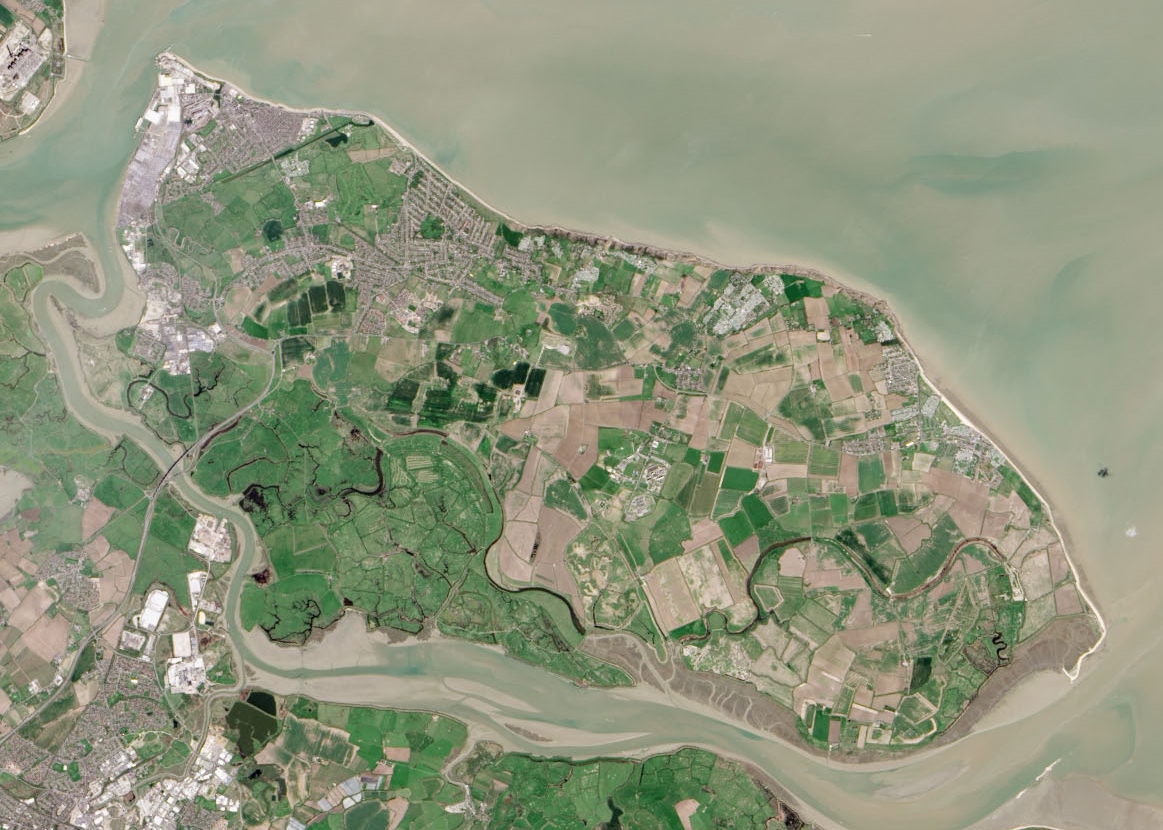
English: Isle of Sheppey as seen by the Operational Land Imager. |
| Datum | |
| Boarne | Cropped version of File:Thames Estuary and Wind Farms from Space NASA.jpg |
| Auteur | Operational Land Imager |
| Oare ferzjes |
 (uncropped version) |
| Camera location | | View this and other nearby images on: OpenStreetMap |
|---|
Lisinsje
| This file is in the public domain in the United States because it was solely created by NASA. NASA copyright policy states that "NASA material is not protected by copyright unless noted". (See Template:PD-USGov, NASA copyright policy page or JPL Image Use Policy.) | ||
 |
Warnings:
|
Triemskiednis
Klik op in datum/tiid om it bestân te besjen sa't it op dat stuit wie.
| Datum/Tiid | Miniatuer | ôfmjittings | Meidogger | Opmerking | |
|---|---|---|---|---|---|
| lêste | 22 jun 2015, 23.55 | | 1.163 × 830 (481 KB) | Delusion23 | User created page with UploadWizard |
Bestânsgebrûk
De neikommende side brûkt dit bestân:
Globaal bestânsgebrûk
De neikommende oare wiki's brûke dit bestân:
- Gebrûk op cs.wikipedia.org
- Gebrûk op da.wikipedia.org
- Gebrûk op en.wikipedia.org
- Gebrûk op es.wikipedia.org
- Gebrûk op nl.wikipedia.org
- Gebrûk op no.wikipedia.org
- Gebrûk op pt.wikipedia.org
- Gebrûk op sh.wikipedia.org