Ofbyld:Kenya location map.svg

Size of this PNG preview of this SVG file: 545 × 600 piksels. Oare resolúsjes: 218 × 240 piksels | 436 × 480 piksels | 698 × 768 piksels | 931 × 1.024 piksels | 1.862 × 2.048 piksels | 1.000 × 1.100 piksels.
Oarspronklik bestân (SVG-bestân, nominaal 1.000 × 1.100 pixels, bestânsgrutte: 329 KB)
Gearfetting
| Beskriuwing |
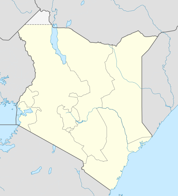
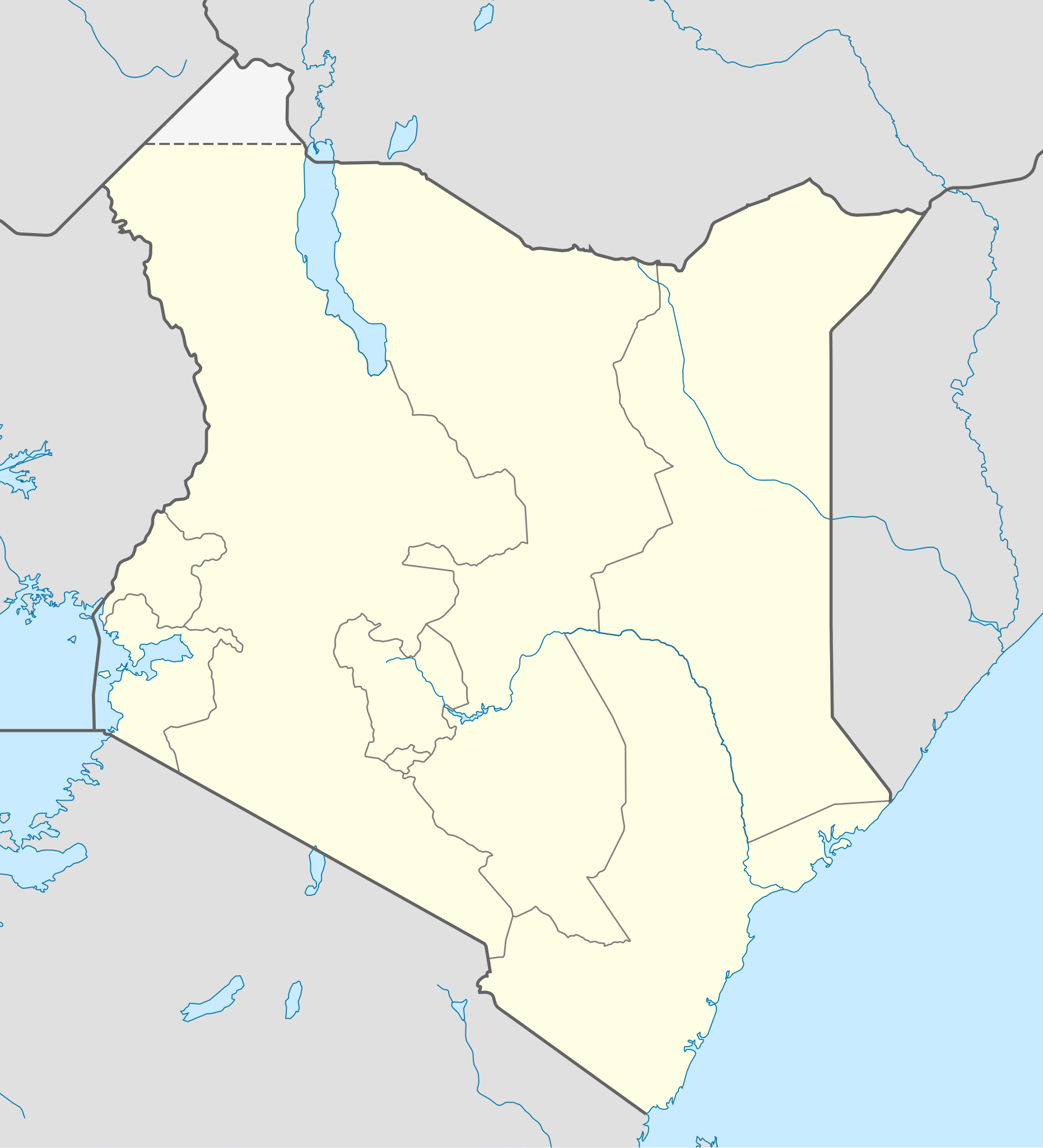
Deutsch: Location map of Kenya
Equirectangular projection. Strechted by 100.0%. Geographic limits of the map:
|
| Datum | |
| Boarne | Eigen wurk |
| Auteur | Uwe Dedering |
| Oare ferzjes |
|

Lisinsje
Uwe Dedering at Dútsk Wikipedy, the copyright holder of this work, hereby publishes it under the following licenses:

|
Der wurdt tastimming jûn ta kopiearjen, fersprieden en/of wizigjen fan dit dokumint ûnder de betinksten fan de GNU-lisinsje foar iepen dokumintaasje, ferzje 1.2, as eltse lettere ferzje útjûn troch de Free Software Foundation; sûnder Ynfariante Seksjes, sûnder Omkaftteksten foar de Foarkante en sûnder Omkaftteksten foar de Efterkante. In kopy fan de lisinsje is opnaam yn de seksje "Text of the GNU Free Documentation License". |
This file is licensed under the Creative Commons Attribution-Share Alike 3.0 Unported license.
Nammefermelding: Uwe Dedering at Dútsk Wikipedy
- Fiel jo frij:
- te dielen – it wurk te kopiearjen, fersprieden en út te stjoeren
- te fermingen – it wurk oan te passen
- Under de neikommende betingsten:
- Nammefermelding – You must give appropriate credit, provide a link to the license, and indicate if changes were made. You may do so in any reasonable manner, but not in any way that suggests the licensor endorses you or your use.
- Lyk diele – If you remix, transform, or build upon the material, you must distribute your contributions under the same or compatible license as the original.
This file is licensed under the Creative Commons Attribution-Share Alike 3.0 Germany license.
Nammefermelding: Uwe Dedering at Dútsk Wikipedy
- Fiel jo frij:
- te dielen – it wurk te kopiearjen, fersprieden en út te stjoeren
- te fermingen – it wurk oan te passen
- Under de neikommende betingsten:
- Nammefermelding – You must give appropriate credit, provide a link to the license, and indicate if changes were made. You may do so in any reasonable manner, but not in any way that suggests the licensor endorses you or your use.
- Lyk diele – If you remix, transform, or build upon the material, you must distribute your contributions under the same or compatible license as the original.

You may select the license of your choice.
Original upload log
Transferred from de.wikipedia to Commons by Uwe Dedering.
The original description page was here. All following user names refer to de.wikipedia.
- 2010-02-16 11:08 Uwe Dedering 1000×1200× (349329 bytes) {{Information |Beschreibung = Location map of Kenya Equirectangular projection. Strechted by 100.0%. Geographic limits of the map: * N: 7.0° N * S: -5.0° N * W: 33.0° E * E: 43.0° E Made with Natural Earth. Free vector and raster map data @ naturalearthdata.com. |Quelle = own work |Urheber = [[Benutzer:Uwe Dedering|Uwe Dedering]] |Datum = 20100216 |Genehmigung = |Andere Versionen = |Anmerkungen = }}
Triemskiednis
Klik op in datum/tiid om it bestân te besjen sa't it op dat stuit wie.
| Datum/Tiid | Miniatuer | ôfmjittings | Meidogger | Opmerking | |
|---|---|---|---|---|---|
| lêste | 17 feb 2010, 14.00 | | 1.000 × 1.100 (329 KB) | Uwe Dedering | regional boundaries only for kenya |
| 17 feb 2010, 13.37 |  | 1.000 × 1.100 (368 KB) | Uwe Dedering | Northern limit now 6 degrees | |
| 16 feb 2010, 23.52 |  | 1.000 × 1.200 (341 KB) | Uwe Dedering | {{Information |Description={{de|Location map of Kenya Equirectangular projection. Strechted by 100.0%. Geographic limits of the map: * N: 7.0° N * S: -5.0° N * W: 33.0° E * E: 43.0° E Made with Natural Earth. Free vector and raster map data @ naturale |
Bestânsgebrûk
De neikommende 2 siden brûke dit bestân:
Globaal bestânsgebrûk
De neikommende oare wiki's brûke dit bestân:
- Gebrûk op af.wikipedia.org
- Gebrûk op als.wikipedia.org
- Gebrûk op am.wikipedia.org
- Gebrûk op ar.wikipedia.org
- Gebrûk op arz.wikipedia.org
- Gebrûk op az.wikipedia.org
- Gebrûk op ba.wikipedia.org
- Gebrûk op be-tarask.wikipedia.org
- Gebrûk op be.wikipedia.org
- Gebrûk op bg.wikipedia.org
- Gebrûk op bn.wikipedia.org
- Gebrûk op ceb.wikipedia.org
Mear globaal gebrûk fan dit bestân besjen.