Ofbyld:Locatie Ionische Zee.PNG
Gjin hegere resolúsje beskikber.
Locatie_Ionische_Zee.PNG (473 × 430 pixels, bestânsgrutte: 17 KB, MIME-type: image/png)
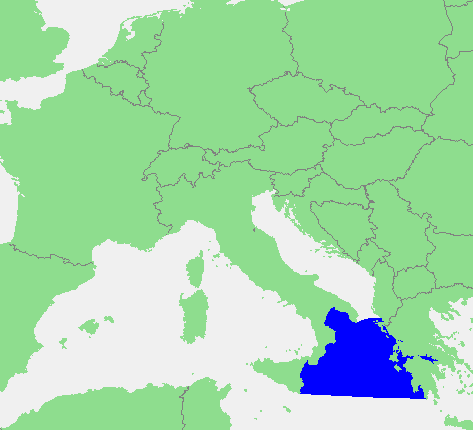
| Beskriuwing | In dutch: Locatie Ionische Zee.PNG | ||||
| Boarne | own work based on PD map | ||||
| Auteur | edited by M.Minderhoud | ||||
| Tastimming (Reusing this file) |
|
Triemskiednis
Klik op in datum/tiid om it bestân te besjen sa't it op dat stuit wie.
| Datum/Tiid | Miniatuer | ôfmjittings | Meidogger | Opmerking | |
|---|---|---|---|---|---|
| lêste | 28 jun 2012, 17.42 | | 473 × 430 (17 KB) | Ciaurlec | Corrected western and southern limits |
| 12 sep 2006, 20.21 |  | 473 × 430 (16 KB) | Michiel1972 | {{Information |Description=In dutch: {{subst:PAGENAME}} |Source= own work based on PD map |Date= |Author= edited by M.Minderhoud |Permission= {{PD-Demis}} |other_versions= }} category:Locator maps of seas |
Bestânsgebrûk
De neikommende side brûkt dit bestân:
Globaal bestânsgebrûk
De neikommende oare wiki's brûke dit bestân:
- Gebrûk op an.wikipedia.org
- Gebrûk op avk.wikipedia.org
- Gebrûk op ca.wikipedia.org
- Gebrûk op es.wikipedia.org
- Gebrûk op fr.wikipedia.org
- Gebrûk op gl.wikipedia.org
- Gebrûk op ia.wikipedia.org
- Gebrûk op incubator.wikimedia.org
- Gebrûk op ky.wikipedia.org
- Gebrûk op li.wikipedia.org
- Gebrûk op nds-nl.wikipedia.org
- Gebrûk op nl.wikipedia.org
- Gebrûk op pt.wikipedia.org
- Gebrûk op ru.wiktionary.org
- Gebrûk op sc.wikipedia.org
- Gebrûk op tl.wikipedia.org
- Gebrûk op vls.wikipedia.org
- Gebrûk op zh-yue.wikipedia.org