Ofbyld:LocationCroatia.png
Gjin hegere resolúsje beskikber.
LocationCroatia.png (250 × 115 pixels, bestânsgrutte: 6 KB, MIME-type: image/png)
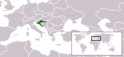
Country locator map for Croatia.
Originally created for the English wikipedia by en:User:Vardion
| |
This work has been released into the public domain by its author, Vardion, at the Ingelsk Wikipedy project. This applies worldwide. In case this is not legally possible: |

|
Ofbyld:LocationCroatia.svg is in fektorferzje fan dizze triem. As net fan sljochtere kwaliteit tsjinnet dizze brûkt te wurden yn plak fan dizze rasterôfbylding.
File:LocationCroatia.png → File:LocationCroatia.svg
Sjoch Help:SVG foar mear ynformaasje. |
 |
Triemskiednis
Klik op in datum/tiid om it bestân te besjen sa't it op dat stuit wie.
| Datum/Tiid | Miniatuer | ôfmjittings | Meidogger | Opmerking | |
|---|---|---|---|---|---|
| lêste | 6 jun 2006, 18.52 | | 250 × 115 (6 KB) | Rain74 | Montenegro |
| 12 des 2004, 01.37 |  | 250 × 115 (7 KB) | Alfio | Country locator map for Croatia |
Bestânsgebrûk
De neikommende side brûkt dit bestân:
Globaal bestânsgebrûk
De neikommende oare wiki's brûke dit bestân:
- Gebrûk op arc.wikipedia.org
- Gebrûk op ar.wikinews.org
- Gebrûk op av.wikipedia.org
- Gebrûk op awa.wikipedia.org
- Gebrûk op bg.wikipedia.org
- Gebrûk op bpy.wikipedia.org
- Gebrûk op ca.wikipedia.org
- Gebrûk op de.wiktionary.org
- Gebrûk op dsb.wikipedia.org
- Gebrûk op el.wikivoyage.org
- Gebrûk op en.wikipedia.org
- Gebrûk op en.wikinews.org
- Wikinews:Template messages/Infoboxes/Countries
- Template:Croatia
- Fire kills six, badly injures seven in Croatia
- Death toll in fatal fire in Croatia climbs to eight
- Man kills five relatives in family massacre in Croatia
- Run-off likely in Croatian presidential elections
- Croatian ruling party expels ex-PM from membership
- Gebrûk op en.wikivoyage.org
- Gebrûk op eu.wiktionary.org
- Gebrûk op fr.wikipedia.org
- Gebrûk op fr.wikinews.org
- Gebrûk op fr.wiktionary.org
- Gebrûk op he.wikivoyage.org
- Gebrûk op hi.wikipedia.org
- Gebrûk op ia.wikipedia.org
- Gebrûk op incubator.wikimedia.org
- Gebrûk op it.wikivoyage.org
- Gebrûk op ja.wiktionary.org
- Gebrûk op ka.wikipedia.org
- Gebrûk op kk.wikipedia.org
- Gebrûk op ko.wikipedia.org
- Gebrûk op ko.wiktionary.org
Mear globaal gebrûk fan dit bestân besjen.