Ofbyld:LocationGreece.png
Gjin hegere resolúsje beskikber.
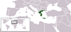
LocationGreece.png (248 × 113 pixels, bestânsgrutte: 3 KB, MIME-type: image/png)

|
This locator map image could be re-created using vector graphics as an SVG file. This has several advantages; see Commons:Media for cleanup for more information. If an SVG form of this image is available, please upload it and afterwards replace this template with
{{vector version available|new image name}}.
It is recommended to name the SVG file “LocationGreece.svg”—then the template Vector version available (or Vva) does not need the new image name parameter. |
Location map for Greece.
Originally created for English Wikipedia by Vardion.
| |
This work has been released into the public domain by its author, Vardion, at the Ingelsk Wikipedy project. This applies worldwide. In case this is not legally possible: |
Triemskiednis
Klik op in datum/tiid om it bestân te besjen sa't it op dat stuit wie.
| Datum/Tiid | Miniatuer | ôfmjittings | Meidogger | Opmerking | |
|---|---|---|---|---|---|
| lêste | 10 mai 2010, 23.35 | | 248 × 113 (3 KB) | Ras67 | cropped |
| 4 jun 2006, 13.54 |  | 250 × 115 (5 KB) | Rain74 | added Serbia-Montenegro border | |
| 27 jun 2005, 22.39 |  | 250 × 115 (4 KB) | Andrew pmk~commonswiki | optimize | |
| 5 des 2004, 17.29 |  | 250 × 115 (7 KB) | EugeneZelenko | Location map for Greece (Hellas).<br/>Originally created for English Wikipedia by Vardion.<br/>{{GFDL}} |
Bestânsgebrûk
De neikommende side brûkt dit bestân:
Globaal bestânsgebrûk
De neikommende oare wiki's brûke dit bestân:
- Gebrûk op als.wikipedia.org
- Gebrûk op am.wikipedia.org
- Gebrûk op ar.wikinews.org
- قالب:اليونان
- محاولات حل أزمة تشكيل الحكومة الجديدة في اليونان
- البرلمان اليوناني المنتخب يفشل في تشكيل حكومة مما يحتم إعادة الانتخابات
- إضراب عام احتجاجاً على خطط التقشف يشل اليونان
- وزراء مالية منطقة اليورو وصندوق النقد الدولي يتفقون على مساعدة اليونان
- اليسار الديمقراطي ينسحب من الائتلاف الحكومي بعد فشل المحادثات حول الراديو والتلفزيون الوطني اليوناني
- إنقاذ أكثر من 120 مهاجراً أغالبهم من سوريون في السواحل اليونانية
- إحباط محاولة لاغتيال أردوغان خلال زيارته لليونان
- Gebrûk op ast.wikipedia.org
- Gebrûk op av.wikipedia.org
- Gebrûk op bg.wikipedia.org
- Gebrûk op bpy.wikipedia.org
- Gebrûk op br.wikipedia.org
- Gebrûk op ca.wikinews.org
- Grècia: el dèficit públic arriba al 15,4 % el 2009
- Grècia: una sortida de l'euro és possible segons Lukàs Papadimos
- Plantilla:Infotaula Grècia
- Europa es conjura pel creixement amb la mirada posada a Grècia
- El PASOK anuncia per demà un govern de coalició amb Nova Democràcia
- Grècia: el programa de la coalició de govern inclou una flexibilització de les mesures d'austeritat
- Grècia: segons Stavros Karagkounis, el poble castigarà la coalició al poder
- Grècia demanarà dos anys més per a aplicar les retallades pactades amb la troica
- La coalició d'esquerra Syriza guanya les eleccions legislatives de Grècia
- Grècia: mor el cantant Demis Roussos
- Grècia diu No al pla de rescat de la troica
- La Comissió Europea no descarta la sortida de Grècia de l'euro si no presenta mesures creïbles
- Varoufakis ataca durament el pacte de Tsipras
- Gebrûk op de.wikinews.org
- Gebrûk op de.wiktionary.org
- Gebrûk op dsb.wikipedia.org
- Gebrûk op el.wikinews.org
- Επεισόδια για τον ΧΥΤΥ στην Κερατέα
- Πρότυπο:Ελλάδα
- Υπερψηφίστηκε από τη Βουλή η σύσταση προανακριτικής επιτροπής για την υπόθεση των υποβρυχίων
- Η Άγκελα Μέρκελ επέκρινε τις άδειες και τα συστήματα συνταξιοδότησης των χωρών της Νοτίου Ευρώπης
- Δεν ελήφθη απόφαση για το θέμα της Ελλάδας στη συνεδρίαση του Eurogroup
- Επιτάχυνση διαδικασίας αποκρατικοποιήσεων στην Ελλάδα
- Οι «αγανακτισμένοι» κατεβαίνουν και στους δρόμους της Ελλάδας
- Συλλαλητήριο για το νοσοκομείο της Ιεράπετρας
- Συνεχίζεται η κατάληψη του δημαρχείου στην Ιεράπετρα για το νοσοκομείο
- Ρεπορτάζ:Γεγονότα στη διαδήλωση των "Αγανακτισμένων" (Σύνταγμα 30-5-2011)
- Ένατη ημέρα κατάληψης στο δημαρχείο Ιεράπετρας για το νοσοκομείο
- Αύξηση 55.9% παρουσιάσαν οι ελληνικές εξαγωγές στη Κίνα
- Τερματίστηκε η κατάληψη του δημαρχείου Ιεράπετρας για το νοσοκομείο
- Νέα υποβάθμιση της Ελληνικής οικονομίας από την Standard and Poor's
- Έκτακτη συνεδρίαση των Υπουργών Οικονομικών της Ευρωζώνης
- Διαδηλώσεις στο κέντρο της Αθήνας
Mear globaal gebrûk fan dit bestân besjen.