Ofbyld:London-boroughs.svg

Size of this PNG preview of this SVG file: 489 × 386 piksels. Oare resolúsjes: 304 × 240 piksels | 608 × 480 piksels | 973 × 768 piksels | 1.280 × 1.010 piksels | 2.560 × 2.021 piksels.
Oarspronklik bestân (SVG-bestân, nominaal 489 × 386 pixels, bestânsgrutte: 46 KB)
Clickable version
Gearfetting
| Beskriuwing |
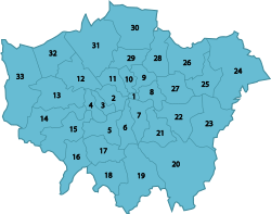
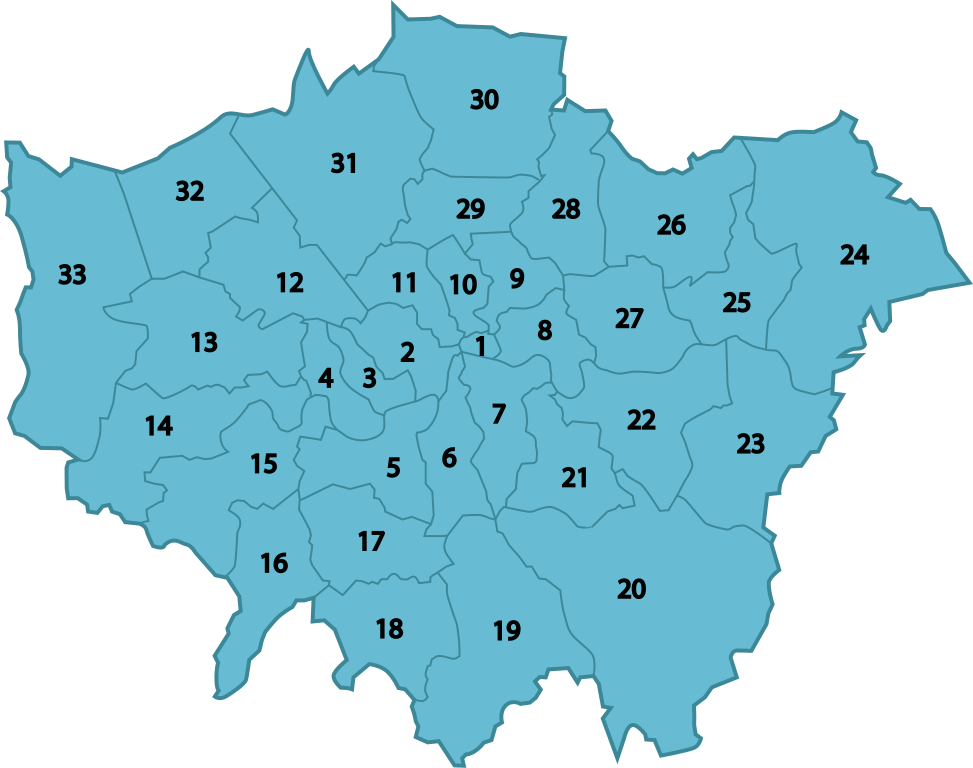
English: Numbered map of the boroughs of London |
| Datum | |
| Boarne | Eigen wurk |
| Auteur | Notscott |
| Oare ferzjes |
|

Lisinsje
I, the copyright holder of this work, hereby publish it under the following licenses:
This file is licensed under the Creative Commons Attribution-Share Alike 3.0 Unported license.
- Fiel jo frij:
- te dielen – it wurk te kopiearjen, fersprieden en út te stjoeren
- te fermingen – it wurk oan te passen
- Under de neikommende betingsten:
- Nammefermelding – You must give appropriate credit, provide a link to the license, and indicate if changes were made. You may do so in any reasonable manner, but not in any way that suggests the licensor endorses you or your use.
- Lyk diele – If you remix, transform, or build upon the material, you must distribute your contributions under the same or compatible license as the original.

|
Der wurdt tastimming jûn ta kopiearjen, fersprieden en/of wizigjen fan dit dokumint ûnder de betinksten fan de GNU-lisinsje foar iepen dokumintaasje, ferzje 1.2, as eltse lettere ferzje útjûn troch de Free Software Foundation; sûnder Ynfariante Seksjes, sûnder Omkaftteksten foar de Foarkante en sûnder Omkaftteksten foar de Efterkante. In kopy fan de lisinsje is opnaam yn de seksje "Text of the GNU Free Documentation License". |
You may select the license of your choice.
Triemskiednis
Klik op in datum/tiid om it bestân te besjen sa't it op dat stuit wie.
| Datum/Tiid | Miniatuer | ôfmjittings | Meidogger | Opmerking | |
|---|---|---|---|---|---|
| lêste | 23 okt 2009, 16.15 | | 489 × 386 (46 KB) | Jolly Janner | Black text increases readability. |
| 18 mai 2009, 01.42 |  | 489 × 386 (35 KB) | Notscott | {{Information |Description={{en|1=Numbered map of the boroughs of London}} |Source=Own work by uploader |Author=Notscott |Date=2009-05-18 |Permission= |other_versions= }} <!--{{ImageUpload|full}}--> [[Category:Locator maps of boroughs o |
Bestânsgebrûk
De neikommende side brûkt dit bestân:
Globaal bestânsgebrûk
De neikommende oare wiki's brûke dit bestân:
- Gebrûk op ab.wikipedia.org
- Gebrûk op af.wikipedia.org
- Gebrûk op ast.wikipedia.org
- Gebrûk op az.wikipedia.org
- Gebrûk op be.wikipedia.org
- Gebrûk op bg.wikipedia.org
- Gebrûk op ce.wikipedia.org
- Gebrûk op cy.wikipedia.org
- Gebrûk op de.wikivoyage.org
- Gebrûk op diq.wikipedia.org
- Gebrûk op el.wikipedia.org
- Gebrûk op en.wikipedia.org
- London boroughs
- Portal:London
- Portal:London/London Boroughs
- User:Abnormaal
- Parks and open spaces in London
- List of public art in London
- User:Palaeovia/Academia
- Template:London boroughs imagemap
- Local government in London
- Grade I listed buildings in London
- User:Alexwishart1
- User:WildBot/test03
- List of London boroughs
- List of local nature reserves in Greater London
- User:Nev1/London Grade I
- Grade II* listed buildings in London
Mear globaal gebrûk fan dit bestân besjen.