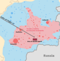
Ofbyld:MH17 map-en.svg

Size of this PNG preview of this SVG file: 512 × 256 piksels. Oare resolúsjes: 320 × 160 piksels | 640 × 320 piksels | 1.024 × 512 piksels | 1.280 × 640 piksels | 2.560 × 1.280 piksels.
Oarspronklik bestân (SVG-bestân, nominaal 512 × 256 pixels, bestânsgrutte: 212 KB)
Triemskiednis
Klik op in datum/tiid om it bestân te besjen sa't it op dat stuit wie.
| Datum/Tiid | Miniatuer | ôfmjittings | Meidogger | Opmerking | |
|---|---|---|---|---|---|
| lêste | 13 mrt 2023, 18.44 |  | 512 × 256 (212 KB) | Tyrrrz | Corrected transliteration of Ukrainian capital |
| 15 sep 2014, 18.14 |  | 512 × 256 (212 KB) | PM3 | fixed takeoff and last contact times, see [http://www.onderzoeksraad.nl/en/onderzoek/2049/investigation-crash-mh17-17-july-2014/preliminary-report#fasen] | |
| 10 sep 2014, 09.35 |  | 512 × 256 (212 KB) | Wereldburger758 | Valid SVG now. | |
| 18 jul 2014, 15.21 |  | 512 × 256 (231 KB) | Matthiasb | 1315 UTC is correct, 1415 GMT is wrong for 1415 WEST | |
| 18 jul 2014, 05.53 |  | 512 × 256 (231 KB) | Maxdamantus | Original times seem to be more accurate. | |
| 17 jul 2014, 22.40 |  | 512 × 256 (231 KB) | Cmglee | Fix times and font. | |
| 17 jul 2014, 22.36 |  | 512 × 256 (231 KB) | Cmglee | User created page with UploadWizard |
Bestânsgebrûk
De neikommende side brûkt dit bestân:
Globaal bestânsgebrûk
De neikommende oare wiki's brûke dit bestân:
- Gebrûk op ar.wikipedia.org
- Gebrûk op bat-smg.wikipedia.org
- Gebrûk op be-tarask.wikipedia.org
- Gebrûk op be.wikipedia.org
- Gebrûk op bg.wikipedia.org
- Gebrûk op bs.wikipedia.org
- Gebrûk op ca.wikipedia.org
- Gebrûk op da.wikipedia.org
- Gebrûk op en.wikipedia.org
- Gebrûk op en.wikinews.org
- Gebrûk op eo.wikipedia.org
- Gebrûk op es.wikipedia.org
- Gebrûk op et.wikipedia.org
- Gebrûk op eu.wikipedia.org
- Gebrûk op fa.wikipedia.org
- Gebrûk op fr.wikinews.org
- Gebrûk op ga.wikipedia.org
- Gebrûk op hr.wikipedia.org
- Gebrûk op id.wikipedia.org
- Gebrûk op kk.wikipedia.org
- Gebrûk op km.wikipedia.org
- Gebrûk op ko.wikipedia.org
- Gebrûk op lt.wikipedia.org
- Gebrûk op mr.wikipedia.org
- Gebrûk op ms.wikipedia.org
- Gebrûk op my.wikipedia.org
- Gebrûk op nl.wikinews.org
- Gebrûk op no.wikipedia.org
- Gebrûk op oc.wikipedia.org
- Gebrûk op pnb.wikipedia.org
- Gebrûk op pt.wikipedia.org
- Gebrûk op ro.wikipedia.org
- Gebrûk op sco.wikipedia.org
- Gebrûk op sh.wikipedia.org
- Gebrûk op simple.wikipedia.org
- Gebrûk op si.wikipedia.org
- Gebrûk op sk.wikipedia.org
- Gebrûk op sr.wikipedia.org
- Gebrûk op sr.wikinews.org
- Gebrûk op sv.wikipedia.org
- Gebrûk op te.wikipedia.org
- Gebrûk op th.wikipedia.org
Mear globaal gebrûk fan dit bestân besjen.


