Ofbyld:Map of Ireland's capitals.png

Grutte fan dit proefbyld: 470 × 599 piksels. Oare resolúsjes: 188 × 240 piksels | 376 × 480 piksels | 602 × 768 piksels | 803 × 1.024 piksels | 1.630 × 2.078 piksels.
Oarspronklik bestân (1.630 × 2.078 pixels, bestânsgrutte: 136 KB, MIME-type: image/png)
Gearfetting

|
This map image could be re-created using vector graphics as an SVG file. This has several advantages; see Commons:Media for cleanup for more information. If an SVG form of this image is available, please upload it and afterwards replace this template with
{{vector version available|new image name}}.
It is recommended to name the SVG file “Map of Ireland's capitals.svg”—then the template Vector version available (or Vva) does not need the new image name parameter. |
| Beskriuwing |
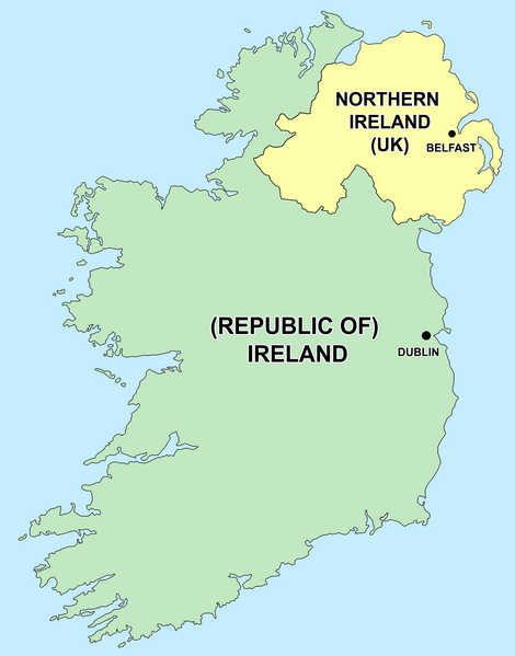
English: Political capitals of the countries Ireland and Northern Ireland Bahasa Indonesia: Ibu kota dari negara Irlandia Utara (Belfast) dan Republik Irlandia (Dublin) |
| Datum | 26 desimber 2006 (original upload date) |
| Boarne | Transferred from en.wikipedia to Commons by Kajasudhakarababu using CommonsHelper. |
| Auteur | The original uploader was Jonto at Ingelsk Wikipedy. |
Lisinsje
| This file is licensed under the Creative Commons Attribution-Share Alike 3.0 Unported license. Subject to disclaimers. | ||
| ||
| This licensing tag was added to this file as part of the GFDL licensing update. |

|
Der wurdt tastimming jûn ta kopiearjen, fersprieden en/of wizigjen fan dit dokumint ûnder de betinksten fan de GNU-lisinsje foar iepen dokumintaasje, ferzje 1.2, as eltse lettere ferzje útjûn troch de Free Software Foundation; sûnder Ynfariante Seksjes, sûnder Omkaftteksten foar de Foarkante en sûnder Omkaftteksten foar de Efterkante. In kopy fan de lisinsje is opnaam yn de seksje "Text of the GNU Free Documentation License". Subject to disclaimers. |
Original upload log
- delete all current 21:50, 26 December 2006 Thumbnail for version as of 21:50, 26 December 2006 415×541 (13 KB) Jonto (Talk | contribs | block) (Updated as per talk.)
- delete revert 13:42, 11 October 2006 Thumbnail for version as of 13:42, 11 October 2006 415×541 (11 KB) Evertype (Talk | contribs | block) (I re-coloured the existing map and replaced the text on the island.)
- delete revert 04:08, 11 January 2006 Thumbnail for version as of 04:08, 11 January 2006 415×541 (5 KB) Zscout370 (Talk | contribs | block) (Compression)
- delete revert 07:31, 31 May 2005 Thumbnail for version as of 07:31, 31 May 2005 415×541 (14 KB) WikiDon (Talk | contribs | block)
en:Category:Maps of Northern Ireland
Triemskiednis
Klik op in datum/tiid om it bestân te besjen sa't it op dat stuit wie.
| Datum/Tiid | Miniatuer | ôfmjittings | Meidogger | Opmerking | |
|---|---|---|---|---|---|
| lêste | 5 jul 2015, 16.22 | | 1.630 × 2.078 (136 KB) | Cmdrjameson | Compressed with pngout. Reduced by 93kB (40% decrease). |
| 19 sep 2014, 02.11 |  | 1.630 × 2.078 (229 KB) | Wiki01916 | Improved text legibility and colour as per Map Maker best practises guide. | |
| 9 des 2013, 03.01 |  | 804 × 1.023 (125 KB) | Asarlaí | Reverted to version as of 12 August 2012. This has much clearer writing, shows the border more clearly, shows the size of the capitals more accurately, and has a more neutral color for NI | |
| 16 sep 2013, 12.26 |  | 817 × 1.042 (106 KB) | Setanta Saki | Minor fix | |
| 16 sep 2013, 08.58 |  | 817 × 1.042 (105 KB) | Setanta Saki | minor fix | |
| 16 sep 2013, 08.44 |  | 817 × 1.042 (104 KB) | Setanta Saki | Update with higher quality map and titles | |
| 5 aug 2013, 18.22 |  | 804 × 1.023 (113 KB) | SonofSetanta | Lifting colour of Northern Ireland away from Green - more neutral. | |
| 12 aug 2012, 21.47 |  | 804 × 1.023 (125 KB) | Asarlaí | ||
| 17 mai 2012, 15.41 |  | 415 × 541 (8 KB) | HighKing | Reverted to version as of 13:46, 1 May 2011 This is a political map. As per IMOS and IRE-IRL , use correct names. | |
| 31 jul 2011, 06.44 |  | 415 × 541 (13 KB) | BoutYeBigLad | For clarity. The map does NOT clearly dispel any confusion as it is not made clear that Ireland has been primarily the name of the island for hundreds of years.. |
Bestânsgebrûk
De neikommende side brûkt dit bestân:
Globaal bestânsgebrûk
De neikommende oare wiki's brûke dit bestân:
- Gebrûk op ar.wikipedia.org
- Gebrûk op arz.wikipedia.org
- Gebrûk op ast.wikipedia.org
- Gebrûk op be-tarask.wikipedia.org
- Gebrûk op bg.wikipedia.org
- Gebrûk op bs.wikipedia.org
- Gebrûk op ca.wikipedia.org
- Gebrûk op cs.wikipedia.org
- Gebrûk op da.wikipedia.org
- Gebrûk op el.wikipedia.org
- Gebrûk op en.wikipedia.org
- The Troubles
- Talk:Westminster system
- Talk:Casimir III the Great
- Talk:Ivory Coast/Archive 1
- Talk:Tartar sauce
- Talk:Patrick Pearse/Archive 1
- Talk:Pope Paul VI/Archive 1
- User talk:Bernfarr
- Talk:Paul Martin
- User:Jtdirl
- Talk:Culture of New Zealand/Archive 1
- User talk:Michael Hardy/Archive2
- Talk:Irish Free State
- Talk:Empress Elisabeth of Austria
- Talk:North Macedonia/Archive 7
- Talk:Nelson, New Zealand
- Talk:James VI and I/Archive 1
- Talk:Prime minister/Archive 1
- Talk:Charlotte of Belgium
- Talk:Lucian Pulvermacher
- Talk:Patrice de MacMahon
- Talk:First lady
- Talk:Loyalism
- Talk:Parliament House, Dublin
- Talk:Mary Robinson
- History of the Republic of Ireland
- User talk:Karl Schalike
- Talk:John O'Connor (cardinal)
- Talk:Swiss Guards
- Talk:Geraldine of Albania
- Talk:Monarchy of Canada/Archive 2
- Talk:Duarte Pio, Duke of Braganza
- User talk:Gidonb/Archive 2005
- User talk:Lunkwill
Mear globaal gebrûk fan dit bestân besjen.