Ofbyld:Map of West Tennessee counties.png
Grutte fan dit proefbyld: 800 × 196 piksels. Oare resolúsjes: 320 × 78 piksels | 1.000 × 245 piksels.
Oarspronklik bestân (1.000 × 245 pixels, bestânsgrutte: 34 KB, MIME-type: image/png)
Gearfetting
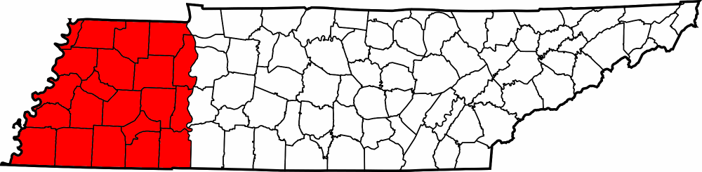
| Beskriuwing |
English: Map showing the counties of West Tennessee, United States. |
| Datum | |
| Boarne | Eigen wurk; File:Tennessee county locator map - blank.png |
| Auteur | User:Huntster |
Lisinsje
| This file is licensed under the Creative Commons Attribution-Share Alike 3.0 Unported license. Subject to disclaimers. | ||
| ||
| This licensing tag was added to this file as part of the GFDL licensing update. |

|
Der wurdt tastimming jûn ta kopiearjen, fersprieden en/of wizigjen fan dit dokumint ûnder de betinksten fan de GNU-lisinsje foar iepen dokumintaasje, ferzje 1.2, as eltse lettere ferzje útjûn troch de Free Software Foundation; sûnder Ynfariante Seksjes, sûnder Omkaftteksten foar de Foarkante en sûnder Omkaftteksten foar de Efterkante. In kopy fan de lisinsje is opnaam yn de seksje "Text of the GNU Free Documentation License". Subject to disclaimers. |
Original upload log
Transferred from en.wikipedia to Commons using For the Common Good.
The original description page was here. All following user names refer to en.wikipedia.
| Datum/Tiid | Ofmjittings | Meidogger | Opmerking |
|---|---|---|---|
| 07:19, 4 June 2005 | 300 × 75 (11,229 bytes) | w:en:Dale Arnett (oerlis | bydragen) | (Public domain map courtesy of [http://www.lib.utexas.edu/ The General Libraries, The University of Texas at Austin], modified to show counties. {{GFDL}} See [[Wikipedia:U.S. county map]]s.) |
Triemskiednis
Klik op in datum/tiid om it bestân te besjen sa't it op dat stuit wie.
| Datum/Tiid | Miniatuer | ôfmjittings | Meidogger | Opmerking | |
|---|---|---|---|---|---|
| lêste | 24 mai 2013, 05.08 | 1.000 × 245 (34 KB) | Huntster | Introduce higher quality map. | |
| 24 mai 2013, 04.48 | 300 × 75 (11 KB) | Huntster | Transferred from en.wikipedia: see original upload log above |
Bestânsgebrûk
De neikommende side brûkt dit bestân:
Globaal bestânsgebrûk
De neikommende oare wiki's brûke dit bestân:
- Gebrûk op el.wikipedia.org
- Gebrûk op en.wikipedia.org
- Gebrûk op gu.wikipedia.org
- Gebrûk op it.wikipedia.org
- Gebrûk op ja.wikipedia.org
- Gebrûk op ko.wikipedia.org
- Gebrûk op ru.wikipedia.org
- Gebrûk op simple.wikipedia.org
- Gebrûk op vi.wikipedia.org
- Gebrûk op zh.wikipedia.org