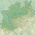
Ofbyld:North Rhine-Westphalia relief location map.jpg

Oarspronklik bestân(1.800 × 1.790 pixels, bestânsgrutte: 1,52 MB, MIME-type: image/jpeg)

Dit bestân komt fan Wikimedia Commons, en kin ek troch oare projekten brûkt wurde. De beskriuwing op syn bestânsside dêre wurdt hjirûnder werjûn.

Gearfetting

Beskriuwing
Deutsch: Positionskarte Nordrhein-Westfalen, Germany. Geographische Begrenzung der Karte:
English: Location map North Rhine-Westphalia, Germany. Geographic limits of the map:
Français : Carte du land Rhénanie-du-Nord-Westphalie (Allemagne) destinée à géolocalisation. Les limites géographiques sont:
Coords
52.552° N
50.315° N
5.834° E
9.481° E
Open this image as an overlay in Google Earth (Google Maps, Bing) (Help|Source)
Datum
Boarne

Eigen wurk

Auteur Grundkarte TUBS, Relief Alexrk2
Oare ferzjes

[bewurkje]

Ofbyld:North Rhine-Westphalia location map 03.svg is in fektorferzje fan dizze triem. As net fan sljochtere kwaliteit tsjinnet dizze brûkt te wurden yn plak fan dizze rasterôfbylding.

File:North Rhine-Westphalia relief location map.jpg → File:North Rhine-Westphalia location map 03.svg

Sjoch Help:SVG foar mear ynformaasje.

In other languages ([//commons.wikimedia.org/w/index.php?title=Template:In_other_languages&action=edit translate this])
Alemannisch  Bahasa Indonesia  Bahasa Melayu  British English  català  čeština  dansk  Deutsch  eesti  English  español  Esperanto  euskara  français  Frysk  galego  hrvatski  Ido  italiano  lietuvių  magyar  Nederlands  norsk bokmål  norsk nynorsk  occitan  Plattdüütsch  polski  português  português do Brasil  română  Scots  sicilianu  slovenčina  slovenščina  suomi  svenska  Tiếng Việt  Türkçe  vèneto  Ελληνικά  беларуская (тарашкевіца)  български  македонски  нохчийн  русский  српски / srpski  татарча/tatarça  українська  ქართული  հայերեն  বাংলা  தமிழ்  മലയാളം  ไทย  한국어  日本語  简体中文  繁體中文  עברית  العربية  فارسی  +/−
SVG-triem

Lisinsje

I, the copyright holder of this work, hereby publish it under the following licenses:
GNU head Der wurdt tastimming jûn ta kopiearjen, fersprieden en/of wizigjen fan dit dokumint ûnder de betinksten fan de GNU-lisinsje foar iepen dokumintaasje, ferzje 1.2, as eltse lettere ferzje útjûn troch de Free Software Foundation; sûnder Ynfariante Seksjes, sûnder Omkaftteksten foar de Foarkante en sûnder Omkaftteksten foar de Efterkante. In kopy fan de lisinsje is opnaam yn de seksje "Text of the GNU Free Documentation License".
w:fy:Creative Commons
Nammefermelding Lyk diele
This file is licensed under the Creative Commons Attribution-Share Alike 3.0 Unported, 2.5 Generic, 2.0 Generic and 1.0 Generic license.
Fiel jo frij:
  • te dielen – it wurk te kopiearjen, fersprieden en út te stjoeren
  • te fermingen – it wurk oan te passen
Under de neikommende betingsten:
  • Nammefermelding – You must give appropriate credit, provide a link to the license, and indicate if changes were made. You may do so in any reasonable manner, but not in any way that suggests the licensor endorses you or your use.
  • Lyk diele – If you remix, transform, or build upon the material, you must distribute your contributions under the same or compatible license as the original.
You may select the license of your choice.

Captions

Add a one-line explanation of what this file represents

Items portrayed in this file

depicts Ingelsk

copyrighted Ingelsk

inception Ingelsk

oktober 2009

Triemskiednis

Klik op in datum/tiid om it bestân te besjen sa't it op dat stuit wie.

Datum/TiidMiniatuerôfmjittingsMeidoggerOpmerking
lêste16 des 2009, 21.35Miniatuer foar de ferzje fan 16 des 2009 om 21.351.800 × 1.790 (1,52 MB)TUBSkorr crop area
10 nov 2009, 20.21Miniatuer foar de ferzje fan 10 nov 2009 om 20.211.795 × 1.794 (1,17 MB)Alexrk2== {{int:filedesc}} == {{Information |Description= {{de|Physische Positionskarte Nordrhein-Westfalen, Deutschland. Geographische Begrenzung der Karte:}} {{en|Physical Location map [[w:en:North Rhine-Westphalia|North Rhine-West

De neikommende side brûkt dit bestân:

Globaal bestânsgebrûk

Metadata