Ofbyld:PaysBas delisle 1743 fragment.jpg
Oarspronklik bestân (2.666 × 2.042 pixels, bestânsgrutte: 5,11 MB, MIME-type: image/jpeg)
| Beskriuwing |
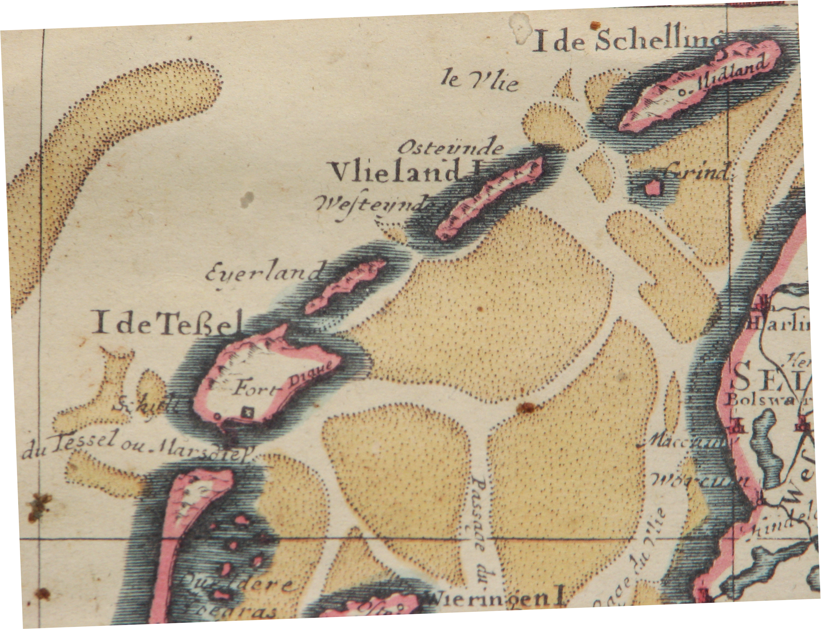
English: Northern fragment of a map of The Netherlands, publication date circa 1743
Nederlands: Noordelijk fragment van een kaart van Nederland, publicatie ca 1743
Français : parte de Carte des Provinces Unies des Pays Bas, par G. de L'Isle, A Amsterdam 1743 |
| Datum | |
| Boarne | Edition Covens & Mortier 1743 from 1702 original. |
| Auteur | Hans Erren |
published by Covens & Mortier, Amsterdam
|
This work is in the public domain in its country of origin and other countries and areas where the copyright term is the author's life plus 70 years or fewer.
| |
| This file has been identified as being free of known restrictions under copyright law, including all related and neighboring rights. | |
Triemskiednis
Klik op in datum/tiid om it bestân te besjen sa't it op dat stuit wie.
| Datum/Tiid | Miniatuer | ôfmjittings | Meidogger | Opmerking | |
|---|---|---|---|---|---|
| lêste | 26 jun 2010, 23.12 | | 2.666 × 2.042 (5,11 MB) | Hans Erren | {{Information |Description={{en|1=Northern fragment of a map of The Netherlands, publication date circa 1743}} {{nl|1=Noordelijk fragment van een kaart van Nederland, publicatie ca 1743}} {{fr|1=parte de Carte des Provinces Unies des Pays Bas, par G. de L |
Bestânsgebrûk
De neikommende 2 siden brûke dit bestân:
Globaal bestânsgebrûk
De neikommende oare wiki's brûke dit bestân:
- Gebrûk op ca.wikipedia.org
- Gebrûk op de.wikipedia.org
- Gebrûk op en.wikipedia.org
- Gebrûk op fr.wikipedia.org
- Gebrûk op id.wikipedia.org
- Gebrûk op it.wikipedia.org
- Gebrûk op nl.wikipedia.org
- Gebrûk op pl.wikipedia.org
- Gebrûk op www.wikidata.org