Ofbyld:Rhineland-Palatinate location map G.svg

Size of this PNG preview of this SVG file: 465 × 600 piksels. Oare resolúsjes: 186 × 240 piksels | 372 × 480 piksels | 595 × 768 piksels | 794 × 1.024 piksels | 1.588 × 2.048 piksels | 708 × 913 piksels.
Oarspronklik bestân (SVG-bestân, nominaal 708 × 913 pixels, bestânsgrutte: 741 KB)
Gearfetting
| Beskriuwing |
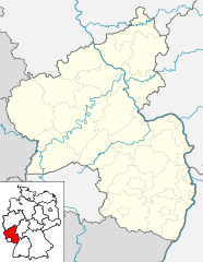
Deutsch: Positionskarte Rheinland-Pfalz, einschl. der Lage innerhalb Deutschlands. Geographische Begrenzung der Karte:
English: Location map Rhineland-Palatinate, showing position of Rhineland-Palatinate within Germany. Geographic limits of the map:
|
| Datum | |
| Boarne | Own work based on: Rhineland-Palatinate location map.svg |
| Auteur | Hanhil based on work by TUBS |
| SVG genesis | This locator map was created with Adobe Illustrator by TUBS, and with Inkscape. |
Lisinsje
I, the copyright holder of this work, hereby publish it under the following licenses:

|
Der wurdt tastimming jûn ta kopiearjen, fersprieden en/of wizigjen fan dit dokumint ûnder de betinksten fan de GNU-lisinsje foar iepen dokumintaasje, ferzje 1.2, as eltse lettere ferzje útjûn troch de Free Software Foundation; sûnder Ynfariante Seksjes, sûnder Omkaftteksten foar de Foarkante en sûnder Omkaftteksten foar de Efterkante. In kopy fan de lisinsje is opnaam yn de seksje "Text of the GNU Free Documentation License". |
This file is licensed under the Creative Commons Attribution-Share Alike 3.0 Unported, 2.5 Generic, 2.0 Generic and 1.0 Generic license.
- Fiel jo frij:
- te dielen – it wurk te kopiearjen, fersprieden en út te stjoeren
- te fermingen – it wurk oan te passen
- Under de neikommende betingsten:
- Nammefermelding – You must give appropriate credit, provide a link to the license, and indicate if changes were made. You may do so in any reasonable manner, but not in any way that suggests the licensor endorses you or your use.
- Lyk diele – If you remix, transform, or build upon the material, you must distribute your contributions under the same or compatible license as the original.
You may select the license of your choice.
Triemskiednis
Klik op in datum/tiid om it bestân te besjen sa't it op dat stuit wie.
| Datum/Tiid | Miniatuer | ôfmjittings | Meidogger | Opmerking | |
|---|---|---|---|---|---|
| lêste | 31 mai 2009, 00.47 | | 708 × 913 (741 KB) | Michiel1972 | frame |
| 22 mai 2009, 18.55 |  | 708 × 913 (737 KB) | Hanhil | {{Information |Description= {{de|Positionskarte Rheinland-Pfalz, einschl. der Lage innerhalb Deutschlands. Geographische Begrenzung der Karte:}} {{en|Location map [[w:en:Rhineland-Palatinate|Rhineland-Palatinat |
Bestânsgebrûk
Mear as 100 siden brûke dit bestân. De neikommende list jout allinne de earste 100 siden dy't dit bestân brûke wer. Der is ek in folsleine list.
- Abdij Maria Laach
- Abdij Marienstatt
- Alzey
- Armsheim
- Augustinertsjerke (Mainz)
- Bacharach
- Bad Breisig
- Bad Ems
- Bad Neuenahr-Ahrweiler
- Bad Salzig
- Basilika St. Martin (Bingen)
- Beilstein (Rynlân-Palts)
- Bingen am Rhein
- Boarch Eltz
- Boarch Klopp
- Boppard
- Bornich
- Briedern
- Bruttig-Fankel
- Burg Ardeck
- Burg Hohlenfels
- Burg Maus
- Burg Metternich
- Burg Schwalbach
- Cochem
- Diez
- Disibodenberg
- Dom fan Mainz
- Dom fan Spiers
- Ediger-Eller
- Gedächtniskirche (Spiers)
- Greveslot Diez
- Haadsynagoge (Mainz)
- Herschwiesen
- Hirzenach
- Holzfeld
- Holzheim (Rynlân-Palts)
- Kamp-Bornhofen
- Karmelitetsjerke (Mainz)
- Kastellaun
- Kastiel Gutenfels
- Katharinenkirche (Oppenheim)
- Kaub
- Kestert
- Kleaster Marije Engelport
- Kleaster Rupertsberg
- Kleaster Schönau (Strüth)
- Klotten
- Koblenz
- Kristustsjerke (Mainz)
- Lahnstein
- Leaffrouwetsjerke (Mainz)
- Lieg
- Lütz
- Mainz
- Marksburg
- Meisenheim
- Mesenich
- Niederburg
- Nije Synagoge (Bingen am Rhein)
- Nije Synagoge (Mainz)
- Nürburgring
- Oberdiebach
- Oberwesel
- Oppenhausen
- Oppenheim
- Osterspai
- Pfalzgrafenstein
- Protestantske tsjerke (Bornich)
- Protestantske tsjerke (Sankt Goarshausen)
- Remagen
- Rhens
- Rochuskapel (Bingen)
- Ruppertshofen (Rynlân-Palts)
- Sankt Goar
- Sankt Goarshausen
- Sankt Goär (Lieg)
- Sankt Maximin (Lütz)
- Senheim
- Sint-Ignatiustsjerke (Mainz)
- Sint-Jehannestsjerke (Mainz)
- Sint-Kastorbasilyk (Koblenz)
- Sint-Kwintentsjerke (Mainz)
- Sint-Maternustsjerke (Ürzig)
- Sint-Petrustsjerke (Mainz)
- Sint-Stefanustsjerke (Mainz)
- Slot Bürresheim
- Slot Oranienstein
- Spiers
- Stiftstsjerke Diez
- Synagoge fan Landau in der Pfalz
- Trechtingshausen
- Treis-Karden
- Trier
- Tsjerke fan it Hillich Bloed fan Kristus (Armsheim)
- Udenhausen (Boppard)
- Udenheim
- Waldorf (Rynlân-Palts)
- Weiler (Boppard)
- Worms
Mear ferwizings nei dit bestân besjen.
Globaal bestânsgebrûk
De neikommende oare wiki's brûke dit bestân:
- Gebrûk op de.wikivoyage.org
- Gebrûk op es.wikipedia.org
- Palacio de Stolzenfels
- Maguncia
- Ludwigshafen am Rhein
- Tréveris
- Kaiserslautern
- Mayen
- Saarburg
- Nürburg
- Bad Neuenahr-Ahrweiler
- Castillo de Lahneck
- Cochem
- Abadía de Santa Maria Laach
- Castillo de Pfalzgrafenstein
- Fortaleza de Ehrenbreitstein
- Adenau
- Landstuhl
- Altenahr
- Bogel
- Plantilla:Mapa de localización de Renania-Palatinado
- Basílica de San Paulino (Tréveris)
- Abadía de San Matías
- Castillo de Rheinstein
- Abadía de Prüm
- Basílica de San Martín (Bingen am Rhein)
- Basílica de San Cástor (Coblenza)
- Basílica del Santo Salvador (Prüm)
- Oppenheim (Alemania)
- Ahrbrück
- Antweiler
- Aremberg
- Bad Breisig
- Barweiler
- Bauler
- Berg (Ahrweiler)
- Brohl-Lützing
- Dankerath
- Dedenbach
- Dernau
- Dorsel
- Eichenbach
- Fuchshofen
- Gönnersdorf
- Harscheid
- Heckenbach
- Herschbroich
- Hönningen
- Hoffeld
- Honerath
Mear globaal gebrûk fan dit bestân besjen.