Ofbyld:River Ouse map.png
Grutte fan dit proefbyld: 529 × 600 piksels. Oare resolúsjes: 212 × 240 piksels | 423 × 480 piksels | 677 × 768 piksels | 903 × 1.024 piksels | 1.767 × 2.004 piksels.
Oarspronklik bestân (1.767 × 2.004 pixels, bestânsgrutte: 3,7 MB, MIME-type: image/png)
Gearfetting
| Beskriuwing |
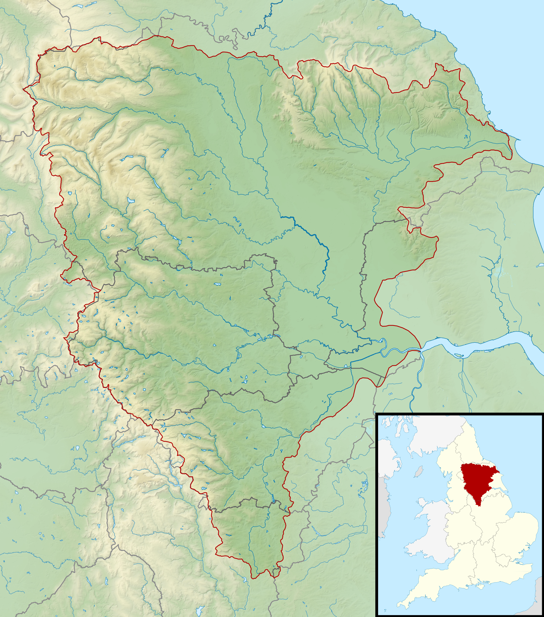
English: Map of the River Ouse and its catchment in England.
Map is on British National Grid with limits at grid refs NY7020 (top left), OV2020 (top right), SJ7050 (bottom left), TF2050 (bottom right). |
| Datum | |
| Boarne |
|
| Auteur | Nilfanion, created using Ordnance Survey data |
| Tastimming (Reusing this file) |
This file is licensed under the Creative Commons Attribution-Share Alike 3.0 Unported license. Nammefermelding: Contains Ordnance Survey data © Crown copyright and database right
|
Triemskiednis
Klik op in datum/tiid om it bestân te besjen sa't it op dat stuit wie.
| Datum/Tiid | Miniatuer | ôfmjittings | Meidogger | Opmerking | |
|---|---|---|---|---|---|
| lêste | 6 mrt 2014, 01.41 | | 1.767 × 2.004 (3,7 MB) | Nilfanion | == {{int:filedesc}} == {{Information |Description= {{en|Map of the River Ouse and its catchment in England. Map is on British National Grid with limits at grid refs NY7020 (top left), OV2020 (top right), SJ7050 (bottom left), TF2050 (bottom right).}}... |
Bestânsgebrûk
De neikommende side brûkt dit bestân:
Globaal bestânsgebrûk
De neikommende oare wiki's brûke dit bestân:
- Gebrûk op br.wikipedia.org
- Gebrûk op en.wikipedia.org
- Gebrûk op nl.wikipedia.org
- Gebrûk op sh.wikipedia.org
- Gebrûk op sr.wikipedia.org