Ofbyld:SG-Settlements.png

Grutte fan dit proefbyld: 800 × 580 piksels. Oare resolúsjes: 320 × 232 piksels | 640 × 464 piksels | 1.024 × 742 piksels | 1.280 × 928 piksels | 2.560 × 1.856 piksels | 3.702 × 2.684 piksels.
Oarspronklik bestân (3.702 × 2.684 pixels, bestânsgrutte: 419 KB, MIME-type: image/png)
Gearfetting
| Beskriuwing |
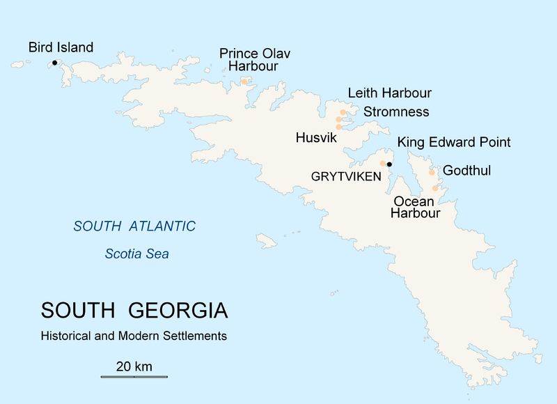
English: Map of South Georgia Island (Settlements) published by the author Apcbg. |
| Datum | |
| Boarne | Eigen wurk |
| Auteur | Apcbg |
Lisinsje
I, the copyright holder of this work, hereby publish it under the following license:

|
Der wurdt tastimming jûn ta kopiearjen, fersprieden en/of wizigjen fan dit dokumint ûnder de betinksten fan de GNU-lisinsje foar iepen dokumintaasje, ferzje 1.2, as eltse lettere ferzje útjûn troch de Free Software Foundation; sûnder Ynfariante Seksjes, sûnder Omkaftteksten foar de Foarkante en sûnder Omkaftteksten foar de Efterkante. In kopy fan de lisinsje is opnaam yn de seksje "Text of the GNU Free Documentation License". |
| This file is licensed under the Creative Commons Attribution-Share Alike 3.0 Unported license. | ||
| ||
| This licensing tag was added to this file as part of the GFDL licensing update. |
Triemskiednis
Klik op in datum/tiid om it bestân te besjen sa't it op dat stuit wie.
| Datum/Tiid | Miniatuer | ôfmjittings | Meidogger | Opmerking | |
|---|---|---|---|---|---|
| lêste | 18 nov 2007, 22.26 | | 3.702 × 2.684 (419 KB) | Apcbg | {{Information |Description=Map of South Georgia Island (Settlements) published by the author Apcbg. |Source=self-made |Date=18 November 2007 |Author= Apcbg }} == Licensing == {{self|GFDL}} |
| 18 nov 2007, 22.16 |  | 3.702 × 2.684 (419 KB) | Apcbg | {{Information |Description=Map of South Georgia Island (Settlements) published by the author Apcbg. |Source=self-made |Date=18 November 2007 |Author= Apcbg }} == Licensing == {{self|GFDL}} | |
| 18 nov 2007, 20.23 |  | 3.702 × 2.684 (419 KB) | Apcbg | {{Information |Description=Map of South Georgia Island (Settlements) published by the author Apcbg. |Source=self-made |Date=18 November 2007 |Author= Apcbg }} == Licensing == {{self|GFDL}} | |
| 7 okt 2007, 13.00 |  | 2.962 × 1.952 (164 KB) | Apcbg | {{Information |Description=Map of South Georgia Island (Settlements) published by the author Apcbg. |Source=self-made |Date=7 October 2007 |Author= Apcbg }} == Licensing == {{self|GFDL}} | |
| 7 okt 2007, 12.32 |  | 2.962 × 1.952 (164 KB) | Apcbg | {{Information |Description=Map of South Georgia Island (Settlements) published by the author Apcbg. |Source=self-made |Date=7 October 2007 |Author= Apcbg }} == Licensing == {{self|GFDL}} | |
| 7 okt 2007, 10.42 |  | 2.962 × 1.952 (163 KB) | Apcbg | {{Information |Description=Map of South Georgia Island (Settlements) published by the author Apcbg. |Source=self-made |Date=7 October 2007 |Author= Apcbg }} == Licensing == {{self|GFDL}} | |
| 5 okt 2007, 23.55 |  | 2.962 × 1.952 (16,57 MB) | Apcbg | {{Information |Description=Map of South Georgia Island (Settlements) published by the author Apcbg. |Source=self-made |Date=5 October 2007 |Author= Apcbg }} == Licensing == {{self|GFDL}} | |
| 5 okt 2007, 23.36 |  | 2.962 × 1.952 (211 KB) | Apcbg | {{Information |Description=Map of South Georgia Island (Settlements) published by the author Apcbg. |Source=self-made |Date=5 October 2007 |Author= Apcbg }} == Licensing == {{self|GFDL}} |
Bestânsgebrûk
De neikommende side brûkt dit bestân:
Globaal bestânsgebrûk
De neikommende oare wiki's brûke dit bestân:
- Gebrûk op af.wikipedia.org
- Gebrûk op ar.wikipedia.org
- Gebrûk op bg.wikipedia.org
- Gebrûk op bs.wikipedia.org
- Gebrûk op ca.wikipedia.org
- Gebrûk op de.wikipedia.org
- Gebrûk op el.wikipedia.org
- Gebrûk op en.wikipedia.org
- South Georgia and the South Sandwich Islands
- Grytviken
- South Georgia
- King Edward Point
- Bird Island, South Georgia
- History of South Georgia and the South Sandwich Islands
- Leith Harbour
- Solveig Gunbjørg Jacobsen
- Prince Olav Harbour
- Godthul
- Ocean Harbour
- Invasion of South Georgia
- Reindeer in South Georgia
- List of settlements in South Georgia and the South Sandwich Islands
- Gebrûk op eo.wikipedia.org
- Gebrûk op es.wikipedia.org
- Gebrûk op et.wikipedia.org
- Gebrûk op fa.wikipedia.org
- Gebrûk op fi.wikipedia.org
- Gebrûk op fr.wikipedia.org
- Gebrûk op gd.wikipedia.org
- Gebrûk op gl.wikipedia.org
- Gebrûk op he.wikipedia.org
- Gebrûk op hu.wikipedia.org
- Gebrûk op id.wikipedia.org
- Gebrûk op incubator.wikimedia.org
- Gebrûk op is.wikipedia.org
Mear globaal gebrûk fan dit bestân besjen.