Ofbyld:Snake watershed.png
Grutte fan dit proefbyld: 597 × 600 piksels. Oare resolúsjes: 239 × 240 piksels | 478 × 480 piksels | 1.000 × 1.005 piksels.
Oarspronklik bestân (1.000 × 1.005 pixels, bestânsgrutte: 296 KB, MIME-type: image/png)
Gearfetting
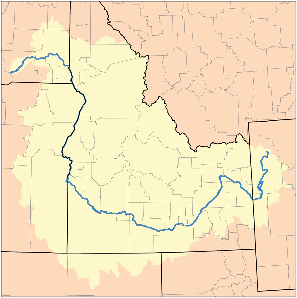
English: Map of the Snake River Watershed of Idaho — the Western United States.
I, Karl Musser, created it based on USGS data.
I, the copyright holder of this work, hereby publish it under the following license:
This file is licensed under the Creative Commons Attribution-Share Alike 2.5 Generic license.
- Fiel jo frij:
- te dielen – it wurk te kopiearjen, fersprieden en út te stjoeren
- te fermingen – it wurk oan te passen
- Under de neikommende betingsten:
- Nammefermelding – You must give appropriate credit, provide a link to the license, and indicate if changes were made. You may do so in any reasonable manner, but not in any way that suggests the licensor endorses you or your use.
- Lyk diele – If you remix, transform, or build upon the material, you must distribute your contributions under the same or compatible license as the original.
Triemskiednis
Klik op in datum/tiid om it bestân te besjen sa't it op dat stuit wie.
| Datum/Tiid | Miniatuer | ôfmjittings | Meidogger | Opmerking | |
|---|---|---|---|---|---|
| lêste | 23 feb 2010, 00.52 | | 1.000 × 1.005 (296 KB) | Kmusser | increased resolution |
| 6 mai 2007, 00.36 |  | 189 × 190 (15 KB) | DanMS | Trimmed excess white space around image and uploaded same again. | |
| 16 nov 2005, 21.00 |  | 200 × 200 (15 KB) | Kmusser | ||
| 8 sep 2005, 17.31 |  | 200 × 200 (36 KB) | Kmusser | ||
| 9 aug 2005, 14.38 |  | 200 × 200 (17 KB) | Kmusser | This is a map of the Tennessee River Watershed. I, Karl Musser, created it based on USGS data. {{GFDL}} Category:Maps of rivers |
Bestânsgebrûk
De neikommende side brûkt dit bestân:
Globaal bestânsgebrûk
De neikommende oare wiki's brûke dit bestân:
- Gebrûk op af.wikipedia.org
- Gebrûk op azb.wikipedia.org
- Gebrûk op en.wikipedia.org
- Gebrûk op fi.wikipedia.org
- Gebrûk op io.wikipedia.org
- Gebrûk op kk.wikipedia.org
- Gebrûk op lt.wikipedia.org
- Gebrûk op nl.wikipedia.org
- Gebrûk op pt.wikipedia.org
- Gebrûk op sl.wikipedia.org
- Gebrûk op sv.wikipedia.org
- Gebrûk op sw.wikipedia.org
- Gebrûk op uk.wikipedia.org
- Gebrûk op zh.wikipedia.org