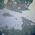
Ofbyld:Straits of Mackinac crx.jpg

Grutte fan dit proefbyld: 589 × 599 piksels. Oare resolúsjes: 236 × 240 piksels | 629 × 640 piksels.
Oarspronklik bestân (629 × 640 pixels, bestânsgrutte: 335 KB, MIME-type: image/jpeg)
Triemskiednis
Klik op in datum/tiid om it bestân te besjen sa't it op dat stuit wie.
| Datum/Tiid | Miniatuer | ôfmjittings | Meidogger | Opmerking | |
|---|---|---|---|---|---|
| lêste | 20 nov 2015, 13.26 |  | 629 × 640 (335 KB) | Louie Wannahocka | Cross-wiki upload from en.wikipedia.org |
Bestânsgebrûk
De neikommende side brûkt dit bestân:
Globaal bestânsgebrûk
De neikommende oare wiki's brûke dit bestân:
- Gebrûk op bg.wikipedia.org
- Gebrûk op en.wikipedia.org
- Gebrûk op eo.wikipedia.org
- Gebrûk op it.wikipedia.org
- Gebrûk op ml.wikipedia.org
- Gebrûk op ru.wikipedia.org
- Gebrûk op ta.wikipedia.org
- Gebrûk op www.wikidata.org
- Gebrûk op zh-yue.wikipedia.org
- Gebrûk op zh.wikipedia.org


