Ofbyld:USA Montana location map.svg

Size of this PNG preview of this SVG file: 800 × 595 piksels. Oare resolúsjes: 320 × 238 piksels | 640 × 476 piksels | 1.024 × 761 piksels | 1.280 × 952 piksels | 2.560 × 1.903 piksels | 1.201 × 893 piksels.
Oarspronklik bestân (SVG-bestân, nominaal 1.201 × 893 pixels, bestânsgrutte: 636 KB)
Gearfetting
| Beskriuwing |
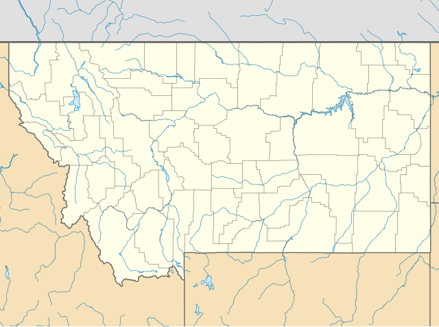
Quadratische Plattkarte, N-S-Streckung 150.0 %. Geographische Begrenzung der Karte:
Equirectangular projection, N/S stretching 150.0 %. Geographic limits of the map:
|
||
| Datum | |||
| Boarne | Eigen wurk | ||
| Auteur | Alexrk2 | ||
| Oare ferzjes |
Derivative works of this file:
|
||
| SVG genesis |
|


Lisinsje
I, the copyright holder of this work, hereby publish it under the following licenses:

|
Der wurdt tastimming jûn ta kopiearjen, fersprieden en/of wizigjen fan dit dokumint ûnder de betinksten fan de GNU-lisinsje foar iepen dokumintaasje, ferzje 1.2, as eltse lettere ferzje útjûn troch de Free Software Foundation; sûnder Ynfariante Seksjes, sûnder Omkaftteksten foar de Foarkante en sûnder Omkaftteksten foar de Efterkante. In kopy fan de lisinsje is opnaam yn de seksje "Text of the GNU Free Documentation License". |
This file is licensed under the Creative Commons Attribution 3.0 Unported license.
- Fiel jo frij:
- te dielen – it wurk te kopiearjen, fersprieden en út te stjoeren
- te fermingen – it wurk oan te passen
- Under de neikommende betingsten:
- Nammefermelding – You must give appropriate credit, provide a link to the license, and indicate if changes were made. You may do so in any reasonable manner, but not in any way that suggests the licensor endorses you or your use.
You may select the license of your choice.
Triemskiednis
Klik op in datum/tiid om it bestân te besjen sa't it op dat stuit wie.
| Datum/Tiid | Miniatuer | ôfmjittings | Meidogger | Opmerking | |
|---|---|---|---|---|---|
| lêste | 20 jan 2019, 22.33 | | 1.201 × 893 (636 KB) | Milenioscuro | Does not match with the color conventions |
| 19 jan 2019, 01.52 |  | 1.201 × 893 (657 KB) | Allice Hunter | Colours changed | |
| 2 jul 2009, 17.39 |  | 1.201 × 893 (636 KB) | Alexrk2 | == Beschreibung == {{Information |Description= {{de|Positionskarte von Montana, USA}} Quadratische Plattkarte, N-S-Streckung 150.0 %. Geographische Begrenzung der Karte: * N: 49.8° N * S: 43.6° N * W: 116.3° W * O: 103.8° W |
Bestânsgebrûk
De neikommende 6 siden brûke dit bestân:
Globaal bestânsgebrûk
De neikommende oare wiki's brûke dit bestân:
- Gebrûk op an.wikipedia.org
- Gebrûk op ar.wikipedia.org
- Gebrûk op azb.wikipedia.org
- پیونیر جانکشن، مونتانا
- لیک مری رونن، مونتانا
- لیتل براوینق، مونتانا
- سانتا ریتا، مونتانا
- هبقن لیک استیتس، مونتانا
- وست کوتنای، مونتانا
- شامات، مونتانا
- ویکسویل، مونتانا
- فاکس، مونتانا
- کت کریک، مونتانا
- بل کریک، مونتانا
- ملویل، مونتانا
- آسویقو، مونتانا
- کورینت، مونتانا
- کربی، مونتانا
- هانقری جو، مونتانا
- کارترویل، مونتانا
- مکلیود، مونتانا
- کینزی، مونتانا
- ساوت قلستونبری، مونتانا
- هینزدیل، مانتانا
- کاریوون، مونتانا
- لیتل بیترروت لیک، مونتانا
- هپیز این، مونتانا
- بلومفیلد، مونتانا
- براکوی، مونتانا
- سدان، مونتانا
- مکسویل، مونتانا
- ریدر کریک، مونتانا
- لوتر، مونتانا
- سوان لیک، مونتانا
- ساوت هیلز، مونتانا
- راپلیی، مونتانا
- کوروین اسپرینقز، مونتانا
- هلنا فلتس، مونتانا
- دکر، مونتانا
- راکی بوی وست، مونتانا
- د سیلوس، مونتانا
- پاندرزا پاینز، مونتانا
- پیلتزویل، مونتانا
- کمس، مونتانا
- آکتون، مونتانا
- سیلوانیت، مونتانا
- کوندون، مونتانا
- میرز، مونتانا
Mear globaal gebrûk fan dit bestân besjen.