Ofbyld:DEU Enger COA.svg

Size of this PNG preview of this SVG file: 500 × 600 piksels. Oare resolúsjes: 200 × 240 piksels | 400 × 480 piksels | 640 × 768 piksels | 854 × 1.024 piksels | 1.707 × 2.048 piksels | 536 × 643 piksels.
Oarspronklik bestân (SVG-bestân, nominaal 536 × 643 pixels, bestânsgrutte: 3 KB)
Gearfetting
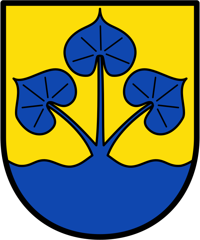
| coat of arms | English: the German Town of Enger. |
|||||||||||||||||||
| blazonry | Deutsch: „In Gold (Gelb) aus einem Wellenschildfuß wachsend, drei fächerförmig gestellte blaue gestielte Seerosenblätter." English: “...” |
|||||||||||||||||||
| References | Peter Veddeler: Wappen, Siegel, Flaggen; Münster 2003; S. 120 | |||||||||||||||||||
| Tinktuer (heraldyk) | orazure |
|||||||||||||||||||
| Datum |
Deutsch: verliehen am 14 april 1970 English: granted on 14 april 1970 |
|||||||||||||||||||
| Object history |
Deutsch: Das vom Regierungspräsidenten in Detmold am 14. April 1970 verliehene Wappen ist abgeleitet von einem aus dem 18. Jahrhundert überlieferten Siegel. Die Seeblätter beziehen sich auf das Wappen des ehemaligen Herzogtums Engern. |
|||||||||||||||||||
| Artist | Original: Ûnbekend Vector: first upload by TUBS |
|||||||||||||||||||
| Boarne | Wappengeschichte der Stadt Enger | |||||||||||||||||||
| Oare ferzjes |
|
|||||||||||||||||||
| SVG genesis | ||||||||||||||||||||

Lisinsje
This file depicts the coat of arms of a German Körperschaft des öffentlichen Rechts (corporation governed by public law). According to § 5 Abs. 1 of the German Copyright law, official works like coats of arms are in the public domain.
Note: The usage of coats of arms is governed by legal restrictions, independent of the copyright status of the depiction shown here.
|
 |
| Object location | | View this and other nearby images on: OpenStreetMap |
|---|
Triemskiednis
Klik op in datum/tiid om it bestân te besjen sa't it op dat stuit wie.
| Datum/Tiid | Miniatuer | ôfmjittings | Meidogger | Opmerking | |
|---|---|---|---|---|---|
| lêste | 2 jun 2021, 07.25 | | 536 × 643 (3 KB) | Jürgen Krause | redrawn refered to https://www.enger.de/Leben-in-Enger/Stadtportrait/Wappengeschichte |
| 19 feb 2010, 14.27 |  | 598 × 646 (34 KB) | Hagar66 | {{Information |Description= |Source= |Date= |Author= |Permission= |other_versions= }} | |
| 20 sep 2008, 14.40 |  | 598 × 646 (6 KB) | TUBS | Coat of arms of the Town de:Enger Source: http://www.ngw.nl/int/dld/e/enger.htm <br /> Converted into SVG format, modified and transparency added by TUBS based upon 40px {{PD-Coa-Germany}} [[Category:Co |
Bestânsgebrûk
De neikommende side brûkt dit bestân:
Globaal bestânsgebrûk
De neikommende oare wiki's brûke dit bestân:
- Gebrûk op ar.wikipedia.org
- Gebrûk op be.wikipedia.org
- Gebrûk op ca.wikipedia.org
- Gebrûk op ce.wikipedia.org
- Gebrûk op de.wikipedia.org
- Enger
- Benutzer:1-1111
- Besenkamp
- Benutzer:Marc-André Aßbrock
- Westerenger
- Dreyen
- Benutzer:Vorlage/aus Enger
- Belke-Steinbeck
- Oldinghausen
- Pödinghausen
- Liste der Wappen im Kreis Herford
- Benutzer:Vorlage/Herkunftsvorlagen/Nordrhein-Westfalen
- Vorlage:Navigationsleiste Stadtteile von Enger
- Enger (Stadtteil)
- Siele (Enger)
- Benutzer:Vorlage/2aus Enger
- Benutzer:Vorlage/3aus Enger
- Herringhausen (Enger)
- Kategorie:Benutzer:aus Enger
- Benutzer:Pulsaris
- Benutzer:Pulsaris/Vorlage:Babel
- Liste der Bodendenkmäler in Enger
- Gebrûk op en.wikipedia.org
- Gebrûk op eo.wikipedia.org
- Gebrûk op es.wikipedia.org
- Gebrûk op eu.wikipedia.org
- Gebrûk op fr.wikipedia.org
- Gebrûk op hu.wikipedia.org
- Gebrûk op it.wikipedia.org
- Gebrûk op ja.wikipedia.org
- Gebrûk op kk.wikipedia.org
- Gebrûk op ku.wikipedia.org
- Gebrûk op lld.wikipedia.org
- Gebrûk op lv.wikipedia.org
- Gebrûk op ms.wikipedia.org
- Gebrûk op nds.wikipedia.org
- Gebrûk op nl.wikipedia.org
- Gebrûk op nn.wikipedia.org
- Gebrûk op pl.wikipedia.org
- Gebrûk op pt.wikipedia.org
- Gebrûk op ro.wikipedia.org
- Gebrûk op ru.wikipedia.org
- Gebrûk op sh.wikipedia.org
- Gebrûk op sr.wikipedia.org
Mear globaal gebrûk fan dit bestân besjen.