Ofbyld:Wisconsin geographic provinces.svg

Size of this PNG preview of this SVG file: 585 × 600 piksels. Oare resolúsjes: 234 × 240 piksels | 468 × 480 piksels | 749 × 768 piksels | 998 × 1.024 piksels | 1.997 × 2.048 piksels | 1.015 × 1.041 piksels.
Oarspronklik bestân (SVG-bestân, nominaal 1.015 × 1.041 pixels, bestânsgrutte: 213 KB)
Gearfetting
| Beskriuwing |
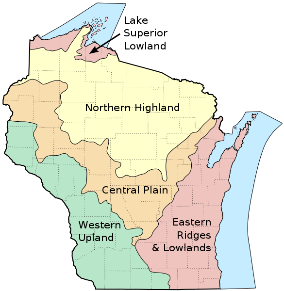
English: Map of the geographic regions of Wisconsin. |
| Datum | |
| Boarne |
Own work based on the following sources:
|
| Auteur | User:Jua Cha |
| Oare ferzjes | Derivative works of this file: Wisconsin geographic provinces ru.svg |
Lisinsje
| I, the copyright holder of this work, release this work into the public domain. This applies worldwide. In some countries this may not be legally possible; if so: I grant anyone the right to use this work for any purpose, without any conditions, unless such conditions are required by law. |
Triemskiednis
Klik op in datum/tiid om it bestân te besjen sa't it op dat stuit wie.
| Datum/Tiid | Miniatuer | ôfmjittings | Meidogger | Opmerking | |
|---|---|---|---|---|---|
| lêste | 16 mrt 2010, 16.24 | | 1.015 × 1.041 (213 KB) | Jua Cha | increased border width |
| 16 mrt 2010, 06.33 |  | 1.015 × 1.041 (213 KB) | Jua Cha | {{Information |Description={{en|1=Map of the geographic regions of Wisconsin.}} |Source=Own work based on the following sources: *Base map for state and county boundaries: File:Map of Wisconsin highlighting Adams County.svg by [[User:Dbenbenn|Da |
Bestânsgebrûk
De neikommende side brûkt dit bestân:
Globaal bestânsgebrûk
De neikommende oare wiki's brûke dit bestân:
- Gebrûk op ar.wikipedia.org
- Gebrûk op arz.wikipedia.org
- Gebrûk op de.wikipedia.org
- Gebrûk op en.wikipedia.org
- Gebrûk op et.wikipedia.org
- Gebrûk op eu.wikipedia.org
- Gebrûk op fr.wikipedia.org
- Gebrûk op hu.wikipedia.org
- Gebrûk op ja.wikipedia.org
- Gebrûk op ro.wikipedia.org
- Gebrûk op te.wikipedia.org