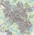
Ofbyld:Zwolle-topografie.jpg

Grutte fan dit proefbyld: 526 × 600 piksels. Oare resolúsjes: 210 × 240 piksels | 421 × 480 piksels | 673 × 768 piksels | 898 × 1.024 piksels | 1.938 × 2.210 piksels.
Oarspronklik bestân (1.938 × 2.210 pixels, bestânsgrutte: 3,15 MB, MIME-type: image/jpeg)
Triemskiednis
Klik op in datum/tiid om it bestân te besjen sa't it op dat stuit wie.
| Datum/Tiid | Miniatuer | ôfmjittings | Meidogger | Opmerking | |
|---|---|---|---|---|---|
| lêste | 13 jan 2013, 12.24 |  | 1.938 × 2.210 (3,15 MB) | Janwillemvanaalst | Added various topographic improvements, which were already available in the BRT open-geodata source files: - Symbols for special physical appearances of land types such as "swampy terrain" - Symbol for carpool parking + large open parking spaces (in ad... |
| 5 jan 2013, 18.45 |  | 1.938 × 2.210 (3,02 MB) | Janwillemvanaalst | Various rendering improvements, following the advice of several topographic experts. Scale remains unchanged. | |
| 30 des 2012, 16.58 |  | 1.938 × 2.210 (2,94 MB) | Janwillemvanaalst | Map redrawn using updated (Dec. 2012) open geodata Dutch government base registries BRT + BAG. Rendered using QuantumGIS and Photoshop. | |
| 18 mrt 2012, 16.20 |  | 3.582 × 3.610 (4,89 MB) | Janwillemvanaalst | Building polygons now taken from Open Geodata BAG registry (Jan. 2012); increased image resolution. | |
| 11 feb 2012, 18.10 |  | 2.425 × 2.485 (3,33 MB) | Janwillemvanaalst | Added car parking features, plus slightly improved zoom level | |
| 9 feb 2012, 18.46 |  | 2.185 × 2.239 (2,82 MB) | Janwillemvanaalst |
Bestânsgebrûk
De neikommende side brûkt dit bestân: