Ofbyld:Alps location map.png

Grutte fan dit proefbyld: 800 × 552 piksels. Oare resolúsjes: 320 × 221 piksels | 640 × 442 piksels | 1.024 × 707 piksels | 1.280 × 884 piksels | 2.000 × 1.381 piksels.
Oarspronklik bestân (2.000 × 1.381 pixels, bestânsgrutte: 4,73 MB, MIME-type: image/png)
.png)
.png)
.png)
.png)
.png)
.png)
.png)
.png)
.png)
.png)
.png)
.png)
.png)
.png)
.png)
.png)
.png)
.png)
.png)
.png)
.png)
.png)
.png)
.png)
.png)
.png)
.png)
.png)
.png)
.png)
.png)
.png)
.png)
.png)
.png)
.png)
.png)
.png)
.png)
.png)
.png)

|
This map has been made or improved in the German Kartenwerkstatt (Map Lab). You can propose maps to improve as well.
|
Lisinsje
The map has been created with the Generic Mapping Tools: https://www.generic-mapping-tools.org/ using one or more of these public-domain datasets for the relief:
|

|
Der wurdt tastimming jûn ta kopiearjen, fersprieden en/of wizigjen fan dit dokumint ûnder de betinksten fan de GNU-lisinsje foar iepen dokumintaasje, ferzje 1.2, as eltse lettere ferzje útjûn troch de Free Software Foundation; sûnder Ynfariante Seksjes, sûnder Omkaftteksten foar de Foarkante en sûnder Omkaftteksten foar de Efterkante. In kopy fan de lisinsje is opnaam yn de seksje "Text of the GNU Free Documentation License". |
| This file is licensed under the Creative Commons Attribution-Share Alike 3.0 Unported license. | ||
| ||
| This licensing tag was added to this file as part of the GFDL licensing update. |
Triemskiednis
Klik op in datum/tiid om it bestân te besjen sa't it op dat stuit wie.
| Datum/Tiid | Miniatuer | ôfmjittings | Meidogger | Opmerking | |
|---|---|---|---|---|---|
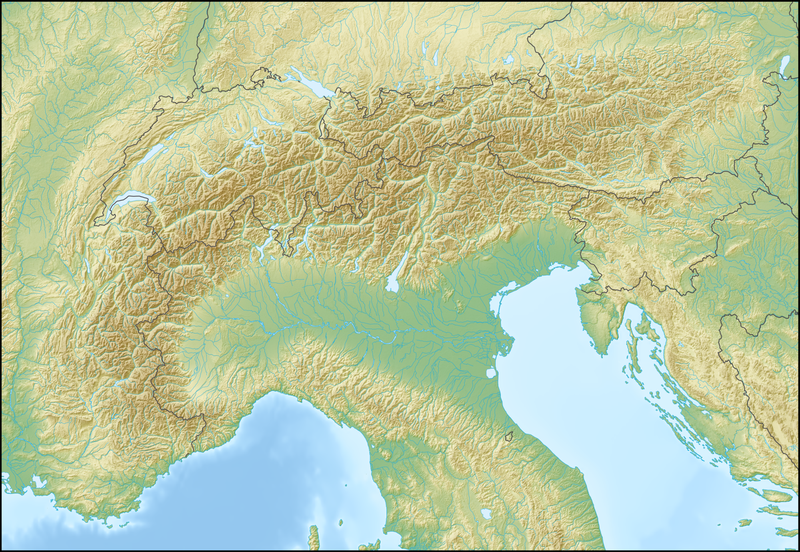
| lêste | 20 feb 2009, 14.58 | | 2.000 × 1.381 (4,73 MB) | Lencer | {{Information |Description= {{de|Positionskarte der Alpen}} Quadratische Plattkarte. Geographische Begrenzung der Karte: * N: 48.5 ° N * S: 42.75 ° N * W: 4.5 ° O * O: 17 ° O {{en|Location map of the Alps}} Equirecta |
Bestânsgebrûk
Der binne gjin siden dy't dit bestân brûke.
Globaal bestânsgebrûk
De neikommende oare wiki's brûke dit bestân:
- Gebrûk op als.wikipedia.org
- Gebrûk op an.wikipedia.org
- Gebrûk op ar.wikipedia.org
- Gebrûk op as.wikipedia.org
- Gebrûk op az.wikipedia.org
- Gebrûk op ba.wikipedia.org
- Gebrûk op be.wikipedia.org
- Манблан
- Матэргорн
- Шаблон:На карце/Альпы
- Цугшпіцэ
- Грайскія Альпы
- Штахлеркопф
- Заходнія Альпы
- Лігурыйскія Альпы
- Бернскія Альпы
- Праванскія Альпы
- Алечгорн
- Мёнх
- Коцкія Альпы
- Альпы Дафінэ
- Лепанцінскія Альпы
- Высокі Таўэрн
- Гларнскія Альпы
- Юлійскія Альпы
- Юра (горы)
- Граўшпіц
- Рэтыйскія Альпы
- Паўднёвыя Вапняковыя Альпы
- Цэнтральныя Усходнія Альпы
- Лага-Маджорэ
- Адамела
- Берніна (горны масіў)
- Пунта-Перукеці
- Руая (рака)
- Gebrûk op bg.wikipedia.org
Mear globaal gebrûk fan dit bestân besjen.