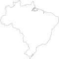
Ofbyld:Contorno do mapa do Brasil.svg

Oarspronklik bestân(SVG-bestân, nominaal 345 × 345 pixels, bestânsgrutte: 8 KB)

Dit bestân komt fan Wikimedia Commons, en kin ek troch oare projekten brûkt wurde. De beskriuwing op syn bestânsside dêre wurdt hjirûnder werjûn.

Gearfetting

Português: Contorno do mapa do Brasil com detalhamento de nível médio e suavizado, não oficial e não exato porque foi desenhado por mim a olho nu. Inicialmente foi especialmente desenhado para a bandeira do Estado de São Paulo (ver Image:Bandeira do estado de São Paulo.svg).
A map drawn (maybe with CorelDRAW!® or Inkscape) by FML.
FML
CC-By-SA
(See here my formal authorization)
I, the copyright holder of this work, hereby publish it under the following license:
w:fy:Creative Commons
Nammefermelding Lyk diele
This file is licensed under the Creative Commons Attribution-Share Alike 2.5 Generic license.
Fiel jo frij:
  • te dielen – it wurk te kopiearjen, fersprieden en út te stjoeren
  • te fermingen – it wurk oan te passen
Under de neikommende betingsten:
  • Nammefermelding – You must give appropriate credit, provide a link to the license, and indicate if changes were made. You may do so in any reasonable manner, but not in any way that suggests the licensor endorses you or your use.
  • Lyk diele – If you remix, transform, or build upon the material, you must distribute your contributions under the same or compatible license as the original.

pt:Brasil

Captions

Add a one-line explanation of what this file represents
this is an image of the map of brazil in white

Items portrayed in this file

depicts Ingelsk

copyrighted Ingelsk

media type Ingelsk

image/svg+xml

checksum Ingelsk

e458887ff0bd660a9283bddc621df0e8688c78b8

determination method Ingelsk: SHA-1 Ingelsk

data size Ingelsk

7.801 byte

height Ingelsk

345 pixel

width Ingelsk

345 pixel

Triemskiednis

Klik op in datum/tiid om it bestân te besjen sa't it op dat stuit wie.

Datum/TiidMiniatuerôfmjittingsMeidoggerOpmerking
lêste18 sep 2011, 20.30Miniatuer foar de ferzje fan 18 sep 2011 om 20.30345 × 345 (8 KB)Giro720Map concentric to an (imaginary) circle with r=755 centered at the origin.
10 aug 2011, 09.56Miniatuer foar de ferzje fan 10 aug 2011 om 09.56347 × 345 (8 KB)OAlexander~commonswikiBetter optimisation, eliminated minor error on right edge. (Upped wrong version previously)
10 aug 2011, 09.52Miniatuer foar de ferzje fan 10 aug 2011 om 09.52512 × 510 (20 KB)OAlexander~commonswikiBetter optimisation, eliminated minor error on right edge.
10 aug 2011, 09.48Miniatuer foar de ferzje fan 10 aug 2011 om 09.48512 × 510 (20 KB)OAlexander~commonswikiRepair (did not display in Firefox and Safari) and optimization.
20 feb 2006, 13.26Miniatuer foar de ferzje fan 20 feb 2006 om 13.26526 × 524 (82 KB)FML
30 jan 2006, 03.41Miniatuer foar de ferzje fan 30 jan 2006 om 03.41526 × 524 (82 KB)FML
30 jan 2006, 03.33Miniatuer foar de ferzje fan 30 jan 2006 om 03.33526 × 524 (143 KB)FML{{pt|Contorno do mapa do Brasil com detalhamento de nível médio e suavizado, '''não oficial''' e '''não exato''' porque foi desenhado por mim a olho nu. Inicialmente foi especialmente desenhado para a bandeira do Estado de São Paulo (ver [

Der binne gjin siden dy't dit bestân brûke.

Globaal bestânsgebrûk

De neikommende oare wiki's brûke dit bestân:

Metadata