Ofbyld:Detailed map of Ellsworth, Kansas.png
Gjin hegere resolúsje beskikber.
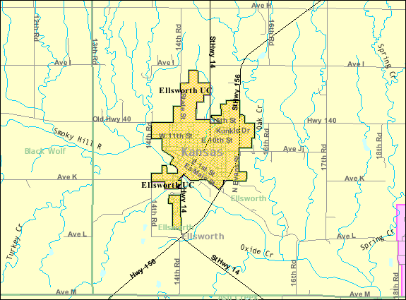
Detailed_map_of_Ellsworth,_Kansas.png (575 × 425 pixels, bestânsgrutte: 31 KB, MIME-type: image/png)
| Beskriuwing |
English: Detailed map of Ellsworth, Kansas |
|||
| Datum | Datum ûnbekend; downloaded 21 October 2010 | |||
| Boarne | http://factfinder.census.gov/servlet/MapItDrawServlet?geo_id=16000US2020500&_bucket_id=50&tree_id=420&context=saff&_lang=en&_sse=on, from http://factfinder.census.gov | |||
| Auteur | United States Census Bureau | |||
| Tastimming (Reusing this file) |
|

Original upload log
| Datum/Tiid | Ofmjittings | Meidogger | Opmerking |
|---|---|---|---|
| 21 oktober 2010, 06:21:11 | 575 × 425 (32830 bytes) | Sbmeirow (oerlis · bydragen) | {{Information |Description={{en|1=Detailed map of {{w|Ellsworth, Kansas}}}} |Source=http://factfinder.census.gov/servlet/MapItDrawServlet?geo_id=16000US2020500&_bucket_id=50&tree_id=420&context=saff&_lang=en&_sse=on, from http://factfinder.census.gov |Aut |
Triemskiednis
Klik op in datum/tiid om it bestân te besjen sa't it op dat stuit wie.
| Datum/Tiid | Miniatuer | ôfmjittings | Meidogger | Opmerking | |
|---|---|---|---|---|---|
| lêste | 11 des 2014, 06.24 | | 575 × 425 (31 KB) | GifTagger | Bot: Converting file to superior PNG file. (Source: Detailed_map_of_Ellsworth,_Kansas.gif). This GIF was problematic due to non-greyscale color table. |
Bestânsgebrûk
Der binne gjin siden dy't dit bestân brûke.
Globaal bestânsgebrûk
De neikommende oare wiki's brûke dit bestân:
- Gebrûk op en.wikipedia.org
- Gebrûk op fa.wikipedia.org
- Gebrûk op sh.wikipedia.org