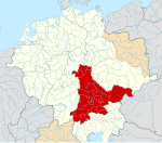
Ofbyld:Duchy of Swabia locator map (1004).svg

Size of this PNG preview of this SVG file: 686 × 600 piksels. Oare resolúsjes: 275 × 240 piksels | 549 × 480 piksels | 878 × 768 piksels | 1.171 × 1.024 piksels | 2.342 × 2.048 piksels | 4.431 × 3.875 piksels.
Oarspronklik bestân (SVG-bestân, nominaal 4.431 × 3.875 pixels, bestânsgrutte: 4,7 MB)
Triemskiednis
Klik op in datum/tiid om it bestân te besjen sa't it op dat stuit wie.
| Datum/Tiid | Miniatuer | ôfmjittings | Meidogger | Opmerking | |
|---|---|---|---|---|---|
| lêste | 11 des 2016, 19.31 |  | 4.431 × 3.875 (4,7 MB) | Alphathon | Accidentally included part of Franconia |
| 11 des 2016, 19.23 |  | 4.431 × 3.875 (4,7 MB) | Alphathon | == {{int:filedesc}} == {{Inkscape}} {{Information |Description={{en|A map of the en:Duchy of Swabia/Alemannia (German: ''Herzogtum Schwaben'') around 1004 CE. The map is derived from a vectorised version of one found in Professor G. Droys... |
Bestânsgebrûk
De neikommende side brûkt dit bestân:
Globaal bestânsgebrûk
De neikommende oare wiki's brûke dit bestân:
- Gebrûk op cs.wikipedia.org
- Gebrûk op en.wikipedia.org
- Gebrûk op es.wikipedia.org
- Gebrûk op fi.wikipedia.org
- Gebrûk op fr.wikipedia.org
- Gebrûk op he.wikipedia.org
- Gebrûk op id.wikipedia.org
- Gebrûk op it.wikipedia.org
- Gebrûk op ja.wikipedia.org
- Gebrûk op ko.wikipedia.org
- Gebrûk op pt.wikipedia.org
- Gebrûk op ro.wikipedia.org
- Gebrûk op ru.wikipedia.org
- Gebrûk op simple.wikipedia.org
- Gebrûk op sl.wikipedia.org
- Gebrûk op tr.wikipedia.org
- Gebrûk op uk.wikipedia.org
- Gebrûk op vi.wikipedia.org


