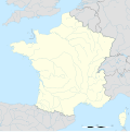
Ofbyld:France blank.svg

Size of this PNG preview of this SVG file: 599 × 599 piksels. Oare resolúsjes: 240 × 240 piksels | 480 × 480 piksels | 768 × 768 piksels | 1.023 × 1.024 piksels | 2.047 × 2.048 piksels | 1.796 × 1.797 piksels.
Oarspronklik bestân (SVG-bestân, nominaal 1.796 × 1.797 pixels, bestânsgrutte: 240 KB)
Triemskiednis
Klik op in datum/tiid om it bestân te besjen sa't it op dat stuit wie.
| Datum/Tiid | Miniatuer | ôfmjittings | Meidogger | Opmerking | |
|---|---|---|---|---|---|
| lêste | 19 okt 2017, 15.37 |  | 1.796 × 1.797 (240 KB) | Sting | No borders over the Lake of Constance |
| 2 okt 2012, 13.38 |  | 1.796 × 1.797 (232 KB) | Palosirkka | Scrubbed with http://codedread.com/scour/ | |
| 7 nov 2008, 15.50 |  | 1.796 × 1.797 (559 KB) | Sting | + boundary for the Channel Islands ; - canals | |
| 25 sep 2008, 04.46 |  | 1.796 × 1.797 (564 KB) | Sting | Completely new version using NGDC WDBII data and with known projection | |
| 21 sep 2006, 18.34 |  | 1.796 × 1.796 (973 KB) | Sting | Colours | |
| 20 sep 2006, 02.34 |  | 1.796 × 1.796 (974 KB) | Sting | {{Information |Description=SVG map of France |Source=Own work |Date=September 2006 |Author=Eric Gaba (Sting) |Permission=CC-BY-SA-2.5 |other_versions= }} ---- {{fr}} * '''Sujet :''' Carte vectorielle de la France ; * '''Auteur :''' Eric |
Bestânsgebrûk
Der binne gjin siden dy't dit bestân brûke.
Globaal bestânsgebrûk
De neikommende oare wiki's brûke dit bestân:
- Gebrûk op ar.wikipedia.org
- Gebrûk op en.wikipedia.org
- Gebrûk op fr.wikipedia.org
- Utilisateur:Yug/Archive2016
- Discussion modèle:Fragéoloc
- Discussion Portail:France/2005-2007
- Wikipédia:Atelier graphique/Images à améliorer/Archives/Septembre 2007
- Utilisateur:Wikisoft*/Cartes
- Utilisateur:Wikisoft*/Tests cartes 1
- Utilisateur:Wikisoft*/Modèle:Infobox Montagnes de France
- Discussion utilisateur:Wikisoft*/Modèle:Infobox Montagnes de France
- Wikipédia:Atelier graphique/Cartes/Archives/octobre 2008
- Utilisateur:Géobox/5
- Wikipédia:Atelier graphique/Cartes/Archives/juillet 2009
- Discussion utilisateur:Sting/Archive 08
- Wikipédia:Atelier graphique/Cartes/Archives/janvier 2010
- Utilisateur:Géobox/Géolocalisation/France
- Utilisateur:Wikisoft*/France
- Wikipédia:Atelier graphique/Cartes/Archives/Demandes mises en sommeil/France
- Utilisateur:Wikisoft*/Modèle:Géobox Montagnes
- Wikipédia:Opération Libre
- Gebrûk op gan.wikipedia.org
- Gebrûk op it.wikibooks.org
- Gebrûk op lb.wikipedia.org

