Ofbyld:Hawaii Island topographic map-en.svg

Size of this PNG preview of this SVG file: 728 × 600 piksels. Oare resolúsjes: 291 × 240 piksels | 583 × 480 piksels | 932 × 768 piksels | 1.243 × 1.024 piksels | 2.485 × 2.048 piksels | 3.110 × 2.563 piksels.
Oarspronklik bestân (SVG-bestân, nominaal 3.110 × 2.563 pixels, bestânsgrutte: 2,12 MB)
Gearfetting
| Beskriuwing |
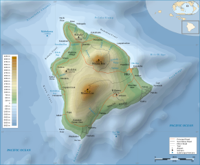
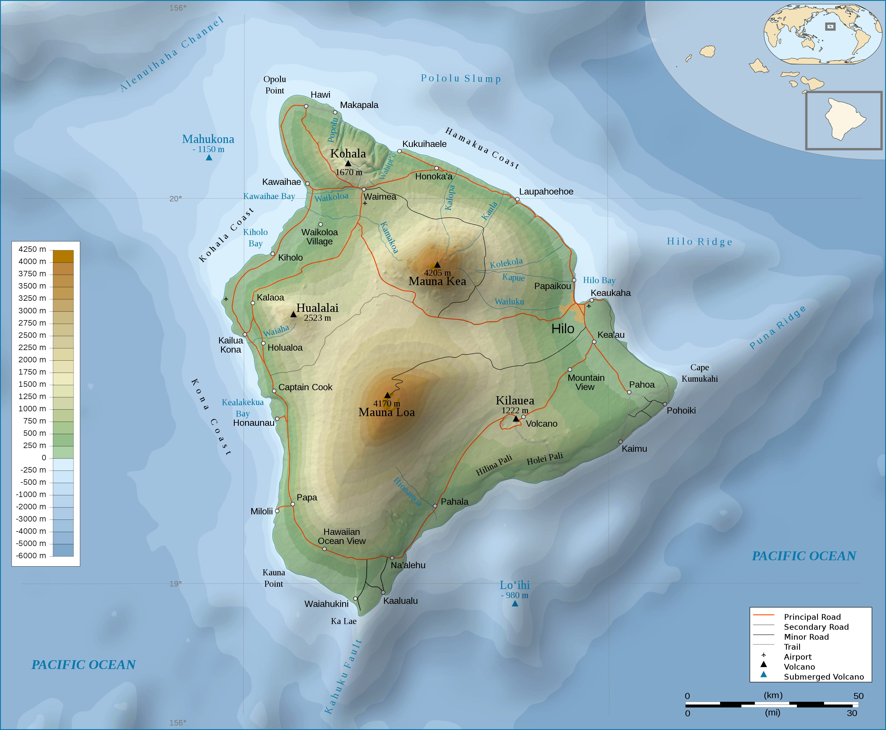
English: Topographic Map in english of the island of Hawaii. |
| Datum | (UTC) |
| Boarne | |
| Auteur |
|
| Oare ferzjes |
[]
|


Lisinsje
This file is licensed under the Creative Commons Attribution-Share Alike 3.0 Unported license.
- Fiel jo frij:
- te dielen – it wurk te kopiearjen, fersprieden en út te stjoeren
- te fermingen – it wurk oan te passen
- Under de neikommende betingsten:
- Nammefermelding – You must give appropriate credit, provide a link to the license, and indicate if changes were made. You may do so in any reasonable manner, but not in any way that suggests the licensor endorses you or your use.
- Lyk diele – If you remix, transform, or build upon the material, you must distribute your contributions under the same or compatible license as the original.
Original upload log
This image is a derivative work of the following images:
- File:Hawaii_Island_topographic_map-fr.svg licensed with Cc-by-sa-3.0,2.5,2.0,1.0, GFDL
- 2009-02-16T12:24:40Z Sémhur 3110x2563 (2213946 Bytes) Valid SVG
- 2008-05-07T17:31:00Z Sémhur 3110x2563 (2292418 Bytes) Route coupée trop courte, je rallonge.
- 2008-05-02T17:57:22Z Sémhur 3110x2563 (2290853 Bytes) Suppression d'une partie d'une route détruite par une coulée de lave
- 2008-05-01T10:37:28Z Sémhur 3110x2563 (2290359 Bytes) New version, with vectorized shaded relief
- 2008-04-29T18:35:04Z Sting 3110x2563 (1041004 Bytes) Slight correction
- 2008-04-29T18:11:00Z Sting 3110x2563 (1041493 Bytes) Added legend
- 2008-04-22T16:01:56Z Sémhur 3110x2563 (1036030 Bytes) Espacement de lettres (oubli)
- 2008-04-19T08:45:11Z Sémhur 3110x2563 (1034767 Bytes) Correction de l'altitude du Mauna Loa et espacement de lettres
- 2008-04-17T19:04:48Z Sémhur 3110x2563 (1019305 Bytes) Correction d'un problème avec le relief
- 2008-04-17T18:47:58Z Sémhur 3110x2563 (1019765 Bytes) == Description == {{Information |Description= {{en| Topographic Map in french of the island of [[:en:Hawaii (Island)|Hawaii]].}} {{fr| Carte topographique de l'île de [[:fr:Hawaii|Hawaii]].}} |Source=Travail personnel. {{clr
Uploaded with derivativeFX
Triemskiednis
Klik op in datum/tiid om it bestân te besjen sa't it op dat stuit wie.
| Datum/Tiid | Miniatuer | ôfmjittings | Meidogger | Opmerking | |
|---|---|---|---|---|---|
| lêste | 4 mrt 2009, 00.56 | | 3.110 × 2.563 (2,12 MB) | Kmusser | attempted legend fix |
| 4 mrt 2009, 00.54 |  | 3.110 × 2.563 (2,12 MB) | Kmusser | attempted legend fix | |
| 4 mrt 2009, 00.49 |  | 3.110 × 2.563 (2,12 MB) | Kmusser | legend fix | |
| 4 mrt 2009, 00.06 |  | 3.110 × 2.563 (2,12 MB) | Kmusser | {{Information |Description={{Topographic Map in english of the island of Hawaii.}} |Source=*File:Hawaii_Island_topographic_map-fr.svg |Date=2009-03-03 22:04 (UTC) |Author=*File:Hawaii_Island_topographic_map-fr.svg: [[Us |
Bestânsgebrûk
De neikommende side brûkt dit bestân:
Globaal bestânsgebrûk
De neikommende oare wiki's brûke dit bestân:
- Gebrûk op af.wikipedia.org
- Gebrûk op cy.wikipedia.org
- Gebrûk op de.wikipedia.org
- Gebrûk op el.wikipedia.org
- Gebrûk op en.wikipedia.org
- Gebrûk op eo.wikipedia.org
- Gebrûk op fa.wikipedia.org
- Gebrûk op fr.wikipedia.org
- Gebrûk op hr.wikipedia.org
- Gebrûk op ja.wikipedia.org
- Gebrûk op ka.wikipedia.org
- Gebrûk op nl.wikipedia.org
- Gebrûk op pl.wikipedia.org
- Gebrûk op tr.wikipedia.org
- Gebrûk op zh.wikipedia.org