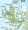
Ofbyld:Isle of Skye UK relief location map labels.jpg

Grutte fan dit proefbyld: 562 × 599 piksels. Oare resolúsjes: 225 × 240 piksels | 450 × 480 piksels | 720 × 768 piksels | 960 × 1.024 piksels | 2.004 × 2.137 piksels.
Oarspronklik bestân (2.004 × 2.137 pixels, bestânsgrutte: 867 KB, MIME-type: image/jpeg)
Triemskiednis
Klik op in datum/tiid om it bestân te besjen sa't it op dat stuit wie.
| Datum/Tiid | Miniatuer | ôfmjittings | Meidogger | Opmerking | |
|---|---|---|---|---|---|
| lêste | 13 jan 2013, 21.58 |  | 2.004 × 2.137 (867 KB) | Ruhrfisch | Remove word "MAP", all other info is the same |
| 13 jan 2013, 05.21 |  | 2.004 × 2.137 (885 KB) | Ruhrfisch | {{Information |Description=Relief map of the Isle of Skye, UK. Equirectangular map projection on WGS 84 datum, with N/S stretched 180% Geographic limits: *West: 6.85W *East: 5.5W *North: 57.8N *South: 57.0N |Source=[[w:Ordnance Sur... |
Bestânsgebrûk
De neikommende side brûkt dit bestân:
Globaal bestânsgebrûk
De neikommende oare wiki's brûke dit bestân:
- Gebrûk op ar.wikipedia.org
- Gebrûk op arz.wikipedia.org
- Gebrûk op ast.wikipedia.org
- Gebrûk op bg.wikipedia.org
- Gebrûk op br.wikipedia.org
- Gebrûk op ca.wikipedia.org
- Gebrûk op ceb.wikipedia.org
- Gebrûk op da.wikipedia.org
- Gebrûk op de.wikipedia.org
- Gebrûk op el.wikipedia.org
- Gebrûk op en.wikipedia.org
- Gebrûk op eo.wikipedia.org
- Gebrûk op es.wikipedia.org
- Gebrûk op eu.wikipedia.org
- Gebrûk op fi.wikipedia.org
- Gebrûk op fr.wikipedia.org
Mear globaal gebrûk fan dit bestân besjen.


