Ofbyld:Jackson Glacier terminus.jpg
Grutte fan dit proefbyld: 800 × 540 piksels. Oare resolúsjes: 320 × 216 piksels | 640 × 432 piksels | 900 × 608 piksels.
Oarspronklik bestân (900 × 608 pixels, bestânsgrutte: 131 KB, MIME-type: image/jpeg)
Gearfetting
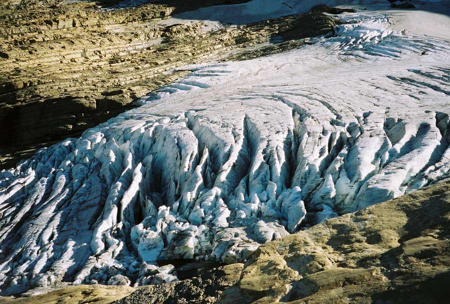
| Beskriuwing | Image of the terminal end of Jackson Glacier in Glacier National Park (U.S.) |
| Boarne | United States Geological Survey...from the following link [1], enlarged at [2] |
| Auteur | USGS |
![[2]](https://www.nrmsc.usgs.gov/images/gcc/Jackson_terminus.jpg)
| Camera location | | View this and other nearby images on: OpenStreetMap |
|---|
Lisinsje
This image is in the public domain in the United States because it only contains materials that originally came from the United States Geological Survey, an agency of the United States Department of the Interior. For more information, see the official USGS copyright policy.
|
Triemskiednis
Klik op in datum/tiid om it bestân te besjen sa't it op dat stuit wie.
| Datum/Tiid | Miniatuer | ôfmjittings | Meidogger | Opmerking | |
|---|---|---|---|---|---|
| lêste | 20 jan 2008, 02.16 | | 900 × 608 (131 KB) | MONGO | {{Information |Description=Image of the terminal end of Jackson Glacier in Glacier National Park (U.S.) |Source=United States Geological Survey...from the following link [http://www.nrmsc.usgs.g |
Bestânsgebrûk
De neikommende side brûkt dit bestân:
Globaal bestânsgebrûk
De neikommende oare wiki's brûke dit bestân:
- Gebrûk op as.wikipedia.org
- Gebrûk op ceb.wikipedia.org
- Gebrûk op cy.wikipedia.org
- Gebrûk op el.wikipedia.org
- Gebrûk op en.wikipedia.org
- Gebrûk op en.wikiversity.org
- Gebrûk op eo.wikipedia.org
- Gebrûk op fa.wikipedia.org
- Gebrûk op fr.wikipedia.org
- Gebrûk op hr.wikipedia.org
- Gebrûk op hy.wikipedia.org
- Gebrûk op ku.wikipedia.org
- Gebrûk op nl.wikipedia.org
- Gebrûk op sr.wikipedia.org
- Gebrûk op ur.wikipedia.org
- Gebrûk op www.wikidata.org