Ofbyld:Oudorp 1866.png
Grutte fan dit proefbyld: 701 × 600 piksels. Oare resolúsjes: 281 × 240 piksels | 561 × 480 piksels | 898 × 768 piksels | 1.197 × 1.024 piksels | 1.600 × 1.369 piksels.
Oarspronklik bestân (1.600 × 1.369 pixels, bestânsgrutte: 151 KB, MIME-type: image/png)
Gearfetting
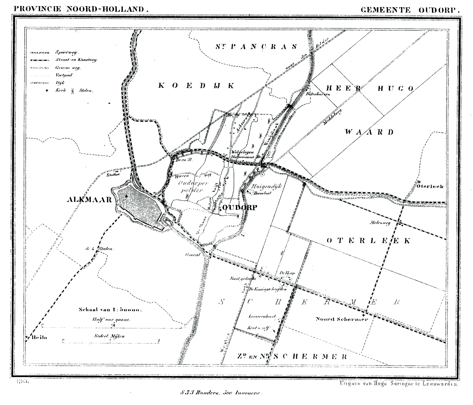
| Beskriuwing | Historic map of Oudorp (now part of municipality Alkmaar), North Holland, the Netherlands |
| Datum | 1865 - 1870 |
| Boarne | Gemeente Atlas van Nederland (Municipal Atlas of the Netherlands) |
| Auteur | J. Kuyper |
Lisinsje
|
This work is in the public domain in its country of origin and other countries and areas where the copyright term is the author's life plus 70 years or fewer. | |
| This file has been identified as being free of known restrictions under copyright law, including all related and neighboring rights. | |
Triemskiednis
Klik op in datum/tiid om it bestân te besjen sa't it op dat stuit wie.
| Datum/Tiid | Miniatuer | ôfmjittings | Meidogger | Opmerking | |
|---|---|---|---|---|---|
| lêste | 29 jan 2008, 21.53 | | 1.600 × 1.369 (151 KB) | P199 | {{Information |Description=Historic map of Oudorp (now part of municipality Alkmaar), North Holland, the Netherlands |Source=Gemeente Atlas van Nederland (Municipal Atlas of the Netherlands) |Date=1865-1870 |Author=J. Kuyper |Permission= |other_versions= |
Bestânsgebrûk
De neikommende side brûkt dit bestân: