Ofbyld:Saint Helena Airport location.svg

Size of this PNG preview of this SVG file: 740 × 600 piksels. Oare resolúsjes: 296 × 240 piksels | 592 × 480 piksels | 948 × 768 piksels | 1.264 × 1.024 piksels | 2.527 × 2.048 piksels | 802 × 650 piksels.
Oarspronklik bestân (SVG-bestân, nominaal 802 × 650 pixels, bestânsgrutte: 617 KB)
Gearfetting
| Beskriuwing |
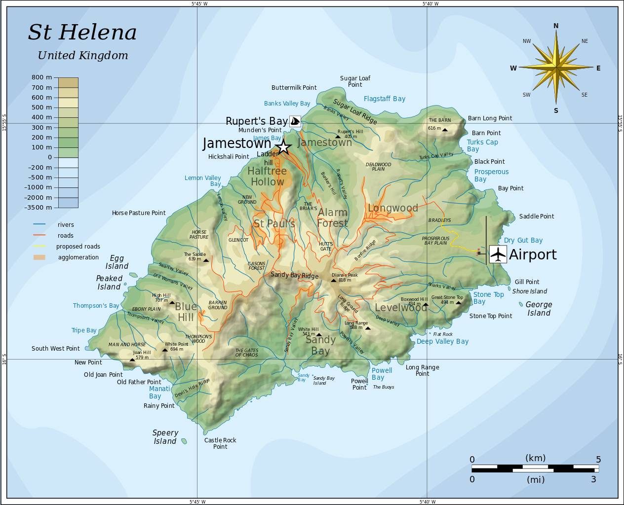
English: Topographic map of the British island of Saint Helena showing Airport. |
| Datum | |
| Boarne |
Modified Mysid's topographic map (Topographic map of Saint Helena-en.svg) in Inkscape. Based on several sources:
|
| Auteur | cvdr |
| Oare ferzjes |
Derivative works of this file: |
| SVG genesis |
Lisinsje
I, the copyright holder of this work, hereby publish it under the following licenses:
This file is licensed under the Creative Commons Attribution-Share Alike 3.0 Unported license.
- Fiel jo frij:
- te dielen – it wurk te kopiearjen, fersprieden en út te stjoeren
- te fermingen – it wurk oan te passen
- Under de neikommende betingsten:
- Nammefermelding – You must give appropriate credit, provide a link to the license, and indicate if changes were made. You may do so in any reasonable manner, but not in any way that suggests the licensor endorses you or your use.
- Lyk diele – If you remix, transform, or build upon the material, you must distribute your contributions under the same or compatible license as the original.

|
Der wurdt tastimming jûn ta kopiearjen, fersprieden en/of wizigjen fan dit dokumint ûnder de betinksten fan de GNU-lisinsje foar iepen dokumintaasje, ferzje 1.2, as eltse lettere ferzje útjûn troch de Free Software Foundation; sûnder Ynfariante Seksjes, sûnder Omkaftteksten foar de Foarkante en sûnder Omkaftteksten foar de Efterkante. In kopy fan de lisinsje is opnaam yn de seksje "Text of the GNU Free Documentation License". |
You may select the license of your choice.
Gearfetting
Triemskiednis
Klik op in datum/tiid om it bestân te besjen sa't it op dat stuit wie.
| Datum/Tiid | Miniatuer | ôfmjittings | Meidogger | Opmerking | |
|---|---|---|---|---|---|
| lêste | 25 des 2011, 21.34 | | 802 × 650 (617 KB) | Cvdr | == Summary == {{Information |Description={{en|1=Topographic map of the British island of Saint Helena.}} |Source=Modified in Inkscape. Based on several sources: * Mysid's Topographic map of Saint Helena-en.svg * [ht |
| 24 des 2011, 23.54 |  | 600 × 600 (5 KB) | Cvdr |
Bestânsgebrûk
De neikommende side brûkt dit bestân:
Globaal bestânsgebrûk
De neikommende oare wiki's brûke dit bestân:
- Gebrûk op cs.wikipedia.org
- Gebrûk op de.wikipedia.org
- Gebrûk op en.wikipedia.org
- Gebrûk op es.wikipedia.org
- Gebrûk op fi.wikipedia.org
- Gebrûk op fr.wikipedia.org
- Gebrûk op it.wikipedia.org
- Gebrûk op ja.wikipedia.org
- Gebrûk op nl.wikipedia.org
- Gebrûk op uk.wikipedia.org
- Gebrûk op zh.wikipedia.org