Ofbyld:Sweden location map.svg

Size of this PNG preview of this SVG file: 311 × 599 piksels. Oare resolúsjes: 124 × 240 piksels | 249 × 480 piksels | 399 × 768 piksels | 532 × 1.024 piksels | 1.064 × 2.048 piksels | 954 × 1.836 piksels.
Oarspronklik bestân (SVG-bestân, nominaal 954 × 1.836 pixels, bestânsgrutte: 2,03 MB)
Gearfetting
| Beskriuwing |
Deutsch: Positionskarte von Schweden
Quadratische Plattkarte, N-S-Streckung 214,7895 %. Geographische Begrenzung der Karte:
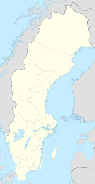
English: Location map of Sweden
Equirectangular projection, N/S stretching 214,7895 %. Geographic limits of the map:
|
||
| Datum | |||
| Boarne | own work, using United States National Imagery and Mapping Agency data | ||
| Auteur | NordNordWest | ||
| Oare ferzjes |
Derivative works of this file:
|
||
| SVG genesis |
|


Lisinsje
I, the copyright holder of this work, hereby publish it under the following licenses:

|
Der wurdt tastimming jûn ta kopiearjen, fersprieden en/of wizigjen fan dit dokumint ûnder de betinksten fan de GNU-lisinsje foar iepen dokumintaasje, ferzje 1.2, as eltse lettere ferzje útjûn troch de Free Software Foundation; sûnder Ynfariante Seksjes, sûnder Omkaftteksten foar de Foarkante en sûnder Omkaftteksten foar de Efterkante. In kopy fan de lisinsje is opnaam yn de seksje "Text of the GNU Free Documentation License". |
This file is licensed under the Creative Commons Attribution-Share Alike 3.0 Unported license.
- Fiel jo frij:
- te dielen – it wurk te kopiearjen, fersprieden en út te stjoeren
- te fermingen – it wurk oan te passen
- Under de neikommende betingsten:
- Nammefermelding – You must give appropriate credit, provide a link to the license, and indicate if changes were made. You may do so in any reasonable manner, but not in any way that suggests the licensor endorses you or your use.
- Lyk diele – If you remix, transform, or build upon the material, you must distribute your contributions under the same or compatible license as the original.
You may select the license of your choice.
Triemskiednis
Klik op in datum/tiid om it bestân te besjen sa't it op dat stuit wie.
| Datum/Tiid | Miniatuer | ôfmjittings | Meidogger | Opmerking | |
|---|---|---|---|---|---|
| lêste | 21 mrt 2023, 01.26 | | 954 × 1.836 (2,03 MB) | HCa | Reverted to version as of 18:28, 15 July 2008 (UTC) |
| 1 nov 2015, 08.45 |  | 842 × 1.837 (1,01 MB) | Larske | Correction of border between Västra Götalands län and Jönköpings län. Habo municipality and Mullsjö municipality belong to Jönköpings län. | |
| 4 aug 2011, 19.11 |  | 842 × 1.837 (981 KB) | NordNordWest | upd | |
| 27 jan 2009, 11.24 |  | 954 × 1.837 (2,74 MB) | Erik Frohne | Added missing border Scania-Blekinge Category:Location maps of Sweden | |
| 29 aug 2008, 10.22 |  | 954 × 1.837 (2,74 MB) | NordNordWest | ||
| 29 aug 2008, 10.18 |  | 954 × 1.837 (1,46 MB) | NordNordWest | ||
| 30 jul 2008, 13.32 |  | 954 × 1.836 (1,46 MB) | NordNordWest | optimized | |
| 15 jul 2008, 20.28 |  | 954 × 1.836 (2,03 MB) | NordNordWest | {{Information |Description= {{de|Positionskarte von Schweden}} Quadratische Plattkarte, N-S-Streckung 190 %. Geographische Begrenzung der Karte: * N: 69.5° N * S: 55.1° N * W: 10.4° O * O: 24.6° O {{en|Location map of [[:en:Sweden|Swe |
Bestânsgebrûk
De neikommende 4 siden brûke dit bestân:
Globaal bestânsgebrûk
De neikommende oare wiki's brûke dit bestân:
- Gebrûk op af.wikipedia.org
- Gebrûk op als.wikipedia.org
- Gebrûk op am.wikipedia.org
- Gebrûk op an.wikipedia.org
- Gebrûk op ar.wikipedia.org
- Gebrûk op arz.wikipedia.org
- Gebrûk op ast.wikipedia.org
Mear globaal gebrûk fan dit bestân besjen.