Ofbyld:Treiser Tunnel Suedportal Oct09 0934.jpg
Grutte fan dit proefbyld: 400 × 600 piksels. Oare resolúsjes: 160 × 240 piksels | 320 × 480 piksels | 512 × 768 piksels | 682 × 1.024 piksels | 1.696 × 2.544 piksels.
Oarspronklik bestân (1.696 × 2.544 pixels, bestânsgrutte: 1,5 MB, MIME-type: image/jpeg)
Gearfetting
| Beskriuwing |
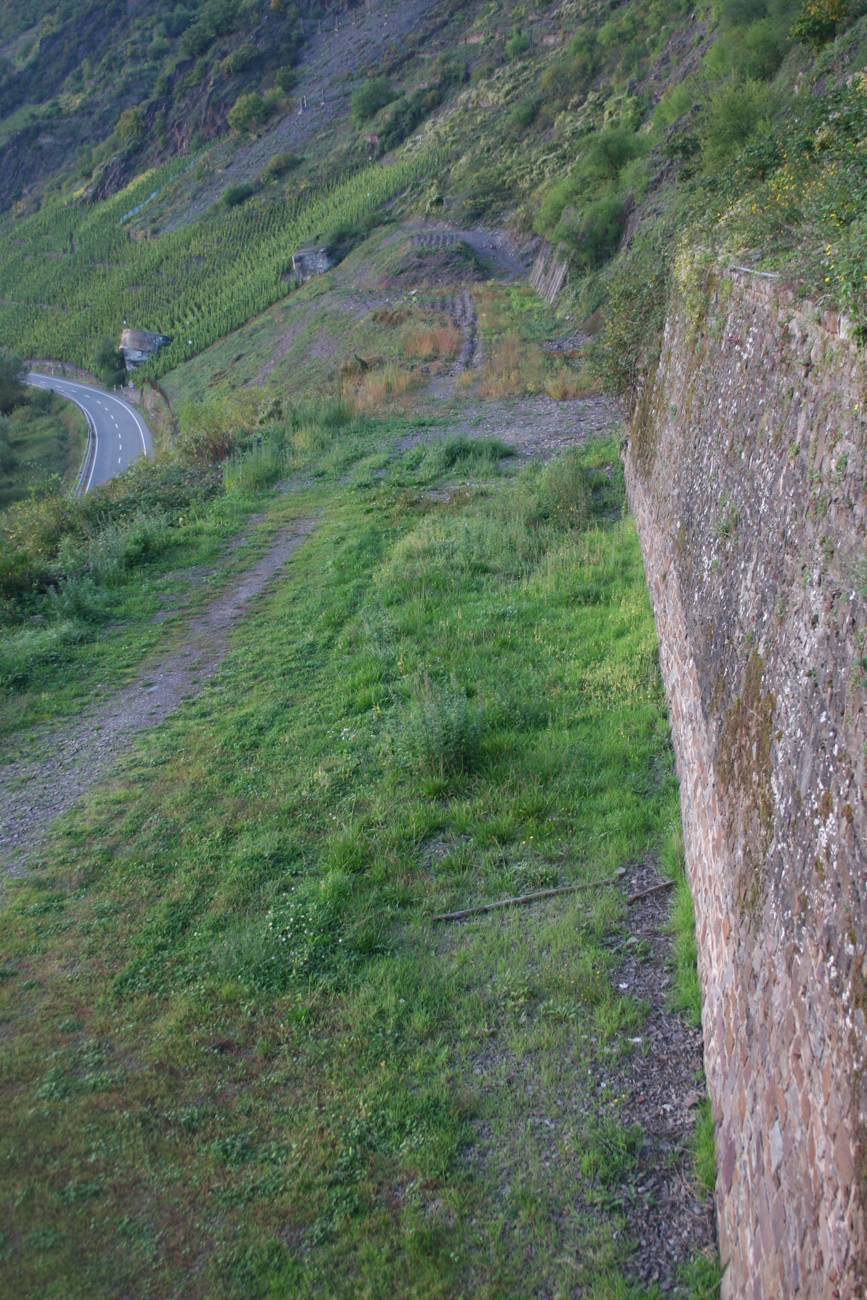
English: View towards the former southern entrance of the Treiser Tunnel, destroyed in 1946, north of the village of Bruttig on the Mosel river. Remnant of a planned and partially built, but never completed strategic railway. Two water tanks built of concrete can be seen in the far left. The watertanks, built in 1944, were part of the constrution site for electronic devices within the tunnel. Inmates of the Concentration Camp of Bruttig-Treis had to work there.
Deutsch: Blick auf das ehemalige, 1946 zerstörte Südportal des Treiser Tunnels, nördlich von Bruttig an der Mosel. Überrest einer geplanten und teilweise fertiggestellten, aber nicht in Betrieb gegangenen strategischen Eisenbahnstrecke. Die Wassergewinnungsanlagen aus Beton links im Hintergrund aus dem Jahre 1944 dienten der mit dem KZ Bruttig-Treis verbundenen U-Verlagerung im Tunnel. |
| Datum | |
| Boarne | Eigen wurk |
| Auteur | Kallewirsch |
| Camera location | | View this and other nearby images on: OpenStreetMap |
|---|
Lisinsje
I, the copyright holder of this work, hereby publish it under the following license:
This file is licensed under the Creative Commons Attribution-Share Alike 3.0 Unported license.
- Fiel jo frij:
- te dielen – it wurk te kopiearjen, fersprieden en út te stjoeren
- te fermingen – it wurk oan te passen
- Under de neikommende betingsten:
- Nammefermelding – You must give appropriate credit, provide a link to the license, and indicate if changes were made. You may do so in any reasonable manner, but not in any way that suggests the licensor endorses you or your use.
- Lyk diele – If you remix, transform, or build upon the material, you must distribute your contributions under the same or compatible license as the original.
Triemskiednis
Klik op in datum/tiid om it bestân te besjen sa't it op dat stuit wie.
| Datum/Tiid | Miniatuer | ôfmjittings | Meidogger | Opmerking | |
|---|---|---|---|---|---|
| lêste | 8 feb 2012, 21.52 | | 1.696 × 2.544 (1,5 MB) | Rotatebot | Bot: Image rotated by 90° (EXIF-Orientation set from 8 to 1, rotated 0°) |
| 8 feb 2012, 21.01 |  | 2.544 × 1.696 (1,5 MB) | Kallewirsch | {{Information |Description ={{en|1=View towards the former southern entrance of the ''Treiser Tunnel'', destroyed in 1946, north of the village of Bruttig on the Mosel river. Remnant of a planned and partially built, but never completed strategic railw |
Bestânsgebrûk
De neikommende side brûkt dit bestân:
Globaal bestânsgebrûk
De neikommende oare wiki's brûke dit bestân:
- Gebrûk op de.wikipedia.org