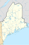
Ofbyld:USA Maine relief location map.svg

Size of this PNG preview of this SVG file: 393 × 599 piksels. Oare resolúsjes: 157 × 240 piksels | 315 × 480 piksels | 504 × 768 piksels | 672 × 1.024 piksels | 1.343 × 2.048 piksels | 820 × 1.250 piksels.
Oarspronklik bestân (SVG-bestân, nominaal 820 × 1.250 pixels, bestânsgrutte: 2,84 MB)
Triemskiednis
Klik op in datum/tiid om it bestân te besjen sa't it op dat stuit wie.
| Datum/Tiid | Miniatuer | ôfmjittings | Meidogger | Opmerking | |
|---|---|---|---|---|---|
| lêste | 31 jan 2021, 18.30 |  | 820 × 1.250 (2,84 MB) | SANtosito | Uploaded own work with UploadWizard |
Bestânsgebrûk
De neikommende side brûkt dit bestân:
Globaal bestânsgebrûk
De neikommende oare wiki's brûke dit bestân:
- Gebrûk op ban.wikipedia.org
- Gebrûk op bg.wikipedia.org
- Gebrûk op ca.wikipedia.org
- Gebrûk op de.wikipedia.org
- WMTW-Sendemast
- Machias Seal Island
- Mount Katahdin
- Long Lake (Chute River)
- Sebago Lake
- Vorlage:Positionskarte USA Maine
- WGME-Sendemast
- Marinefunkstelle Cutler
- Spencer Lake (Stausee, Maine)
- Flagstaff Lake (Maine)
- Two Bush Island
- Baker Island (Maine)
- Mount Desert Island
- Cadillac Mountain
- Bear Island (Maine)
- Cranberry Islands
- Avery Rock
- Pond Island (Sagadahoc County, Maine)
- Benutzer:DiethartK/Nordic Heritage Center
- Amazon Lake (Maine)
- WWLN
- Moosehead Lake
- Sugar Island (Piscataquis County, Maine)
- Deer Island (Piscataquis County, Maine)
Mear globaal gebrûk fan dit bestân besjen.
