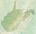
Ofbyld:USA West Virginia relief location map.svg

Size of this PNG preview of this SVG file: 644 × 599 piksels. Oare resolúsjes: 258 × 240 piksels | 516 × 480 piksels | 825 × 768 piksels | 1.100 × 1.024 piksels | 2.200 × 2.048 piksels | 1.201 × 1.118 piksels.
Oarspronklik bestân (SVG-bestân, nominaal 1.201 × 1.118 pixels, bestânsgrutte: 5,84 MB)
Triemskiednis
Klik op in datum/tiid om it bestân te besjen sa't it op dat stuit wie.
| Datum/Tiid | Miniatuer | ôfmjittings | Meidogger | Opmerking | |
|---|---|---|---|---|---|
| lêste | 3 feb 2022, 15.18 |  | 1.201 × 1.118 (5,84 MB) | Ikonact | =={{int:filedesc}}== {{Information |description={{en|1=Relief location map of {{W|West Virginia}}, {{W|USA}} Geographic limits of the map: * N: 40.8° N * S: 37.0° N * W: 82.8° W * E: 77.5° W}} |date=2022-02-03 |source={{own}} *Based on File:USA West Virginia location map.svg *Public domain SRTM3 |author=ikonact |permission= |other versions= }} =={{int:license-header}}== {{self|cc-by-sa-4.0}} Category:Location maps of West Virginia Category:Maps of West Virginia |
Bestânsgebrûk
De neikommende side brûkt dit bestân:
Globaal bestânsgebrûk
De neikommende oare wiki's brûke dit bestân:
- Gebrûk op de.wikipedia.org
- Gebrûk op en.wikipedia.org
- Charleston, West Virginia
- Huntington, West Virginia
- Martinsburg, West Virginia
- Newell, West Virginia
- Clarksburg, West Virginia
- Fairmont, West Virginia
- Bluefield, West Virginia
- Cheat Lake, West Virginia
- Morgantown, West Virginia
- Teays Valley, West Virginia
- Beckley, West Virginia
- Parkersburg, West Virginia
- Weirton, West Virginia
- Wheeling, West Virginia
- Backbone Mountain
- Dolly Sods Wilderness
- Milan Puskar Stadium
- Battle of Greenbrier River
- WesBanco Arena
- Cacapon River
- Jennings Randolph Lake
- New River Gorge National Park and Preserve
- Harpers Ferry National Historical Park
- Bald Knob (West Virginia)
- Cass Scenic Railroad State Park
- Raleigh County Memorial Airport
- Greenbrier Valley Airport
- Mid-Ohio Valley Regional Airport
- Bear Rocks Preserve
- Cranberry Glades
- Birch River (West Virginia)
- Fairfax Stone Historical Monument State Park
- Sleepy Creek
- Edwards Run Wildlife Management Area
- Fort Mill Ridge Wildlife Management Area
- Nathaniel Mountain Wildlife Management Area
- Short Mountain Wildlife Management Area
- Trout Pond
- Mount Storm Lake
- Beech Fork Lake
- Meadow Branch
- Sleepy Creek Lake
- Mill Creek Mountain
- Sleepy Creek Mountain
Mear globaal gebrûk fan dit bestân besjen.