Ofbyld:Venezia location map.svg

Size of this PNG preview of this SVG file: 675 × 396 piksels. Oare resolúsjes: 320 × 188 piksels | 640 × 375 piksels | 1.024 × 601 piksels | 1.280 × 751 piksels | 2.560 × 1.502 piksels.
Oarspronklik bestân (SVG-bestân, nominaal 675 × 396 pixels, bestânsgrutte: 4,7 MB)
Gearfetting
| Camera location | | View this and other nearby images on: OpenStreetMap |
|---|
| Beskriuwing |
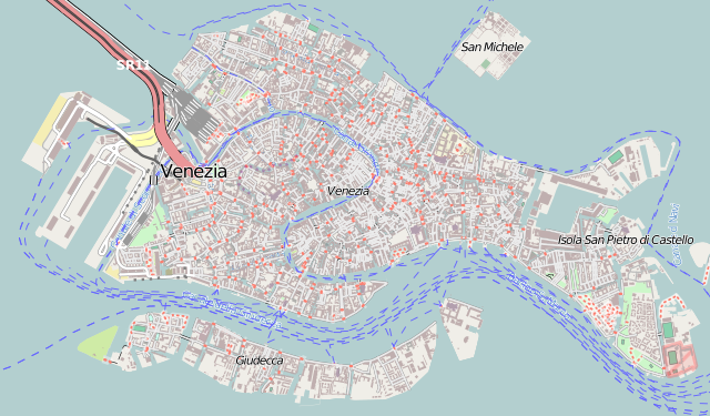
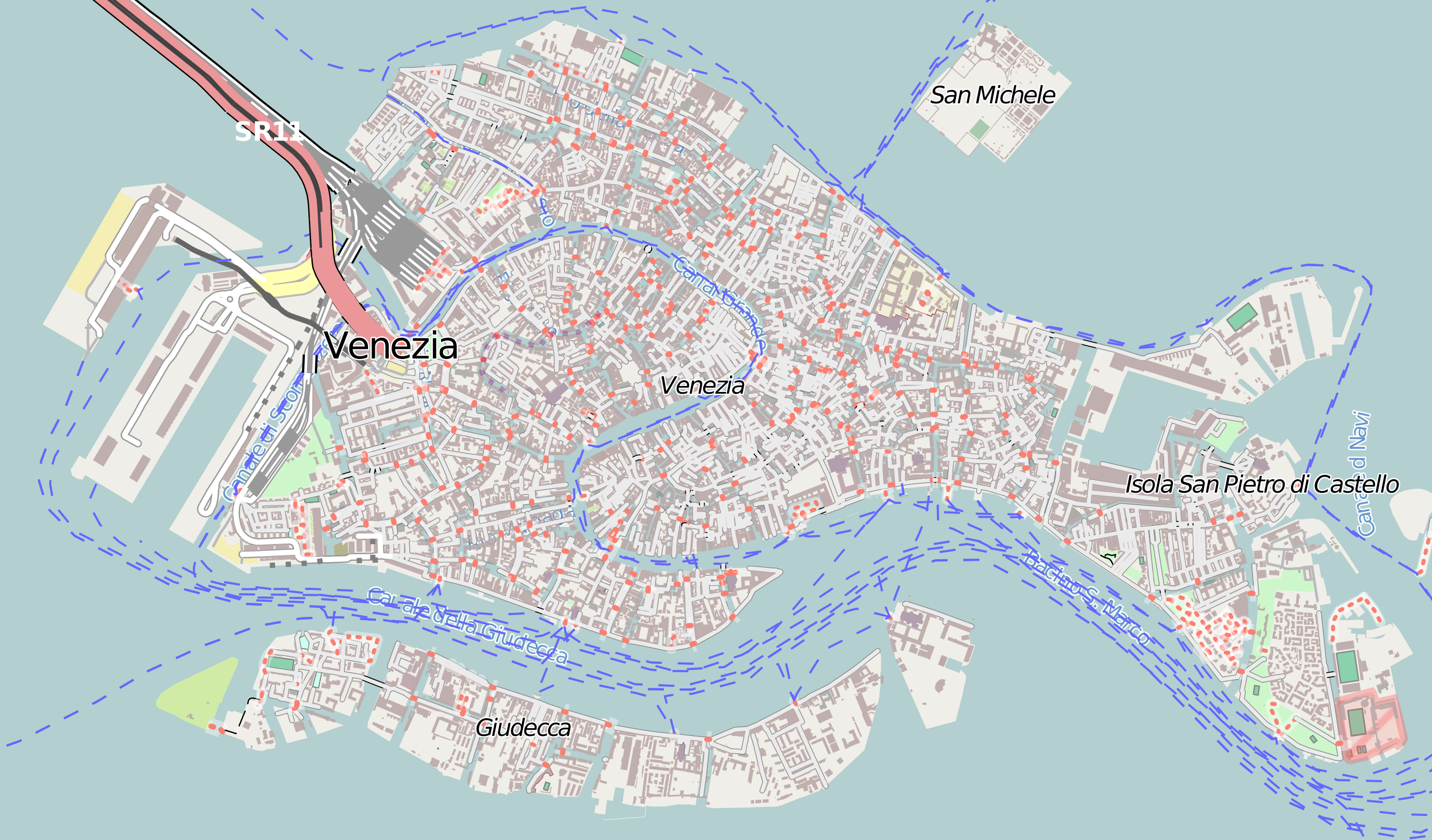
Italiano: Mappa di Venezia.
Français : Carte de Venise, destinée à la géolocalisation.
Deutsch: Karte der Venedig.
English: Map of Venice, for geolocalisation purpose.
Español: Mapa de Venecia.
日本語: ヴェネツィアの地図。
Português: Carta de Veneza.
|
||
| Datum | (UTC) | ||
| Boarne |
Création personnelle ; Données de la carte © les contributeurs d'OpenStreetMap, CC-BY-SA Openstreetmap directement téléchargées en SVG depuis la carte d'OSM ; |
||
| Auteur | © Bourrichon (talk) - fr:Bourrichon | ||
| Tastimming (Reusing this file) |
|
This W3C-unspecified vector image was created with Inkscape .
Lisinsje
I, the copyright holder of this work, hereby publish it under the following license:
This file is licensed under the Creative Commons Attribution-Share Alike 2.0 France license.
Nammefermelding: Bourrichon (atelier graphique)
- Fiel jo frij:
- te dielen – it wurk te kopiearjen, fersprieden en út te stjoeren
- te fermingen – it wurk oan te passen
- Under de neikommende betingsten:
- Nammefermelding – You must give appropriate credit, provide a link to the license, and indicate if changes were made. You may do so in any reasonable manner, but not in any way that suggests the licensor endorses you or your use.
- Lyk diele – If you remix, transform, or build upon the material, you must distribute your contributions under the same or compatible license as the original.

Triemskiednis
Klik op in datum/tiid om it bestân te besjen sa't it op dat stuit wie.
| Datum/Tiid | Miniatuer | ôfmjittings | Meidogger | Opmerking | |
|---|---|---|---|---|---|
| lêste | 8 jul 2013, 13.20 | | 675 × 396 (4,7 MB) | Bourrichon | == {{int:filedesc}} == {{Location|45|44|00|N|12|34|00|E|scale:10000}} {{Information |Description= {{it|Mappa di it:Venezia.}} {{fr|Carte de fr:Venise, destinée à la géolocalisation.}} {{de|Karte der de:Venedig.}} {{en|Map of [[:... |
Bestânsgebrûk
De neikommende 3 siden brûke dit bestân:
Globaal bestânsgebrûk
De neikommende oare wiki's brûke dit bestân:
- Gebrûk op az.wikipedia.org
- Gebrûk op bg.wikipedia.org
- Gebrûk op en.wikipedia.org
- San Zaccaria, Venice
- San Zulian
- San Beneto
- Santa Maria Zobenigo
- San Moisè, Venice
- San Salvador, Venice
- Santo Stefano, Venice
- Tolentini, Venice
- San Pantalon
- San Polo (church)
- San Rocco, Venice
- San Giacomo dell'Orio
- San Michele in Isola
- San Bartolomeo, Venice
- Sant'Andrea della Zirada
- San Basso
- San Simeone Piccolo
- Santa Maria dei Miracoli, Venice
- San Giovanni Elemosinario
- Angelo San Raffaele, Venice
- Santa Maria Formosa
- Sant'Alvise
- San Giovanni Evangelista, Venice
- San Stae
- San Giacomo di Rialto
- Gesuati
- Italian Synagogue (Venice)
- San Francesco della Vigna
- Abbazia della Misericordia
- Madonna dell'Orto
- La Maddalena, Venice
- San Giovanni in Bragora
- San Samuele, Venice
- Le Zitelle
- Santa Giustina, Venice
- San Martino, Venice
- San Canciano, Venice
- San Giovanni Grisostomo, Venice
- Carmini
- San Lorenzo, Venice
- San Silvestro, Venice
Mear globaal gebrûk fan dit bestân besjen.