Ofbyld:Cambridgeshire UK location map.svg

Size of this PNG preview of this SVG file: 533 × 600 piksels. Oare resolúsjes: 213 × 240 piksels | 426 × 480 piksels | 682 × 768 piksels | 910 × 1.024 piksels | 1.820 × 2.048 piksels | 1.125 × 1.266 piksels.
Oarspronklik bestân (SVG-bestân, nominaal 1.125 × 1.266 pixels, bestânsgrutte: 1,79 MB)
| Beskriuwing |
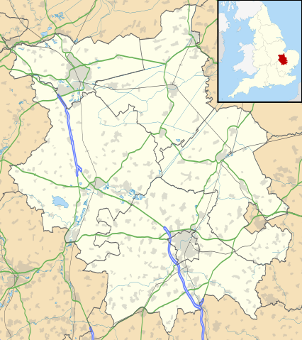
Map of Cambridgeshire, UK with the following information shown:
Equirectangular map projection on WGS 84 datum, with N/S stretched 160% Geographic limits:
|
| Datum | |
| Boarne |
|
| Auteur | Nilfanion, created using Ordnance Survey data |
| Tastimming (Reusing this file) |
This file is licensed under the Creative Commons Attribution-Share Alike 3.0 Unported license. Nammefermelding: Contains Ordnance Survey data © Crown copyright and database right
|
| Oare ferzjes | File:Cambridgeshire UK district map (blank).svg - Blank map |
.svg)
Triemskiednis
Klik op in datum/tiid om it bestân te besjen sa't it op dat stuit wie.
| Datum/Tiid | Miniatuer | ôfmjittings | Meidogger | Opmerking | |
|---|---|---|---|---|---|
| lêste | 26 sep 2010, 20.41 | | 1.125 × 1.266 (1,79 MB) | Nilfanion | {{Information |Description=Map of Cambridgeshire, UK with the following information shown: *Administrative borders *Coastline, lakes and rivers *Roads and railways *Urban areas Equirectangular map projection on WGS 84 datum, with N/S |
Bestânsgebrûk
De neikommende 2 siden brûke dit bestân:
Globaal bestânsgebrûk
De neikommende oare wiki's brûke dit bestân:
- Gebrûk op ar.wikipedia.org
- Gebrûk op bg.wikipedia.org
- Gebrûk op ceb.wikipedia.org
- Gebrûk op en.wikipedia.org
- Kimbolton Castle
- St Ives, Cambridgeshire
- Littleport
- Ramsey Abbey
- St Neots
- Eye, Cambridgeshire
- Eye Green
- Werrington, Peterborough
- Grantchester
- Wisbech
- Coton, Cambridgeshire
- Flag Fen
- Burwell, Cambridgeshire
- Huntingdon
- Perry, Cambridgeshire
- Gamlingay
- Godmanchester
- Eynesbury, Cambridgeshire
- Eaton Ford
- Eaton Socon
- Kimbolton, Cambridgeshire
- Chesterton, Cambridge
- Cambourne
- Soham
- Duxford
- Ramsey, Cambridgeshire
- Orton, Peterborough
- Whittlesey
- March, Cambridgeshire
- Girton College, Cambridge
- Chatteris
- Caldecote, South Cambridgeshire
- Addenbrooke's Hospital
- The Abingtons, Cambridgeshire
- Meldreth
- Denny Abbey
- Wimpole Estate
- Anglesey Abbey
- Hampton, Peterborough
- Thorpe Hall (Peterborough)
- Isleham
- Witcham
- Fulbourn
- Great Wilbraham
- Little Wilbraham
- RAF Brampton
Mear globaal gebrûk fan dit bestân besjen.