Ofbyld:Texas Panhandle.PNG
Gjin hegere resolúsje beskikber.
Texas_Panhandle.PNG (300 × 284 pixels, bestânsgrutte: 15 KB, MIME-type: image/png)
Gearfetting

|
This locator map image could be re-created using vector graphics as an SVG file. This has several advantages; see Commons:Media for cleanup for more information. If an SVG form of this image is available, please upload it and afterwards replace this template with
{{vector version available|new image name}}.
It is recommended to name the SVG file “Texas Panhandle.svg”—then the template Vector version available (or Vva) does not need the new image name parameter. |
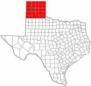
| Beskriuwing | Map of Swisher County Texas modified to show entire Panhandle |
| Datum | 31 july 2004 (original upload date) |
| Boarne | Transferred from en.wikipedia to Commons. |
| Auteur | The original uploader was H2O at Ingelsk Wikipedy. |
Lisinsje

|
Der wurdt tastimming jûn ta kopiearjen, fersprieden en/of wizigjen fan dit dokumint ûnder de betinksten fan de GNU-lisinsje foar iepen dokumintaasje, ferzje 1.2, as eltse lettere ferzje útjûn troch de Free Software Foundation; sûnder Ynfariante Seksjes, sûnder Omkaftteksten foar de Foarkante en sûnder Omkaftteksten foar de Efterkante. In kopy fan de lisinsje is opnaam yn de seksje "Text of the GNU Free Documentation License". |
| This file is licensed under the Creative Commons Attribution-Share Alike 3.0 Unported license. | ||
| ||
| This licensing tag was added to this file as part of the GFDL licensing update. |
Original upload log
The original description page was here. All following user names refer to en.wikipedia.
- 2004-07-31 19:32 H2O 300×284×8 (15219 bytes) Map of Swisher County Texas modified to show entire Panhandle
Triemskiednis
Klik op in datum/tiid om it bestân te besjen sa't it op dat stuit wie.
| Datum/Tiid | Miniatuer | ôfmjittings | Meidogger | Opmerking | |
|---|---|---|---|---|---|
| lêste | 2 mrt 2007, 11.24 | | 300 × 284 (15 KB) | Liftarn | {{Information |Description=Map of Swisher County Texas modified to show entire Panhandle |Source=Originally from [http://en.wikipedia.org en.wikipedia]; description page is/was [http://en.wikipedia.org/w/index.php?title=Image%3ATexas_Panhandle.PNG here]. |
Bestânsgebrûk
De neikommende side brûkt dit bestân:
Globaal bestânsgebrûk
De neikommende oare wiki's brûke dit bestân:
- Gebrûk op ar.wikipedia.org
- Gebrûk op cs.wikipedia.org
- Gebrûk op da.wikipedia.org
- Gebrûk op de.wikipedia.org
- Gebrûk op en.wikipedia.org
- Gebrûk op en.wiktionary.org
- Gebrûk op eo.wikipedia.org
- Gebrûk op es.wikipedia.org
- Gebrûk op et.wikipedia.org
- Gebrûk op eu.wikipedia.org
- Gebrûk op fo.wikipedia.org
- Gebrûk op fr.wikipedia.org
- Gebrûk op it.wikipedia.org
- Gebrûk op ja.wikipedia.org
- Gebrûk op nl.wikipedia.org
- Gebrûk op no.wikipedia.org
- Gebrûk op pt.wikipedia.org
- Gebrûk op ru.wikipedia.org
- Gebrûk op sv.wikipedia.org
- Gebrûk op tr.wikipedia.org
- Gebrûk op vi.wikipedia.org
- Gebrûk op www.wikidata.org
- Gebrûk op zh.wikipedia.org