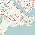
Ofbyld:Location map Fatih.jpg

Grutte fan dit proefbyld: 608 × 599 piksels. Oare resolúsjes: 243 × 240 piksels | 487 × 480 piksels | 779 × 768 piksels | 1.039 × 1.024 piksels | 1.957 × 1.929 piksels.
Oarspronklik bestân (1.957 × 1.929 pixels, bestânsgrutte: 822 KB, MIME-type: image/jpeg)
Triemskiednis
Klik op in datum/tiid om it bestân te besjen sa't it op dat stuit wie.
| Datum/Tiid | Miniatuer | ôfmjittings | Meidogger | Opmerking | |
|---|---|---|---|---|---|
| lêste | 11 jul 2020, 18.06 |  | 1.957 × 1.929 (822 KB) | Nick | Reverted to version as of 17:05, 11 July 2020 (UTC) |
| 11 jul 2020, 18.06 | Gjin miniatuerôfbylding | 300 × 168 (14 KB) | Darren-M | Reverted to version as of 17:04, 11 July 2020 (UTC) | |
| 11 jul 2020, 18.05 |  | 1.957 × 1.929 (822 KB) | Mdaniels5757 | Reverted to version as of 17:04, 11 July 2020 (UTC) | |
| 11 jul 2020, 18.04 | Gjin miniatuerôfbylding | 300 × 168 (14 KB) | EvanHumphrey12 | Reverted to version as of 17:04, 11 July 2020 (UTC) | |
| 11 jul 2020, 18.04 |  | 1.957 × 1.929 (822 KB) | Mdaniels5757 | Reverted to version as of 17:04, 11 July 2020 (UTC) | |
| 11 jul 2020, 18.04 | Gjin miniatuerôfbylding | 300 × 168 (14 KB) | EvanHumphrey12 | Reverted to version as of 17:03, 11 July 2020 (UTC) | |
| 11 jul 2020, 18.04 |  | 1.957 × 1.929 (822 KB) | Mdaniels5757 | Reverted to version as of 17:03, 11 July 2020 (UTC) | |
| 11 jul 2020, 18.03 | Gjin miniatuerôfbylding | 300 × 168 (14 KB) | EvanHumphrey12 | Reverted to version as of 17:02, 11 July 2020 (UTC) | |
| 11 jul 2020, 18.03 |  | 1.957 × 1.929 (822 KB) | Mdaniels5757 | Reverted to version as of 17:02, 11 July 2020 (UTC) | |
| 11 jul 2020, 18.02 | Gjin miniatuerôfbylding | 300 × 168 (14 KB) | EvanHumphrey12 | Reverted to version as of 17:01, 11 July 2020 (UTC) |
Bestânsgebrûk
De neikommende 6 siden brûke dit bestân:
Globaal bestânsgebrûk
De neikommende oare wiki's brûke dit bestân:
- Gebrûk op bg.wikipedia.org
- Gebrûk op bn.wikipedia.org
- Gebrûk op cs.wikipedia.org
- Gebrûk op en.wikipedia.org
- Fener
- Süleymaniye Mosque
- Bulgarian St. Stephen Church
- Basilica Cistern
- Rüstem Pasha Mosque
- Arap Mosque
- Bayezid II Mosque, Istanbul
- Boukoleon Palace
- Hagia Irene
- Chora Church
- Fatih Mosque, Istanbul
- Zeynep Sultan Mosque
- New Mosque, Istanbul
- Column of Marcian
- St. George's Cathedral, Istanbul
- Little Hagia Sophia
- Zeyrek Mosque
- Laleli Mosque
- Fenari Isa Mosque
- Church of St. Anthony of Padua, Istanbul
- Pammakaristos Church
- Ahrida Synagogue of Istanbul
- Kalenderhane Mosque
- Gül Mosque
- Bodrum Mosque
- Yedikule Fortress
- Eski Imaret Mosque
- Church-Mosque of Vefa
- Kefeli Mosque
- Şehzade Mosque
- Sulukule
- Church of Saint Mary of the Mongols
- Hirami Ahmet Pasha Mosque
- Çarşamba, Fatih
- Ayakapı
- Koca Mustafa Pasha Mosque
- Atik Mustafa Pasha Mosque
- Pertevniyal Valide Sultan Mosque
- Vefa
- Theodosius Cistern
- Cistern of Philoxenos
- Sancaktar Hayrettin Mosque
- Church of St. Mary of Blachernae
Mear globaal gebrûk fan dit bestân besjen.


